
TopoFusion Features
At its core, TopoFusion is a lean and mean map display engine, with the ability to display hundreds of GPS tracks and other line data over any number of raster imagery (or a combination of mulitple map types. It interfaces with GPS units, provides intuitive tools for editing tracks and handles the interaction between multiple GPS files smoothly. Read on for all the details, and samples of the numerous imagery types available.
Available Imagery

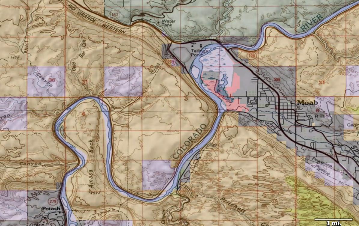
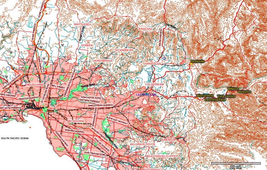
MyTopo Topographic
1:24k, 1:100k:, 1:250k USGS topographic maps, including forest service updates (FR road/trail numbers, campgrounds).
COVERAGE: United States and Canada
SOURCE: myTopo
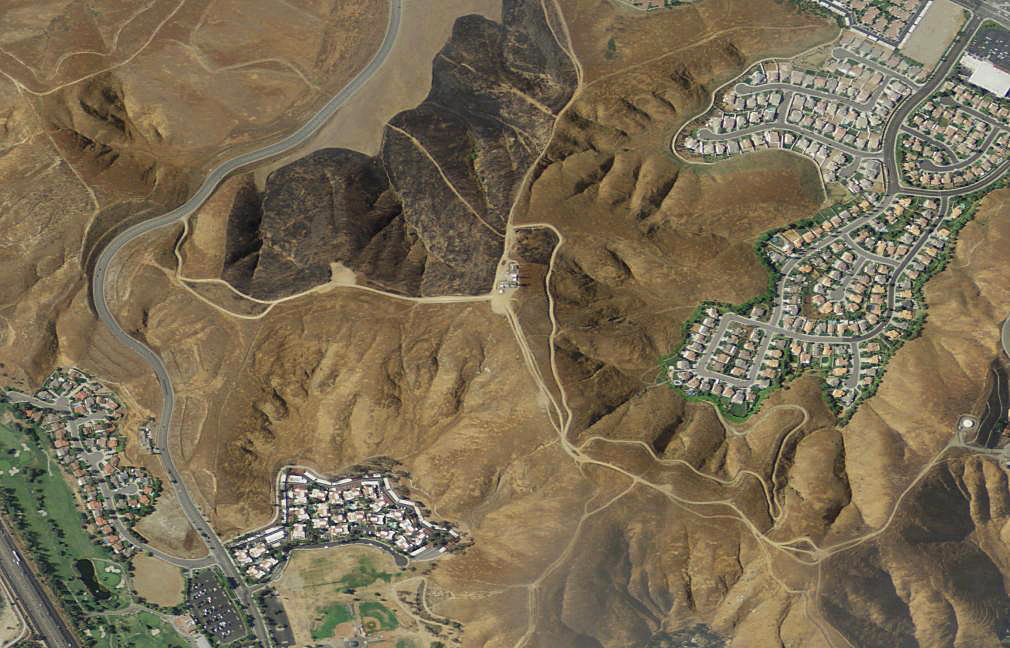
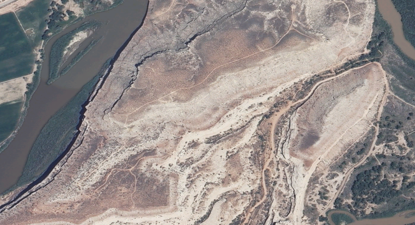
Color Aerial
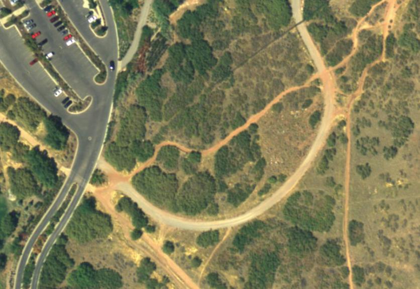
High resolution color aerials (NAIP)
COVERAGE: 90% of United States (coverage map)
RESOLUTION: Less than 1 meter per pixel
SOURCE: Multiple state and USGS servers
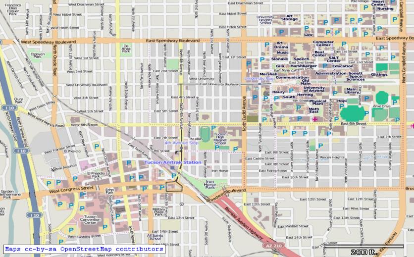
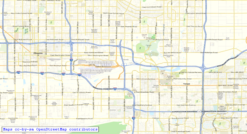
Open Street Map
Community effort, creative commons street maps.
COVERAGE: Worldwide
SOURCE: openstreetmap.org
Land Ownership (US)
PLSS national ownership database: BLM, USFS, NPS, State, Local, Private
COVERAGE: United States
RESOLUTION: High
SOURCE: USGS / National Map
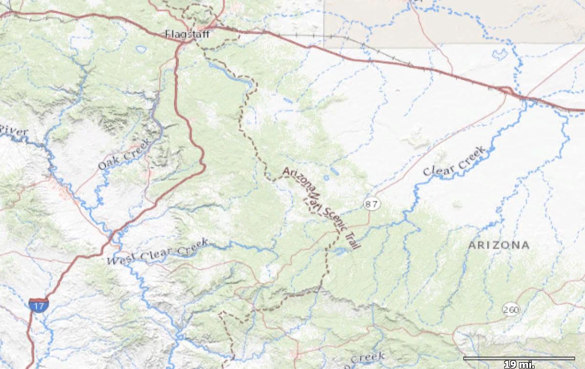
US Topo
Excellent for overview maps with county names, highways, topographic and major features
COVERAGE: United States
RESOLUTION: Medium
SOURCE: USGS / National Map
Australian Topographic
1:250k:, GEODATA topographic maps.
COVERAGE: All of Australia;
RESOLUTION: ~6 meters per pixel
SOURCE: MapConnect

Canadian Topographic
1:50k, 1:250k:, NRCan topographic maps.
COVERAGE: 1:250k - All of Canada; 1:50k - Most areas covered
RESOLUTION: ~6 meters per pixel
SOURCE: NR Canada (*)
Open Aerial
Color aerials "best available" from MapQuest
COVERAGE: Global
RESOLUTION: Varies
SOURCE: MapQuest
MapQuest
MapQuest Street maps based on OSM data.
COVERAGE: Global
RESOLUTION: Varies
SOURCE: MapQuest
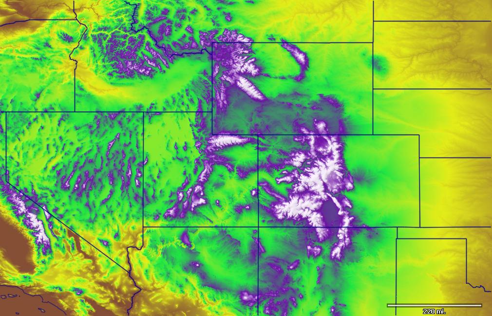
Landsat
Color imagery from the Landsat 7 ETM+ satellites. Great for large scale basemaps.
COVERAGE: Global
RESOLUTION: 15 meters per pixel
SOURCE: NASA's OnEarth Server

Open Cycle Map
Community effort cycling maps with topo contours and shading.
COVERAGE: Worldwide
SOURCE: opencyclemap.org
USGS Imagery Aerial
High resolution color aerials for most of the US
COVERAGE: Very high res for most areas. Medium for others.
RESOLUTION: 0.25 meters per pixel
SOURCE: USGS National Map
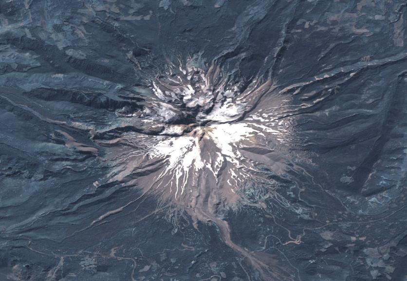
Elevation / 3D
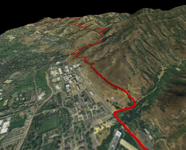
Automatic 3D downloads can be combined with any of the above image types for stunning 3D scenes.
COVERAGE: Entire World (except extreme latitudes)*
RESOLUTION: U.S. - 30 meter, World - 90 meter
SOURCE: NASA's OnEarth Server
* Latitudes 61 S to 61 N are covered by 3D download
FUSION Combo Maps
Fuse any two available map types together for amazing new views!
COVERAGE: Varied
RESOLUTION: Up to 1 meters per pixel
SOURCE: Various. See: TopoFusion Combo Maps for example images.
Colored Elevation
Elevation shaded tiles
COVERAGE: Entire World (except extreme latitudes)*
RESOLUTION: ~1 meter per pixel
SOURCE: NASA's OnEarth Server and TopoFusion

Shaded Relief
Add hill shading, with full control over angle, darkness, and exaggeration, to all TopoFusion imagery.
COVERAGE: Entire World (except extreme latitudes)*
SOURCE: NASA's OnEarth Server
* Latitudes 61 S to 61 N are covered by 3D download
Other imagery
- Custom WMS server support - add new servers or your own. See: WMS servers
- User Calibrated Maps - Add and calibrate your own maps in .jpg, .png, .bmp formats. (TopoFusion Pro Only)
- All maps are downloaded from public servers. You only download the maps you need. Once downloaded, maps are permanently available on the hard drive, for offline use.
- All maps can be exported to .KMZ format, for use as "custom maps" on newer generation Garmin units (e.g. GPSMap 78/62, Oregon)
GPS Support
- Transfers GPS tracks, waypoints, routes to and from GPS units. Also supports realtime tracking.
- Garmin - All USB and Serial Garmin units are supported.
Examples include GPSMap 78/62, Edge 800, Fenix, Oregon, Dakota, GPSMap60CSx, Forerunner 305, Edge 305, VistaCX, eTrex family, GPS12.
- Direct interface with Edge 705/Colorado/Oregon/Nuvi supported
- Magellan - Some USB and all (old) serial Magellan units are supported. Examples include eXplorist series, SportTrack Pro, etc. (Triton units are not supported)
- NMEA - NMEA gps units are supported for real-time ("live") tracking.
Data import/export
- GPX - GPS eXchange format.
- Import - .gpx, .tcx/.crs, .kml (Google), .txt (Timex NMEA), .txf (Maptech), .mxf (Maptech), .txt (UTM / Lat/Lon), eXplorist .log / .upt.
- Import - ESRI Shapefile
- Export - .gpx, .tcx/.crs, .kml, .csv (excel), eXporlist .log / .upt, .txt (UTM), .txf (Maptech), .mxf (Maptech), .svg
- Export - ESRI Shapefile
- Image Export - Export any map view in high resolution (up to 8,000 x 8,000). TopoFusion Pro can also generate high resolution 3D exports.
Display Features
- Optimized display engine using DirectX.
- Smooth panning/zooming. Handles large GPS files.
- 3D view mode available for the entire globe using auto-download or local DEM files.
Photo Management
- Reads time headers (EXIF) from your digital photos to place pictures along your route. See PhotoFusion.
- Automated HTML and imagemap generation. Create an image map with thumbnails of pictures taken with a digital camera along your GPS track. See PhotoFusion.
Data Analysis
- Computes trip statistics: distance traveled, total trip time, elevation climbing/loss, average speed, Pace (minutes per mile), Moving time, stopped time, uphill time, downhill time, flat time, up/down/flat distance, average uphill/downhill grade, max speed.
- TopoFusion Pro adds Heart Rate, Cadence and Power anaylsis features.
- Profile tool plots elevation, speed, pace and grade versus distance and time.
- Track playback plays back your trips in real time, showing position and statistics.
- Supports 9 map datum including WGS 84, NAD 27, WGS 72, Ordinance Survey
Advanced Features
- User Calibrated Maps - Add and calibrate your own maps in .jpg, .png, .bmp formats. (TopoFusion Pro Only)
- WMS Servers - add any server that uses the WMS protocol to TopoFusion. (Pro Only)
- Garmin "Custom Map" support - upload any available map to newer generation Garmin units.
- Combine all maps types using Alpha Blending.
- Multi-Track playback offers a variety of trip visualization and comparison options.
- Combine and average GPS tracks using GPS Networks (Pro Only)
- Track your training with the The TopoFusion logbook.
- Exclusive - Power output for runners using new research. See GOVSS.
- Compute splits by miles, kilometers or laps using Lap Analysis.
- Climbing analysis compares different methods for computing elevation gain. (Pro Only)
- Add elevation data to tracks, or correct faulty GPS elevations using Climbing Analysis
- TopoFusion "Difficulty Index" and "Effort Index".
- Compute Area inside track
- Simplify and Spline GPS tracks
- Auto download of GIS layers - city names, major roads and U.S. Wilderness boundaries.
Implementation details - Information on speed, design, hard disk use.
(*) (c) Her Majesty the Queen in Right of Canada, Department of Natural Resources. All rights reserved.