
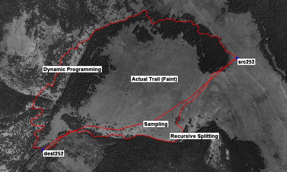
Results from three different trail finding algorithms
Finding roads in images is hard. Finding trails is even harder. But we’ve taken the first crack at it.
There’s a wealth of original research on extracting roads from aerial and satellite images. But no one has studied the more interesting problem — can we program a computer to find and follow narrow and twisty trails?
That has been the question of ongoing research for us, and the results have been accepted to 2008’s Computer Vision and Pattern Recognition conference. CVPR is one of the top vision conference, with competitive acceptance rates.
The answer is that we’ve made some progress and things look promising, but we are a ways off from an automatic trail extractor. Computer Vision, as a field, is a challenging one, and it’s often difficult to write software that can even approximate the recognition ability of the human vision system and brain. It makes it an exciting and rewarding area of study.
TopoFusion was used throughout the research effort. It provided the testbed, visualization and access to Terraserver’s database of aerial photos. We trained the model using aerial photographs from across the United States (using GPS data collected by Scott on his Great Divide Trip). Having access to this data proved quite handy, and improved the applicability of the techniques developed.
You can read the full 8-page paper here:
FindingTrails-cvpr08.pdf [PDF, 1.4 mb]