
Uploading GPS tracks to your GPS using TopoFusion
Garmin ForeTrex - 101/201
This page covers the Foretrex family of GPS units. For other GPS models, go to the main tutorial index page.The Foretrex units are somewhat limited in their ability to display uploaded tracks. They can store 10 tracks that are 500 points each, but only one track can be displayed on the map at a time. For this reason, we recommend you use a single 500 point track. If you want to use a split track and go to the trouble of switching between them, follow the tutorial for the color eTrex series, except use 10 tracks instead of 20.
Step #1 - Check the number of points.

If the track has more than 500 points, you will need to simplify it first. If you have zero points there is something wrong with your file -- try downloading the file again. If you have less than 500, you can skip step #2.
Step #2 - Simplify to 500 points.
In the "hand" / pan mouse tool mode, right click on the GPS track in the map window. A context menu pops up that looks like this: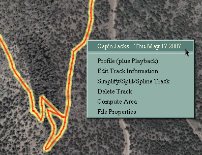
Choose the "Simplify/split/spline track" option.
The simplify/split dialog:
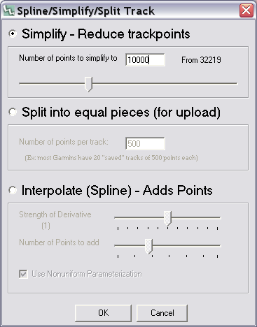
Change the number of points to 500. Hit "OK" on the dialog box. Your track is now 500 points.
Step #3 Clear the GPS's saved tracks.
Make sure you have at least one free saved track on the GPS. Go to Main Menu -> Tracks -> List Saved. If you have 10 tracks already, you will need to delete all or one of them. You must do this on the GPS -- TopoFusion (and no GPS software) cannot do this for you.On the GPS, go to Main Menu -> Tracks. Hit the "find/menu" button. Choose "Delete All Saved Tracks". Confirm the dialog. You should see a message on the GPS saying "10 Unused" at the bottom.
Step #4 Upload the track.
Go to the GPS menu in the main TopoFusion window.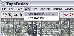
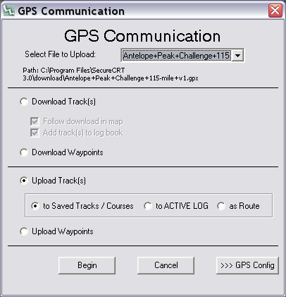
Select the "Upload Track(s)" option.
Choose the file you want to upload in the dropdown selection at the top.
Leave the secondary option as "to Saved Tracks / Courses."
Now hit "Begin" to begin transfer. It should only take a few moments.
Step #5 - Verify the upload.
You should not receive any "Track Truncated" messages on the GPS itself. If you did, something went wrong and the file was not prepared correctly.On the GPS, go to Main Menu -> Tracks. Choose "List Saved" and hit enter on the track you uploaded. Choose "show map". The track should look like the GPS file as show in TopoFusion.
Step #6 - Navigate the Track.
In order to show the GPS track on the Foretrex's map screen you will need to 'navigate' it. Go to Main Menu -> Tracks -> List Saved. Select the track you uploaded and hit enter. Choose "Navigate."Note that if the GPSs turned off you will have to 'navigate' it again to get it to show up again.