
Uploading GPS tracks to your GPS using TopoFusion
Edge 500/800
This page covers the Edge 500/800 units. For other GPS models, go to the main tutorial index page.All uploaded tracks are stored in the "GPS Drive:\Garmin\NewFiles" Directory on the GPS. There does not appear to be a limit to the number of points in a track. We have successfully uploaded tracks with over 40,000 points, which is more points than most routes usually contain.
Step #1 Upload the track.
Go to the GPS menu in the main TopoFusion window.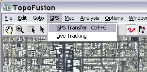
Select the "Upload Track(s)" option.
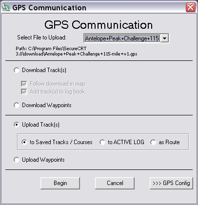
Choose the file you want to upload in the dropdown selection at the top.
Leave the secondary option as "to Saved Tracks / Courses."
Now hit "Begin" to begin transfer. It should only take a few moments.
Alternatively, you can simply copy a GPX file from anywhere on your computer into the "Garmin Drive:\Garmin\NewFiles" directory when your GPS is plugged in.
Step #2 - Verify the upload.
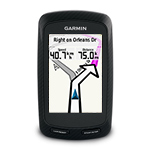
Unplug the GPS and turn it on. Go to the main menu (menu button). Select the courses button. Now select the name of the file you uploaded. A map showing the route should pop up (it may need to calculate for a while if there were a large number of points). The resulting map should correspond to the GPS track as displayed in TopoFusion.Step #3 - Enable the track or Navigate it
In order to display the course on the GPS's map screen you need to enable it. You have two options:- #1 - Hit "go" to navigate the course.
- #2 - Hit the wrench to bring up the config screen for the course. Now choose "map display" at the bottom. Set "Always display" to on and change color if desired (dark red is good). (newly uploaded files are not shown on the map by default)