Mapping Power - Power Analysis in TopoFusion Pro
Attaching PowerTap data to GPS points
It's easy to sync PowerTap with GPS using the "Auto Offset" function in TopoFusion. What you need:
- A .CSV export from WKO or PowerAgent
- A .GPX or .TCX file from the same ride
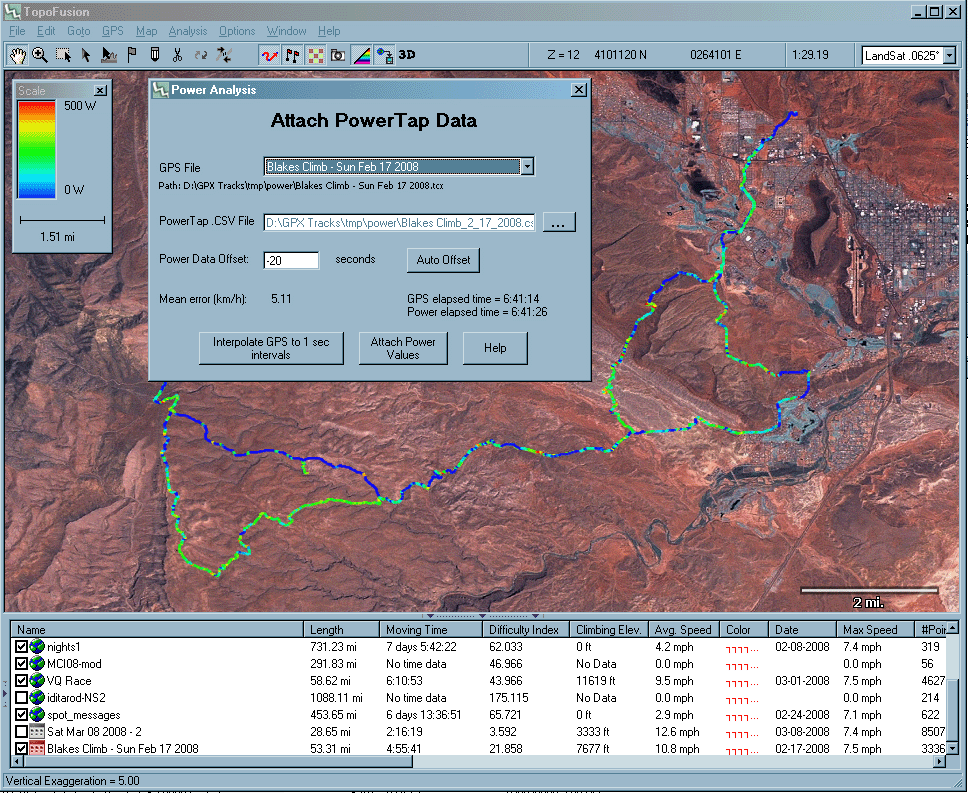
Load the GPX/TCX file in TopoFusion, then go to Power Analysis (found under the Analysis menu). Make sure the GPX/TCX file is selected in the "GPS File" dropdown. Now use the "..." button to find the associated .CSV file. Note: the .CSV export can be of any recording rate and from power meters other than PowerTap (WKO can export any file to PowerTap .CSV format).
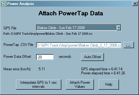
Once the CSV is selected, hit the "Auto Offset" button. TopoFusion will search for the offset between the powertap and GPS file. If you started your GPS and PowerTap at the same time the resulting offset should be small (only a few seconds). TopoFusion will search 30 minutes in both directions, but if your files need a larger offset than this, you will need to seed the offset with an appropriate value. Once you have run the Auto function once, or simply hit the "GO" button, you will be given the elapsed time for both the GPS and PowerTap files. This is a reference in case you need to manually set a larger offset.
The offset is applied to the PowerTap time values. For example, an offset of negative 30 seconds means that the PowerTap started collecting data 30 second before the GPS. If you forgot to turn the PowerTap on while the GPS was collecting points you would need a positive offset. Remember that the Auto search function will look a half hour before and a half hour after the current offset value.
How does the Auto Offset function work?
The Auto function works by looking at the errors between speeds in the GPS file and speeds reported by the powertap. An estimate of this error is provided for the given offset in km/h.
Saving power data
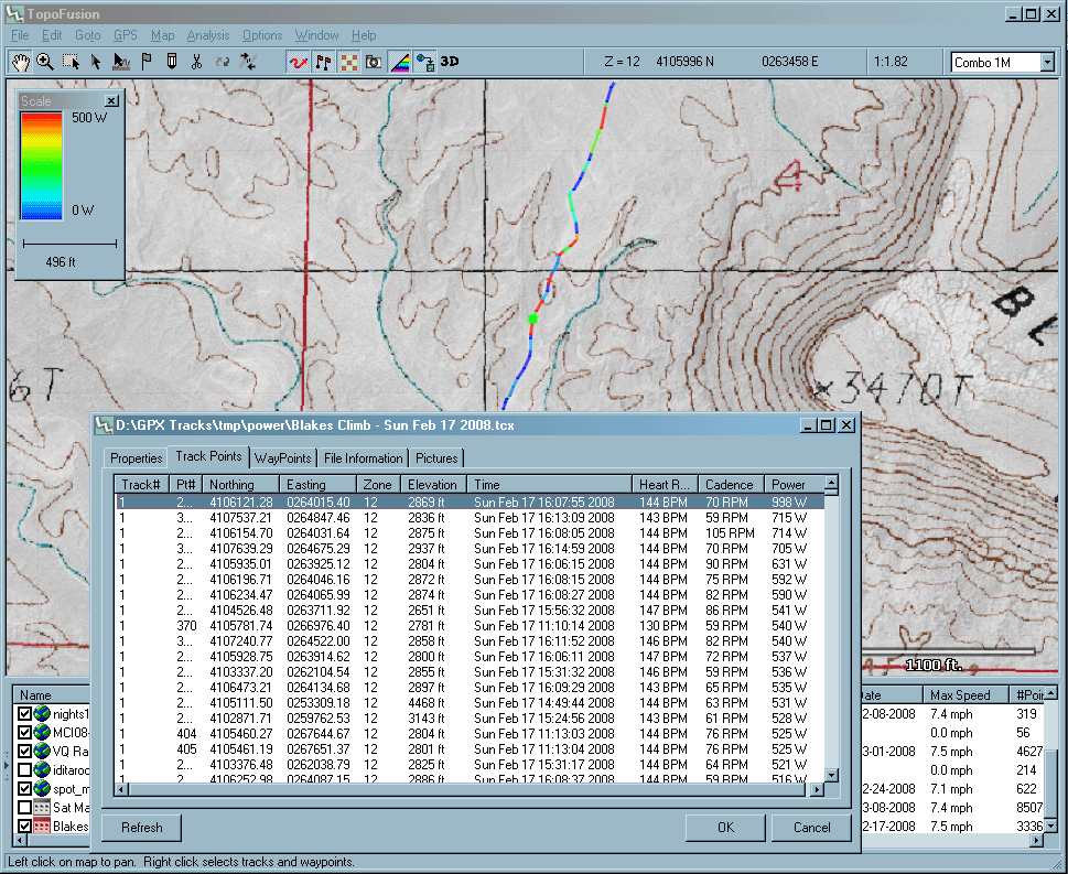
Note that GPX files cannot store power (or heart rate / cadence) data. So once you attach power data you should do "save as" on your GPX file and make sure it is saved to TCX format (readable by Garmin Training Center). This way you'll only need to sync your files once. A warning message will appear if you try to save a file to GPX that has power data.
Interpolating GPS data
Sometimes GPS files (particularly long rides collected with an Edge unit) don't have a recording rate of one point per second. Yet the power tap collects power readings at near second resolution. In order to get more resolution you may want to create more GPS points before attaching PowerTap data.
First make sure the correct file is selected in "GPS File" dropdown. Then hit the Interpolate button. You will now have one GPS point per second. It's recommended that you save this file out (as a new file), then proceed with attaching power data to it.
OK, I've got power data with GPS points, now what?
Here's where it gets cool. First thing to do is go to the Map Menu. At the bottom of the menu there are six options for Track Shading. Choose power. Your GPS track will now be shaded according to power output.Power profiles
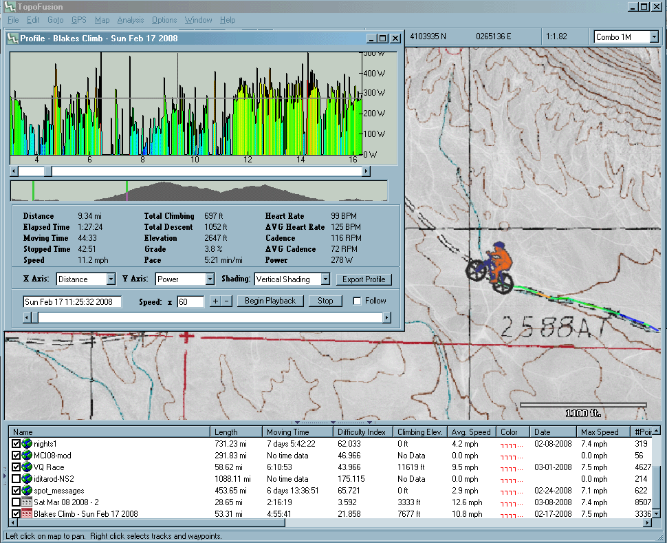
Power intervals
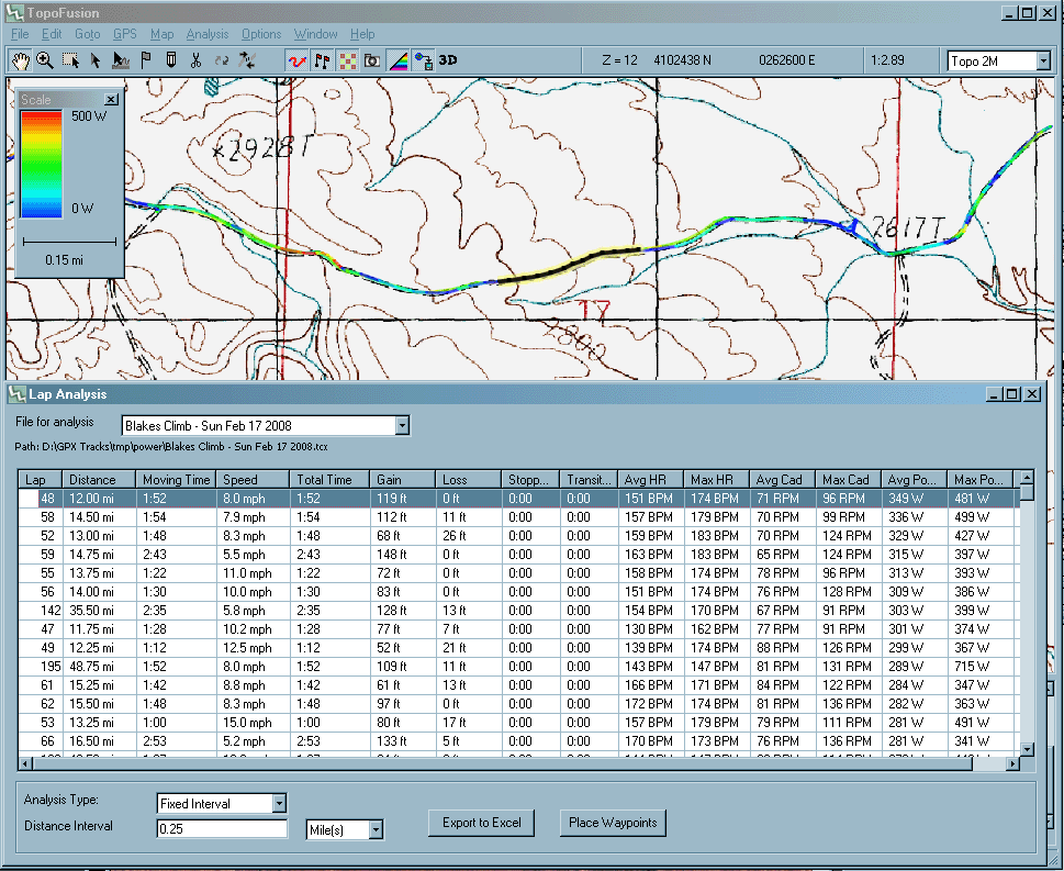
Note that you can sort the intervals by any of the available columns. For example, you can easily find which quarter mile of the ride had the highest average power. Just sort by average power and double click on the top row (as the above screen shot shows).
Finding specific points