Arizona Trail Jamboree
Website no longer active
Please consider this website out of date. New website for the Jamboree from 2020 on: https://rockyroad5050.wordpress.com/az-trail-jamboree-and-work-day/Date and Time
Saturday, January 12, 2019Pistol Hill Trailhead
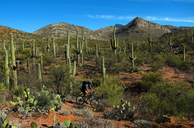
The Arizona Trail Jamboree is a charity ride benefiting the Arizona Trail Association.
Maps / GPS
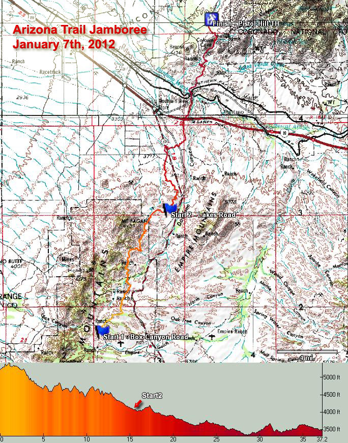
Detail Map: AZT Jamboree Detail.pdf
GPX file: AZT-Jamboree2012.gpx
To sign up please make the suggested $35 donation directly to the Arizona Trail Association. Here is the link to ATA's donation page:
http://www.aztrail.org/donate.html
Directions to Pistol Hill
From Tucson: Head East out of Tucson on 22nd Street, and hang a right on Old Spanish Trail just past Houghton. Follow this road for about 13 miles following the signs to Colossal Cave Park. About two-miles out from the Park, you'll come to the Pistol Hill intersection which will be dirt on your left and paved on your right. Hang a left onto the well-graded dirt road and follow this about 1.5-miles to the trailhead. You will cross a cattle-guard and see the parking on the right with a large wooden signboard. The trailhead is about 20-yards back up the road past the cattle guard.From Phoenix: Take I-10 to exit 279, Wentworth Rd / Vail. Turn left on Wentworth Road, going north to Vail. After about 2 miles the road will cross railroad tracks and hit a T intersection. Turn right to stay on Colossal Cave Road. Follow this until it becomes Colossal Cave Road. 4.2 miles from the T intersection Pistol Hill Road crosses Old Spanish Trail (a paved road) and becomes dirt. Continue for 1.5 miles on the dirt road to the trailhead as described in the directions from Tucson.
Google Map
Please carpool as there is limited parking available!
For more information
Contact Chad Brown at azepicriderandrunner AT gmail.comFriends