
Appalachian Trail GPS
 (Appalachian Trail shaded by elevation)
- Entire AT reduced to 10,000 points and split to 500 point segments
- 290 waypoints for all AT shelters
- Entire AT reduced to 10,000 points and split to 500 point segments
- 290 waypoints for all AT shelters
The UPLOAD file is designed to be uploaded to Garmin GPS units (e.g. GPSMap 60CX, VistaHCX, LegendCX). With 20 tracks at 500 points each this will fill up the "saved tracks" area of the GPS, leaving the active log empty to collect new data as you hike. Use the free version of TopoFusion or any other Garmin software to upload this file.
Some GPS software can't handle a GPS file with 312,000 points. If you want to load the files in other GPS software (like Mapsource or ExpertGPS), stick with the reduced "for upload" file.
Due to a bug in Google Earth the full resolution track cannot be viewed as a single track, so the Google file is the 10,000 point version, split into 500 point tracks so Google can compute the "clamp to ground" correctly.

Appalachian Pages
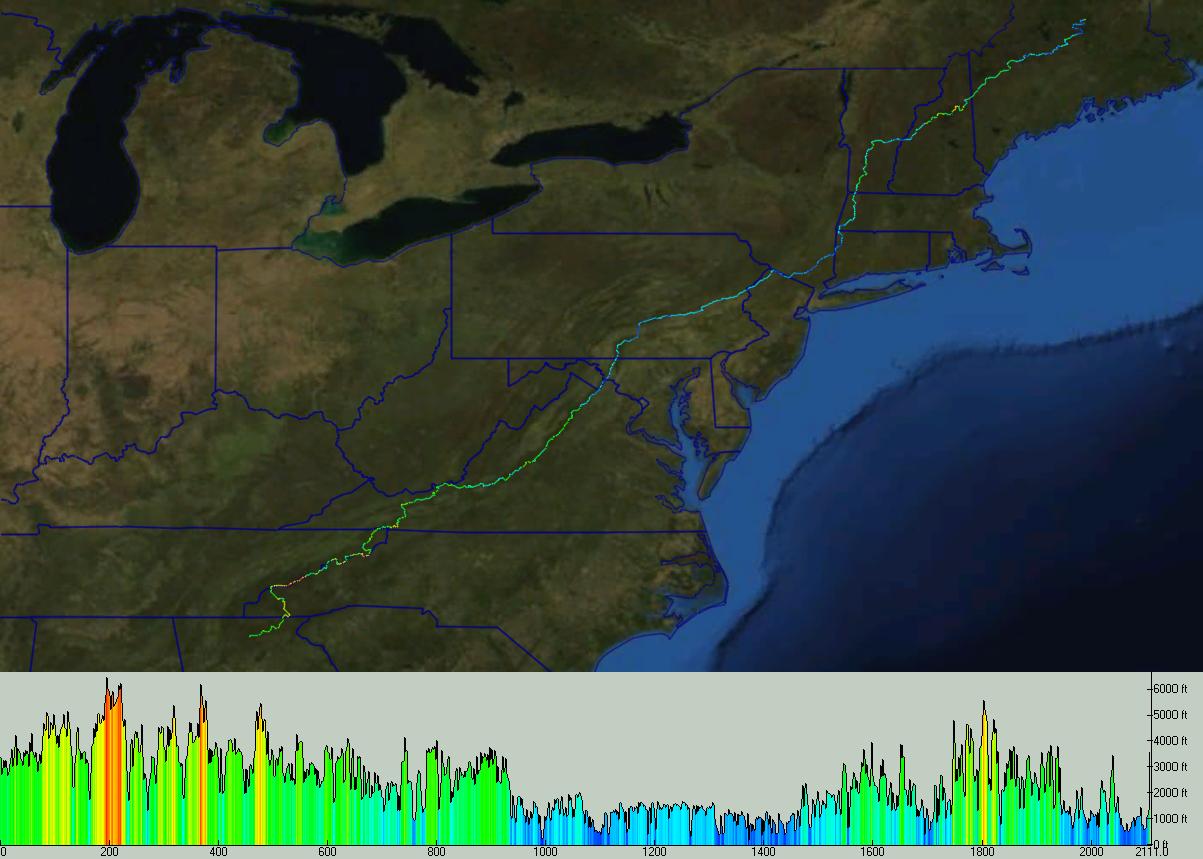
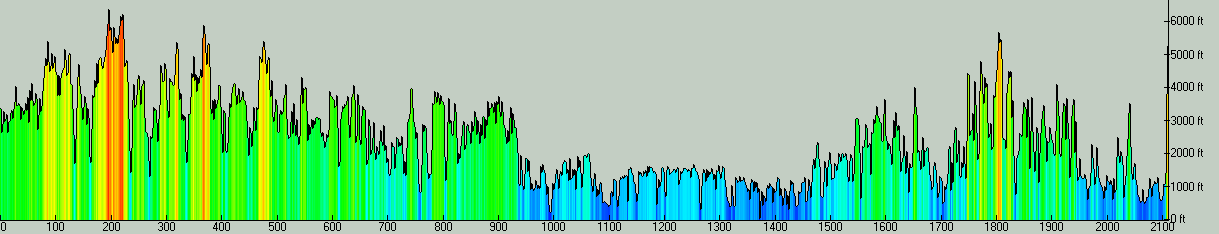
The GPS data on this page was used to generate the profile water marks for the latest handbook on the AT, the Appalachian Pages. With the entire AT profiled, we can look at an elevation plot of the trail (below).According to TopoFusion, the trail has over 600,000 feet of climbing. Using some filtering (in Climbing Analysis), a more realistic number is about 500,000 feet of climbing. That's the equivalent of climbing Everest over 16 times!
 (click for larger version)