
3d Features
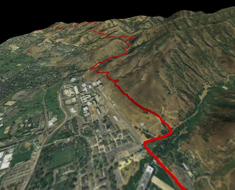
TopoFusion includes the ability to visualize terrain and track data in 3d. Using NASA's JPL server, the 3D data is downloaded automatically, so there is no need to download, convert and store DEM files. The instructions for acquiring DEM data are included here if you want to store elevation data on your computer, since this option is also available to those needing offline or server independent 3D support.Screenshots
Viewing a 3D Model
3d Options
Acquiring DEM data (for offline use)
Screenshots
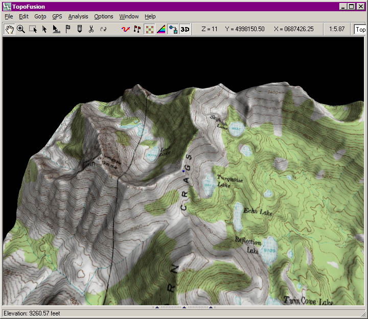
Viewing a 3D model
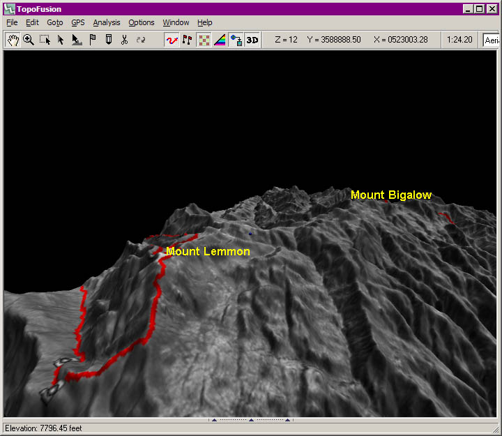
3d mode can be entered either by using the toggle button on the toolbar or by pressing '3' while the focus is on the main view. Switching back to 2d mode is done the same way.
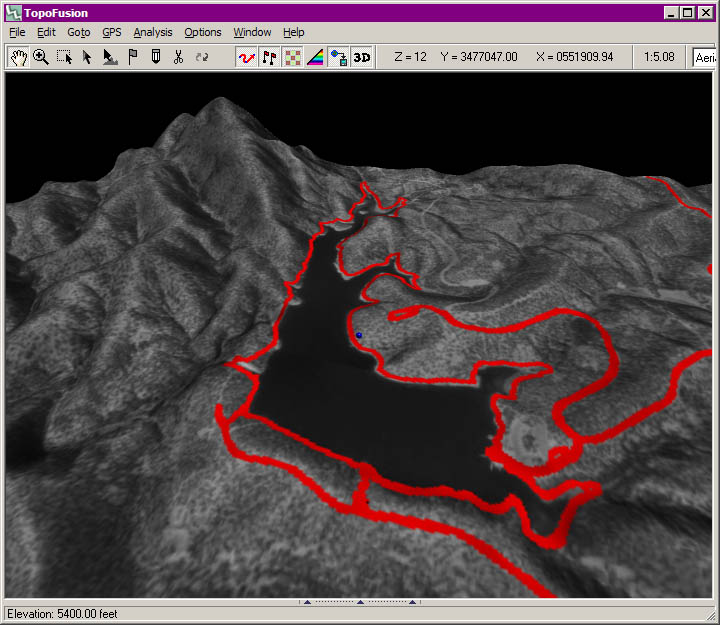
While in 3d mode, dragging the mouse with the left button down rotates the 3d model. Dragging the mouse with the right button down translates the model. The mouse wheel or pgup/pgdn controls zoom. A small blue ball can be seen at the center of scene to help in manipulating the model. Additionally, the elevation at that point is given on the status bar.
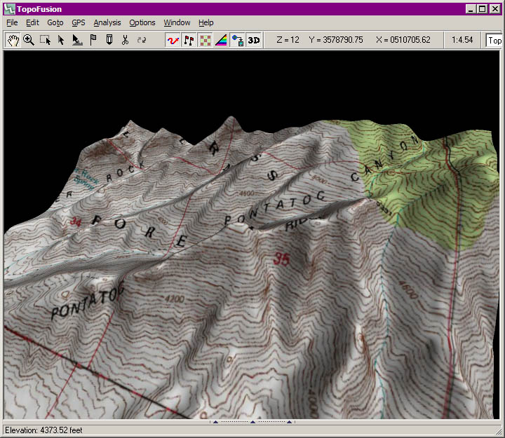
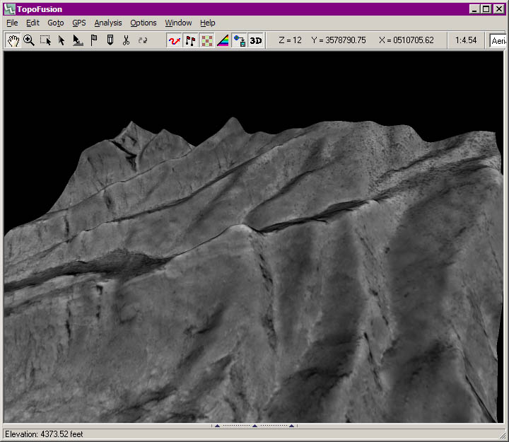
If the blue ball reaches the edge of the model, the model will be regenerated using that point as the new center. You can force a regeneration of the model by pressing the 'r' key. This also has the effect of changing the complexity and extent of the model and the texture (map) used based on the zoom.
3d Options
The following dialog is found in the "Options" Menu:
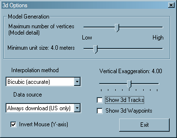
- Maximum number of vertices (5,000 - 300,000) : Maximum number of vertices to use in generating 3d model.
- Minimum unit size (0.1 - 30.0 meters) : Minimum distance between two vertices on the model.
Interpolation Method:
- Bilinear : linear interpolation between DEM elevation points
- Bicubic (smooth) : Bicubic representation using B-splines. Note that this method is *inaccurate*. What this means is that even at the actual DEM points, you will not get the correct elevation. This is due to the DEM elevations being used as "control" points.
- Bicubic (accurate) : Bicubic interpolation using Lagrange interpolation. This bicubic method results in a smoother model than bilinear, but not as smooth as Bicubic (smooth), but it is accurate at the DEM points.
Data Source:
- Use DEM files if available - use this setting if you wish to store DEM data on your computer for offline use. When creating 3D views or doing climbing analysis, elevation data will be read from DEM files if your computer has them in the area of interest. Otherwise, TopoFusion will download the elevation data from the US dataset. Note: You need to switch to the world dataset to get elevation data outside the US.
- Always download (US only) - TopoFusion will always request elevation data from the NASA server for 3D views. This setting uses the higher resolution US NED data set (30 meter resolution). Outside the US it will give flat models.
- Always download (World) - TopoFusion will always request elevation data from the NASA server for 3D views. This setting uses the lower resolution SRTM 90 meter dataset that covers the entire world.
Vertical Exaggeration (0.00 - 8.00 X) : 1.00 is actual representation (no change)
Show 3d Tracks checkbox : Select this if you want to see the tracks rendered as 3d free-flowing tracks based on the elevations contained in the track data (not DEM data).
Show 3d Waypoints checkbox : Select this if you want to see waypoints displayed as floating text strings (not part of the 3d mode) based on their elevation attribute.
Invert Mouse (Y-axis) : self-explanatory, only applies to 3d-mode
Acquiring DEM data
NOTE: TopoFusion automatically downloads elevation data. However, if you want to use the 3D functionality offline (not connected to the internet) you will need to follow these instructions to download, convert and setup DEM files. It's also possible to find higher resolution (10 meter) DEM files.TopoFusion uses ASCII native DEM (.dem) files. These can be acquired by various means. Two methods that we recommend are:
1) USGS Seamless Data Distribution System at http://seamless.usgs.gov/website/seamless/viewer.php
- Zoom to the desired area.
- Select a Download Tool from the tools on the left.
- On the pop-up window press the "Modify Data Request" button
- Change the Data Format from ArcGrid to TIFF
- Click "Save Changes & Return to Summary"
- Click on the first "Download" link (for the NED - TIFF). The file will be named something like "71276843.ZIP"
- Unzip the contents.
- Open 3DEM
- Select "Load Terrain Model" from the File menu. Choose "GeoTiff DEM" and open the .tif file from the zip file downloaded from the USGS.
- Select "Save USGS ASCII DEM" from the file menu. Name the file by some descriptive name.
- Place the resulting .dem file in the DEM directory (set in Options->Preferences in TopoFusion, the program directory by default).