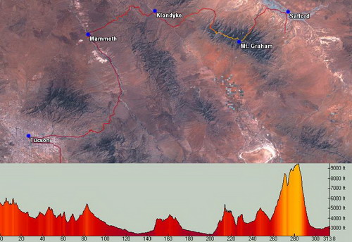
Pretty cool to start a bike tour from your house. I pedaled across Tucson early. I didn’t need an early start, except to avoid traffic in town.
Soon enough I was climbing Redington Road. The desert spoke silence to me. Quite a contrast from the AZT 300 racers who dodged gunfire and all manner of motorized contraptions. I got passed by two trucks on my hour long climb up to Three Feathers.
There I turned onto the Chiva Falls 4×4 route. The 300 course sticks to Redington Road, but I wanted to test the ‘flow’ of this route. Dropping down toward “the chute” I was immediately happy with the choice. I hit a two foot drop and landed poorly, eating up all of my suspension. I figured I had the suspension setup well, since I was unlikely to hit many more drops like that.
After the drop I looked back to see a missing croc on my rear rack. Doh! It wasn’t from the drop, so I started pedaling back. The crocs were mainly for creek/river fording, but also for town/camp since I was going into this ride with sore feet. It was frustrating to be riding backwards when the ride had just started. Even though I had plenty of time to make my destination for the day (Mammoth), I was still in a hurry-up, solo riding mode. I’d struggle into and out of this mode throughout the trip.
Back to Three Feathers and Redington Road, still no croc. I rode all the way back to the pass before finding it. Part of me wanted to just ride back home at this point, since it was all downhill. It seems silly now, but I had a hard time getting started on this trip. All of my solo trips have been races with very focused goals. But this trip was more about exploring and enjoyment. That made it easier to entertain thoughts of bailing.
I retraced my steps towards Chiva Falls, hitting the two foot drop perfectly this time. I slid my way down the chute, touching my foot to the side once, but otherwise riding it. Fun techy climbing ensued, followed by the ‘big tree’ singletrack. All really fun riding.
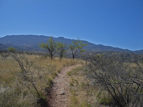
When I got to the Italian Trap gate, I noted that the sign said it was closed to motorized equipment and vehicles. That settled it. New route for the 300.
There are a some vague spots as the trail proceeds up the wash, but minimal sand and only a few dismounts. Plus you get to ride sections like this:
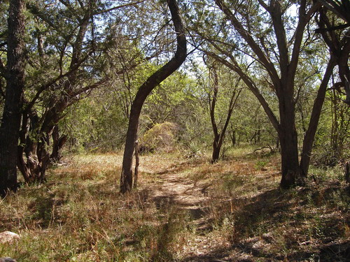
It’s much more quiet and more in the spirit of the 300 route. I checked my moving time for this route and the 300 during my race last year. The old route was one minute slower.
I cruised over to join the AZT, fresh out of the Rincons. Immediately I heard some talking. It was two backpackers, segment hiking the AZT. One guy said he had about 40 miles left before he had hiked the whole thing. Pretty cool, and if I hadn’t lost the croc I would have missed them. After a nice little chat, I was off down the trail.
The AZT was its usual relaxing self. It climbs, but almost doesn’t seem like it. I slowly switched out of the hurry-up mode. Just in time — I had to brake hard to avoid running over a small snake laying across the trail.
I turned back onto Redington, to resume riding graded roads for the rest of the day. This is a favorite training route of mine, since it’s void of traffic and quite scenic. I haven’t really been training this winter, so I haven’t been on the backside of Redington for over a year.
That made it a great ride. Highlights include “big saguaro hill” and Jackassic Park.
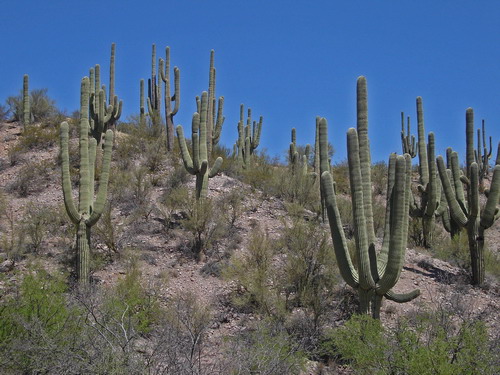
Big Saguaro Hill
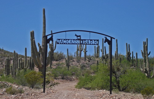
Jackassic Park
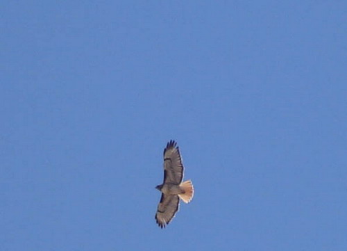
Just me, the hawks …
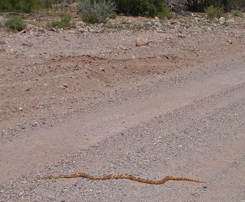
… and the snakes.
I feared for that snake’s life. But I hadn’t seen any vehicles for some time, so I figured he might move on before any came. I thought about encouraging him to leave the road, but I have a little pact with snakes — I don’t mess with them and they don’t mess with me. Seems to be working so far. I rode around and winced five minutes later as I saw a vehicle approaching.
The washboard got a little tedious, but temperatures were unseasonably cool at 2500 feet. It was an absolute pleasure to be out there cruising along.
I crossed the San Pedro River at the same spot as the Soul Ride, stopping for a lunch break. I was going to make it into Mammoth with plenty of time to spare, and realizing that this was a nicer spot than any in town, I pulled out the pad for a nap by the river.
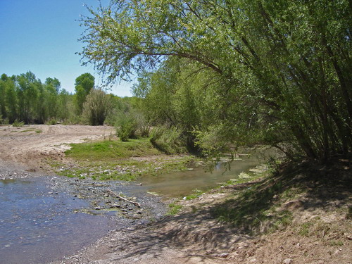
Nap time at the San Pedro River (barely a creek, but I’ll take it)
Nobody passed as I dozed under the trees. Now this is tourin’.
Easy to say when your destination is 13 miles down the road and you’ve got a few hours of daylight. Much harder to get into that mode of thinking when the road ahead is long and full of unknowns.
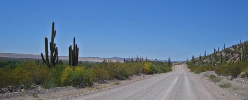
River road, notable due to the lack of San Manuel smelter — demolished last fall
Mammoth called with its Mexican food. La Casita was closed, so I settled for fries and root beer float at the drive-in joint. I checked in to Fosters Lodge ($40 tax included) noticing the pool outside my little room. I got several strange looks from people as I walked over to it. It was frigid, but I went in anyway. Felt good on my 200 mile legs.
Later that night I talked to the motel residents. They’ve been holed up there for some time, working in San Manuel. “Nobody swims in the pool,” one of them said. “It’s too damn cold.” When I told them where I came from and where I was going they assumed I was riding highways, and I really couldn’t get across what I was up to. But they thought it was cool nonetheless.
With plenty of time, I was picky about food choices in town. I had two solid days of serviceless riding to plan for. No chance of anything but water until the very end of the second day — if things went well. There were pieces of familiar ground on this route, but I was exploring new country for most of it.
The tiny TV in my room churned out 200 channels of crap. I shut it off early and went to sleep listening to the motel residents shout and “party” outside.
It was much quieter at first light, blasting down Main Street Mammoth on my way to cross the San Pedro. After a mile of pavement on River Road I came to Cowboy Miller Road, signed like it actually goes somewhere. Well, it does go somewhere, but not anywhere people are interested in. Unless you’re on a bike and wanting to cross the Galiuro Mountains.

I was exploring a new way to access to the “Rug Road”, found by GET mastermind Brett Tucker. Lee and I had taken the traditional approach to the Rug Road in ’05, climbing Copper Creek and descending “Carpet Hill.” This route offered the potential of bypassing Carpet Hill, giving a more direct approach to the Galiuro divide. Brett had walked this route, but he had some distance of XC wash travel that included some pour-offs. He thought I could get around the pour-offs on parallel ATV trails and aerial photos seemed to agree, but it was unknown.
Cowboy Miller was nice enough. Views presented themselves early. Antelope Peak to the west — Tim and Zach would soon be passing around its eastern shoulder on their way to finishing the AZT 300. I was overloaded with food and water, making for some slow elevation gain and sore sit bones. I was anxious to get into the meat of it and start some hike-a-bike.
I found several water sources (one spewing from a metal tank, and one creek running) on my way past Buzzard Roost and Dry Camp. Just beyond the metal tank the road deteriorated into an overgrown ATV trail. I soon found Brett’s GET flag, signifying the spot where thru-hikers should begin traveling XC up the wash.
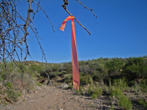
Brett’s GET flag
I thought about giving it a try, but from where I stood, the ATV trail looked much more tempting. I started up the trail instead. It quickly turned to ascend the fall-line, bringing with it large rocks and ruts.
I rode a few flatter portions, but it was pretty much a hike. As it climbed away I could see another two track that I thought would lead me to the Rug Road. It was obvious why Brett had taken the drainage — I was about to descend steeply, right back to the same drainage. Though from above I was glad to not be fighting my way through there. It seemed like it was fairly packed with vegetation.
I found Brett’s other flag, down in the lush drainage. There was water here too, and some magnificent trees. Several 2-tracks converged, but with some care I found the correct one to begin hiking on. None of it was rideable, and it was somewhat a relief to reach the actual Rug Road. A small group of white/brown horses met me there, eyeing me for a moment before galloping off at high speed down the Rug Road.
Ah, the Rug Road. I was very curious to ride this beast again. Somewhat scared, actually. The amount of lava rock, both moveable and stationary is pretty unreal. The grades are always steep. Downhills are almost all rideable, and ups are maybe 50/50 rideable.
The great thing about the Rug Road is the remoteness. There’s just nothing going on back there. Access is too difficult. It’s too far. Too rough. Too unknown. It’s a legendary road if I’ve ever known one. Most people you talk to, if they’ve even heard of it, question its existence, or will pull out some story they heard of someone that might have punched through and lived to tell about it. The stuff of pure western myth.
I can’t really imagine driving a vehicle on it. A motorcycle, maybe, if you’re real good and real brave. But on a bike, you can always get off and walk. And that’s exactly what I did.
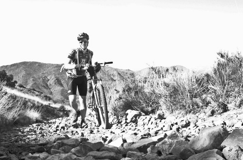
Walkin’ onwards and upwards, meeting the crest of the Galiuros at 5400 feet. I caught my first glimpse of the eastern side. The Santa Teresas towered above Aravaipa Creek with Mt. Graham looming even higher. It was hard to imagine that I would be standing high on Mt. Graham, at 9500 feet, by tomorrow. It seemed like it was in a different world.
The first descent is over 1000 feet, and boy is it rocky. I had to walk down several sections and others I regretted riding, knowing a twisted ankle or minor crash could become very serious out here. I was very happy for every millimeter of tire width and every inch of suspension I was riding with.
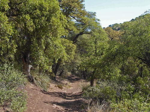
I had forgotten how nice the wooded areas of the Rug Road are. They’re the only relatively flat, reasonable sections on the whole thing. At Parson’s Grove there’s an abandoned cabin next to a trickle of a stream. Beautiful spot. I felt like stopping, maybe for a rest, but I realized it was more out of obligation than anything else. I was making an attempt at reasonable pacing on this trip, but there was nothing that could have kept me at Parson’s Grove. What I wanted to do was ride over the next hill, see what was there, and push further down the trail. Mostly this was due to a (somewhat false) sense of urgency, but I realized it’s also largely my personality. To me, riding (or walking in this case) is more enjoyable than lounging around, as long as I’m not super tired.
Not stopping and intense focus on pushing down the trail sounds and feels a lot like racing. This trip was empathetically not supposed to be a race. I was not willing to sacrifice my summer of riding for this trip. It was going to be sustainable or I was going to pull the plug. As I rolled by the cabin and started pushing my bike up the next roller, I got a very real sense that I was not meeting the sustainability goal.
The Rug Road held such an indomitable place in my mind that I couldn’t rest until it was behind me, and could no longer affect me. Two more rollers resulted in 100% walking uphill, but then I transitioned from loose lava rock to a more solid variety. The next two rollers were just as steep, but with solid rock the odds of riding increased four-fold. I cleaned both, grinning widely.
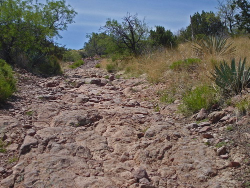
Transitioning to more solid rock
For the next three miles I was treated to some of the best mountain bike descending anywhere. My head was constantly spinning, trying to take in the scenery and wonder of the place. Ledges abound, and the road itself is often carved out of solid rock. It reminds me of Amasa Back in Moab, except that it’s seen about a millionth the amount of traffic.
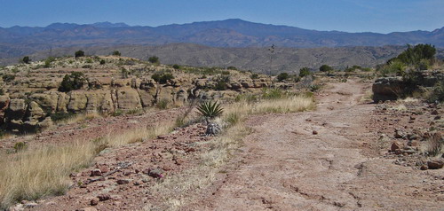
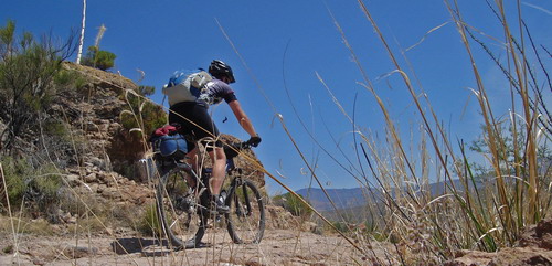
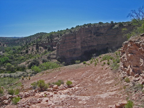
Twisting and turning on banked turns, I flew down to the lush confines of Turkey Creek. First I stopped to survey the next challenge — a steep climb on the other side of Turkey Creek. It did not look good. 1500 feet of climbing on what appeared to be a fall line 4×4 road. “I’ll bet the Rug Road looks like a hike from over there too, though.” The hope was that it shared a common characteristic with the Rug Road — solid rock. If it was loose rock it was sure to be a hike.
Only one way to find out.
It was well past lunch time, and I had planned on pumping water at Turkey Creek. With the Rug Road behind me, and having made good time, it was time for a break. I pulled out my 6″ sub from the Mammoth gas station, and dug in. Amazingly it stayed cold, buried in my pack. I was very fortunate for the prevailing cool weather.
While washing down the sub with my water bottle, it dawned on me that I was sitting next to the main channel of Turkey Creek and it was bone dry. Cue sense of urgency. I could have taken the “known” route to Klondyke, which would have water in Aravaipa Creek. But what fun would that be? I’ve BEEN that way before. The call of the unknown is too irresistible.
I gulped down the last bites of the sandwich and made weak attempts at pedaling the sandy wash. Care was necessary to stay in the main drainage. I got excited following some foot prints, thinking they might be a GET hiker’s, but they led me up a quickly steepening side drain. I bushwhacked back to the main channel, slicing my arms on “wait-a-minute” bushes in the process.
I found the 4×4 “road”, all but covered by nasty bushes. It was clearly not in service anymore (I had passed a carsonite in the wash that indicated motorized traffic was not allowed), which was bad for me. The first few pitches were scary steep — climb-a-bike more than hike-a-bike. Pick the bike up, move it a few feet, then step forward, praying that your feet keep their purchase. My “approach” style climbing shoes were perfect here. Cycling shoes would have been sketchy.
Occasionally the “road” (barely wide enough to ride a quad on, really) would contour into a drainage, and I’d hop on for wishful thinking riding. Unfortunately most of the flat/wide spots had boulders purposely placed to dissuade quads. So I’d have to dismount anyway.
Once up the initial push the true character of the trail was revealed — eroded dirt. Dammit. The sun cooked my back as I walked up. I’d look ahead and swear I was back on the Paradox Trail of the Grand Loop. Then I’d stop and turn around to greet the breeze with my face. The instant cooling reminded me that it was April, and probably twenty degrees cooler than my experience on the Grand Loop.
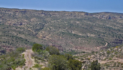
Looking back at the Rug Road
Still, hiking your bike in the afternoon sun is always hot, and water was at a premium. I made haste. A few sections presented themselves as rideable, for those with “system wheels.” I had decided to run 26″ downhill tubes and 6 oz slime, which I’ve found to be nearly flat-proof. Heavy as hell, but flat proof. I was happy for them here, enabling me to run over the small thorny bushes that littered the trail tread. Every bit I wasn’t walking was a good thing.
I attained the ridge and caught booming views of Aravaipa Canyon, the Rug Road and Mt. Graham. I didn’t like what I saw ahead on my ridge, though. Steep rolling and significant elevation to gain. The climb was far from over.
This road saw some traffic, at least, so there were some stretches not completely covered in rocks. But I still had to hike over nearly every bump in the ridge. The downhills were a blast, though, and as I pushed further I got increasingly more interesting views of the geology in Turkey Creek. It was just great, but I was ready to descend into Klondyke and water.
The ridge punished me with more elevation gain, to 4500 feet. It occurred to me that I enjoy this kind of riding — suffering, that is. I guess that’s why I do well in race situations, why I like traveling fast through the landscape. I came to the conclusion that what I was looking for wasn’t to “stop and smell the roses” because that’s not what I want to do. The goal was more to strike a balance between moving fast and rest and relaxation. Taking each moment as it comes and rolling with the flow of the ride.
The present moment was not one for R ‘n R; it was one for action. I stood to grind out the final ridgeline bump, GPS telling me that the descent was nigh. The GPS didn’t tell me the descent would be a hoot. Only my tires could tell me that.
I sang out loud as I grinded into turns, blasting into an overly green Fourmile Canyon. Within a mile or two I turned into the campground to fill up on water. It was empty, of course, as was the “town” of Klondyke. There’s pretty much one house, a ranger station that’s never staffed, and the empty campground. Life moves a little slower in this remote pocket of Arizona. Though I had reached Klondyke in 40 miles from Mammoth, if I had driven there it would have been over 150, with the last 50 or so on washboardy roads.
After soaking my head at the campground faucet, I headed into “town.” I knocked on the door of Bonnie, who is the owner of the Klondyke Country Store. The store has been closed for the last few years, sadly, but Lee and I met the owners and camped on their property on our first Rug Road expedition. I wanted to say hello and to thank her for the care package service she offers GET thru-hikers. I could have mailed myself a package of food, which she would place in a freezer behind the closed store. I didn’t, because it’s not really my style, but it wouldn’t have been a bad idea.
She remembered me (they claimed we were the first cyclists that have ever ridden to Klondyke, let alone on the Rug Road). She also happened to be on the phone with a friend who was inquiring about the Rug Road. “I have a guy on my doorstep that just rode it!”
I sat in the shade of the patio as I tried to describe the different access points, and the difficulty of the endeavor. I sure as hell wouldn’t try to pilot anything motorized on it, but that’s just me. I think I helped him quite a bit, in the end.
I chatted with Bonnie about Klondyke, the locked gate on Aravaipa Road that’s been a thorn in her side, and the selling of the store. A burger and refuel on candy would have gone a long way at the moment. But my bike was loaded with food, and it was time to get on down the road.
As I was leaving I asked how the road out of town is. “Oh, it’s in pretty good shape these days.”
“Cool. Not too washboardy?”
“Now, I’m not gunna say it’s not washboardy! It *is* the Klondyke Road, ya know.”
I rolled out of town to a pleasant tailwind. With the Leviathan’s heavy tires/tubes and ample suspension, it’s pretty much immune to washboard. Throw in a little tailwind, and it was a grand old ride. It reminded me that even the Great Divide Route has its appeal, at times.
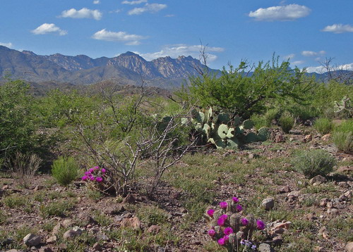
The Santa Teresas
I quickly reached the junction with the road to Safford. I turned to begin climbing. Crazy Horse Canyon was below me, offering some nice rock formations. But my gaze was mostly fixed on Mt. Graham. It was difficult to imagine climbing to the top of it, but that was tomorrow’s project. All I needed to do was finish the approach and find a spot to make camp.
A few tempting camp spots presented themselves, but I still had daylight to burn, so I rolled on by. I crested the pass between the Santa Teresas and Mt. Graham (Pinalenos), at 5000 feet. The tail wind had picked up to the ‘sub-nuclear’ stage, just in time to enjoy a gigantic descent. The massive valley of the Gila River spread out before me, highlighted by evening light. Traveling in excess of 30 mph at times, it was impossible to not be overwhelmed by the vastness of the land in front of my eyes. I felt like a tiny human speck on the planet. This marvelous place is ours to explore, and to have the freedom and strength to do so is a gift not to be taken for granted.
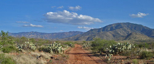
Initial climb to Tripp Canyon
I spotted Brett’s flag on the turn off for the 4WD descent to Underwood wash. Good riding continued down to 3600 feet. 5000 feet of relentless climbing awaited me from here. Time to tick away at it ’til the sun set.
I found several good spots to sleep, except for the powerful cross wind I was riding through. I needed to get up Tripp Canyon, where I hoped to find some shelter from the wind. The canyon walls did just that, and I was able to find a car camping spot complete with fire ring.
If anything I had too much time to sleep, so I took the time to stretch and do some yoga. Then I started a small stick fire, warming up pieces of garlic bread and salami for dinner. A little fire is a great way to pass the time, and I crawled into my sleeping bag relaxed and ready for sleep. I noted how good I felt — especially my back and arms. After the first ’bout with the Rug Road (on a 26″ hard tail) I remember being quite sore from the roughness of the trail. With a full suspension 29er (Lenz Leviathan) it was a different story. I had ridden the Rug Road plus 26 miles, today, and was feeling great.
It was a nice, relatively warm night. Warmer than the first night on the AZT 300, for sure. I slept well, for camping. It was hard to resist the temptation to wake up before dawn, and start up the road. I had a long and unknown day ahead of me.
I hit the trail at 5:30, absolutely pleased as punch to be climbing into the trees of Mt. Graham. Dry Lake Tank was not dry, but was also not a tempting water source. I only had about 60 oz left after camping, but air temperature was so low, and winds so high, that I knew water consumption would be low. I figured I had enough to make it to Riggs Lake, still over 3000 feet above me.
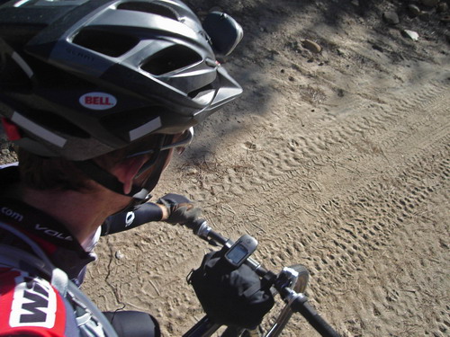
Tripp Canyon road turned steep, and 4×4 style pretty quick. I walked several sections. It was actually a relief from tedious saddle sitting. The climbing hurt, but it was suffering at its finest.
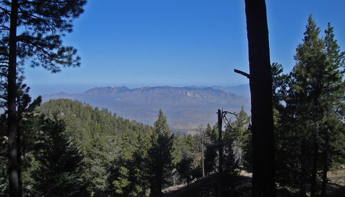
I topped out at 8500 feet, just below the West Peak fire lookout. I got my first glimpse of west pass and the upper reaches of Mt. Graham. In two miles I’d descend 1500 feet on singletrack, only to regain that elevation, plus another 1500 feet, again on singletrack. I was prepared for overgrown, unrideable conditions; I was happy to walk.
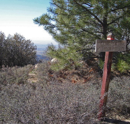
Some nice contouring trail led to the sign for Clark Peak Trail. Wow, it didn’t look good. Completely covered in brambles. Good thing I’ve got system wheels, cuz it’s going to get nasty. I’ve seen that type of bramble bush cause major flats.
I counted each section that I rode as a gift. The trail was quite a gift in this case — I’d say I rode 95% of it, usually only dismounting and pivoting to get around tight switchbacks. Each one I successfully rode brought a big grin to my face.
Brett’s flags helped identify the correct trail at the pass. It’s climbing time. I spent the better part of the next 1.5 hours hiking with my bike, but I actually quite enjoyed it. It was better than the 4×4 road I was climbing earlier. I did manage to clean a couple switchbacks, just for honor’s sake. But an old fire had erased much of the trail tread in places, making any riding difficult.
The upper meadow on Clark Peak is a beautiful place, and one that I always look forward to visiting. From here the trail turns into one of my favorite anywhere. It was so strange to suddenly recognize sections of trail. I had bridged two worlds in my mind. These conceptual worlds were so separate, yet now connected. The Clark Peak trail is a far, far away place in my mind. It takes 2.5 hours on the interstate, an hour on a steep switchbacking road, then 2.5 hours of mountain biking to reach this place. It’s at the very end of the Swift Trail (dirt road that traverses Mt. Graham).
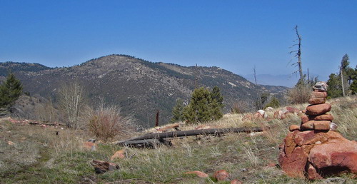
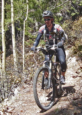
It’s long been a dream of mine to ride from my house to the top of Mt. Graham. Until I explored the Rug Road this wasn’t really possible. Now all the great rides I’ve done on Mt. Graham were connected to my larger trail network. I have this thing about connecting (by riding) all the mountain biking I’ve ever done. Of course I have islands of riding scattered throughout the west that remain unconnected. To me, having ridden, under human power, to these places brings a special connection to them. If I had made it to the place where the GET crosses the Divide Route I would have connected the Divide to my house, which thru the Colorado Trail would connect almost all of the riding I’ve done in Colorado.
So you could say I was psyched to be on Mt. Graham. It’s a very special place.
It didn’t hurt that the trail exits the burn area and becomes eminently rideable. I’ll never tire of smooth trails covered in ponderosa pine needles.
There were a few snow drifts on the upper switchbacks, but soon I was on the swift trail, making a b-line for Riggs Lake.
I had the mountain to myself as I pumped water and ate lunch. It was cold enough that I started shivering with arm/leg warmers and a jacket on.
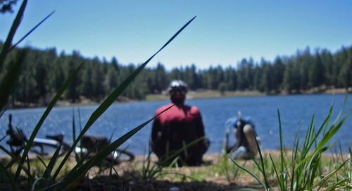
The Swift Trail is always a pleasure to ride, and today was no exception. I was still riding the high of being in this incredible place without using my car. Some trees across the road signaled to me that the gate at the end of the pavement (some 20 miles away) was not yet open. I’ve fallen in love with the sound of high winds blasting through the giant trees that cover Mt. Graham.
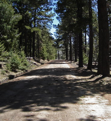
I was looking forward to descending the Ash Creek Trail, also one of my favorites, though not for riding. It’s so steep that riding back up it would be nothing but walking. It’s a great hike. But I had arrived on the mountain by bike, and was poised to enjoy ~6500 feet of descending.
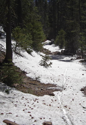
I reached Ash Creek and ventured off down the singletrack. As soon as the grade steepened the snow appeared. The cold air temps meant my tires floated on the snow, so they were completely rideable. Several downed trees in the first switchbacks — no big deal since I was expecting as much.

When Ash Creek is sweet, it’s incredibly sweet. Picture perfect singeltrack of the pine-needled sort. The snow disappeared just in time for the trail to get interesting. The trail nears the creek and crosses several steep sections of off-camber rock. There’s a catwalk constructed of boulders and a retaining fence. But this year I found it all but washed away.
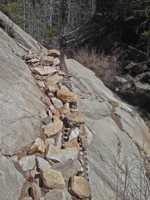
I couldn’t believe it. It seemed like that portion of the trail had been there for decades. Now it was about to fall apart. I didn’t realize it at the time, but I should have taken this as a sign of things to come.
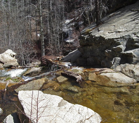
I was more concerned with the deep creek crossing and water rushing down *the trail* ahead of me. I switched to my crocs to step into the knee deep, frigid water. I kept them on for the next crossing, high above a slickrock waterslide. I’ve never seen so much water flashing down the rock before.
This was the lowest point I’d been on the trail (hiking). From here it was new country. My recon consisted of some friends (some of whom are known for low tolerance for hike-a-bike) who had ridden the trail as a loop, and a group of Phoenix downhillers who were going to shuttle the trail after having ridden it before. “How hard can it be?”, I figured.
First I stopped to scramble between boulders in order to grab a photo of the 200 foot Ash Creek Falls:
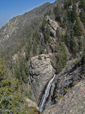
Almost as soon as I entered unfamiliar country, the trail deteriorated into an unrideable rut. I have enough experience with the trail construction on Mt. Graham to be surprised at how eroded the trail was. The CCC did an awesome job of building trail that has stood the test of time. But nature has a way of destroying man’s most “permanent” creations. A massive wildfire and torrential monsoon rains last summer were enough to destroy paved roads and bathrooms elsewhere in Southern Arizona.
Still, all it required was walking my bike down the trail. No big deal.
Then the switchbacks bottomed out back at Ash Creek, fresh off the water fall. I got a small view of my fate — a log jammed, overgrown jumble. It was far too late to turn back, so I picked up my bike and hopped over the next tree. For a while I felt I was following the trail. At least I was finding a few clear spaces to walk.
Suddenly I could find no safe way to proceed down the drainage. I crossed back and forth across the creek. One side was sheer rock and the other a deep rut full of logs and boulders.
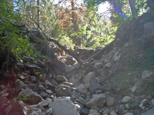
It looks small in the pic, but I was genuinely scared. I had to balance my bike on two boulders, then lower it down by the rear wheel. Downclimbing was not fun, or wise, with crocs on, but I was crossing the creek every few minutes.
After about an hour of getting jabbed by sticks and getting my bike stuck in all ways imaginable, I got to a point where someone had made a little cairn. I couldn’t believe it. I just stared at it, flabbergasted that it has survived whatever torrent had been raging down the drainage. I conducted a circular sweep around the cairn, looking for any sign of a trail. There was none. Just more trees and rocks to fight through.
During the battle, I ripped the strap off both of my crocs, had a water bottle pulled from the bike, and lost some batteries from my handlebar bag. I didn’t go back to search for the lost items. I felt trapped and just wanted to get out of there.
Moments like these aren’t particularly fun, at the time. But they sure are memorable.
More importantly, they offer an opportunity to look at oneself with all illusions shattered. Everything is stripped away. Who I am, where I came from, what I’ve “accomplished” in my life. All meaningless and forgotten. I’m just a consciousness, and one intently focused on a singular goal. Survival — more or less.
The sun was getting low, and navigating this disaster area, solo, wasn’t even safe during daylight. If the sun went down, I’d be stuck for the night.
I stared into the dark cold depths of myself and saw the cracks that remain. I liked what I saw, for the most part. But cracks do indeed remain.
I was desperate to get out of the situation, but in hindsight I realize that I let hysteria in. The situation was desperate, and to some degree the hysteria served its purpose (keeping focus), but it was somewhat unwarranted. A cooler head may have resulted in better choices, and certainly a better outlook. I still had some food, and if anything there was too much water around. A ~flat place to sleep was perhaps even possible.
Then again, I was covering less than one mile per hour, and the GPS showed more than 4 miles as the crow flies to the 4×4 road. Those numbers added up to an uncomfortable, hungry night.
From studying the maps, I knew the trail would leave the drainage to bypass another waterfall. And I knew what side of the water to be on. So I stayed on it, even when the other side looked better.
Amazingly, I found the cut of the trail, veering away from the water. I was so happy to leave the deafening sound of crashing water behind, if only temporarily. I was able to ride between switchbacks, carefully. “Fun” was pretty much out of the picture. I was riding because it was the most efficient use of my energy, not to mention the fastest way down.
I can remember few moments of bike riding with so much focus. My mind was on overdrive. Analyzing every rock, every steep grade. Meticulously predicting how the bike and shifting of weight would feel as I picked my way down the trail. Preparing each muscle in my body for the correct way to bail should things not go as predicted.
Back to the creek, I actually had a trail to follow. It wasn’t rideable, but it was comforting to know I was on the path of least resistance. Creek crossing ensued; I had long ago put the broken crocs in my pack and sacrificed my shoes/socks to the ice water in favor of speed. It was slow going for a while, but soon I was hiking my bike uphill away from the roar of the water yet again.
Contouring trail! Lower desert vegetation (no more trees down)! It was like a burden had been lifted from my shoulders. I was on some really fun, technical trail, free from the influence of wildfires and raging creeks.
Again, I experienced some intense moments of mountain bike focus. The elevation and character of the trail reminded me of another Mt. Graham classic – the Lady Bug Trail. It was on Lady Bug that I earned my only trip to the ER in my mountain biking career. I slashed my cheek open — 22 stitches from the Safford hospital — when my face found its way into a boulder.
I had that incident clearly planted in the front of my mind as I maneuvered my way down the slick rock and ledges. I didn’t want to make another trip to the Safford Hospital, but I also wished to be on the 4×4 road I could see ahead of me. I rode almost everything to the final two switchbacks, peeling my hands out of their handlebar death grip.
My bike had been a dangerous burden through most of Ash Creek, but now it was time to reap the benefit. Glorious coasting. Repeated crossings of Ash Creek slowed me down, but I was flying compared to the trail.
4×4 road transitioned to 2wd dirt. The first human being I had seen for over 24 hours approached in a truck. Before I could even think about waving, he was flipping me off and gassin’ it. I guess he was trying to dust me, or something, but he largely failed.
I wondered why I so desperately wanted to get in to town. It was better up there on the mountain with the bears and mountain lions.
I made it in just before sunset. Checked in after listening to the front desk turn away two guys looking for a room. I had been lucky to reserve one before I left. It was the only one left in town (all others said they were booked). Mining boom can do that.
I wandered around, shattered, looking for food. I knew people were looking at me strangely, but couldn’t care less. Emotions conflicted between being ever so grateful to be out of the wilderness, staring at a pizza, to feeling out of place and wishing I were back on the trail. My body was so broken and tired that I couldn’t really conceive of being out on the trail, and sleep came easily.
I had gone well beyond my goal of sustainability. Even without the Ash Creek ordeal, riding from Mammoth to Safford in two days was too aggressive of a pace. Three days would have made more sense. So I called Lee, who worked out a way to meet me on Highway 191 the next morning. I had hoped to make it a day or two further down the trail, but I was more than happy to have enjoyed the time I did have out on the trail. Before I knew it, I was back home, planning the next adventure and happy to not be completely drained.
I can’t wait to explore more of the Grand Enchantment Trail…


Bravo, Scott. Fun seeing the route through the eyes of a mountain biker. Sounds like you deviated from the GET’s Buford Hill alternate near Klondyke, sticking to the big roads through here. Also, thank gawd the GET doesn’t use Ash Creek, eh? Your ordeal tells me that the recommended GET route in Frye Canyon would’ve been a cakewalk by comparison. One mile of heck vs, what, four? Good work, amigo. And hey, come back soon, ya hear!
incredible trip and awesome write-up.
i wish i had your way with words and apparent lucidity when completely spent.
very cool.
Congrats on another fantastic journey and thanks for the beautiful write-up. Sitting here at home drinking my coffee, I got all tense while reading of your ordeal down Ash Creek. Wow!
So, how many Red Bulls should I take?
gnome-
A caseload, while we’re being antithetical.
Pic from yesterday heading your way.
Thanks for reading everyone.
Wow! Gotta love your defintion of a trail system.
Hi
I can’t be bothered with anything these days, but shrug. I just don’t have anything to say recently.
Bye
Just reread this epic little tale, having now traveled the route myself (on foot). Two points:
A) The Ash Creek Bypass Trail, avoiding the falls and Slick Rock, is still in good shape. Thusly traveled, the trail experience here doesn’t “fall apart” until the subsequent return to the drainage, which may still present less to contend with than the Slick Rock area.
B) Cluff Ranch seems to be militantly anti-OHV, with all manner of old cat tracks in the area now posted as closed – circle/slash style. Ash Creek Rd itself is closed to OHV’s. I suspect a local simply lumped our hero into the Yahoo camp, a case of mistaken identity (and undue prejudice).
Anyhow Scott, may I use your photo of Ash Creek Falls in the GET guide (with due credit)? 🙂