
Tim on the ‘micro track’ / Hedgehog trail
Lacking insight, unable to learn from previous mistakes, I joined Mark and Carrie for a third round of AZT flagging in the Santa Ritas. I had (more) appropriate footwear this time ’round, but it was too little, too late.
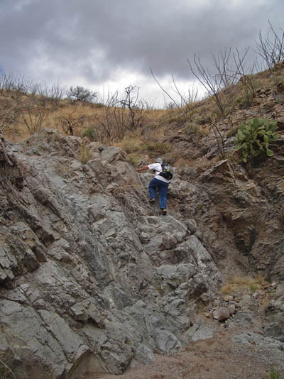
Perhaps not surprisingly, given that photo, crossing Scholefield is no easy task for our dear friend the Arizona Trail. We were cruising down a nice gentle finger ridge, having transitioned from McCleary Canyon to Scholefield. It was almost too easy. We threw up flags and I hoped (against reason, as hope always is) that today’s trail layout problems would be easy.
I was scouting ahead, anxious to peer at the upcoming crossing. What I ran into was a near cliff. Contouring around was almost not an option — solid rock blocked our path. I crossed the drainage, trying to gain a vantage point. I didn’t like what I saw. Mark continued up the wash, looking for some place to cross. It wasn’t looking good. It looked like the only option was to abandon our nice finger-ridge and begin contouring around the head of this wash. From where I sat this looked just as nasty. 6-7 deep crossings, and it would add close to a mile to the trail.
I had one last idea — switchbacks. AZT is no stranger to switch backs. The “cliff” I ran into was an exaggeration at best. I walked back to give it another look. Sure enough, I could visualize 5-6 switchy’s, followed by a narrow traverse under a rock shelf. It’s a construction challenge, not a layout challenge, I told Mark (quoting Francisco).
That burnt 45 minutes, but fortunately much of the rest was not as bad. We took a higher line that lead to a very nice pinyon forest. Shade is a good thing on the AZT. As we ate lunch we joked that we needed the trail gods to smile on us for the next two major crossings. I looked up and added that I was more worried about the weather gods.
Smiles all around. Tucson got a pretty good dumping, but we stayed dry. Two mini-systems threatened, but headed just south of us.
Our crossings were pretty much a piece of cake as we closed in on the tall, skinny sycamore tree — our ending point from last time. I was very relieved to see it, knowing we could turn back. I was ready to get off my feet.
Still, we had left a few line choices empty on our way out, so we had more flagging to fill in. I went to flag the switchback section while Mark and Carrie filled in some other gaps. As I worked my way between ocotillos, flagging tape in hand, I caught some movement in my peripheral. *BUZZ* *BUZZ*
First rattler of the year. Pivot, 180 degree spin, jump down the hill. He was about 12 inches from my leg when I jumped. I have this little pact with snakes. I don’t mess with them, they don’t mess with me. Seems to be working so far. I left a slight gap in the flags there, and radio’d Mark and Carrie to NOT follow my flags down to the pour-off.

The weather was looking good to the north…
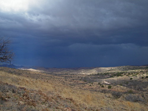
…not so good to the west

Leave a Reply