It is clear that the Rincon Mountains are not being managed as wilderness, by any interpretation of the word or law. It’s time for the NPS to either begin responsible management of the area or give up the wilderness distinction.
4/16 – Alan and I picked up our “back country” permit at the visitors center as the doors opened at 9am. The “rangers” inside displayed a lack of knowledge about their own backcountry. They are there to tend to the tourists, I suppose.
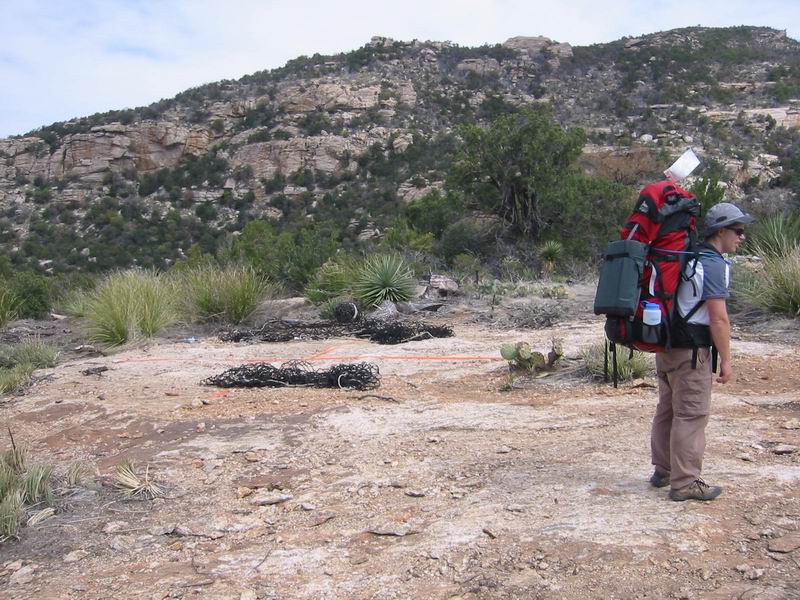
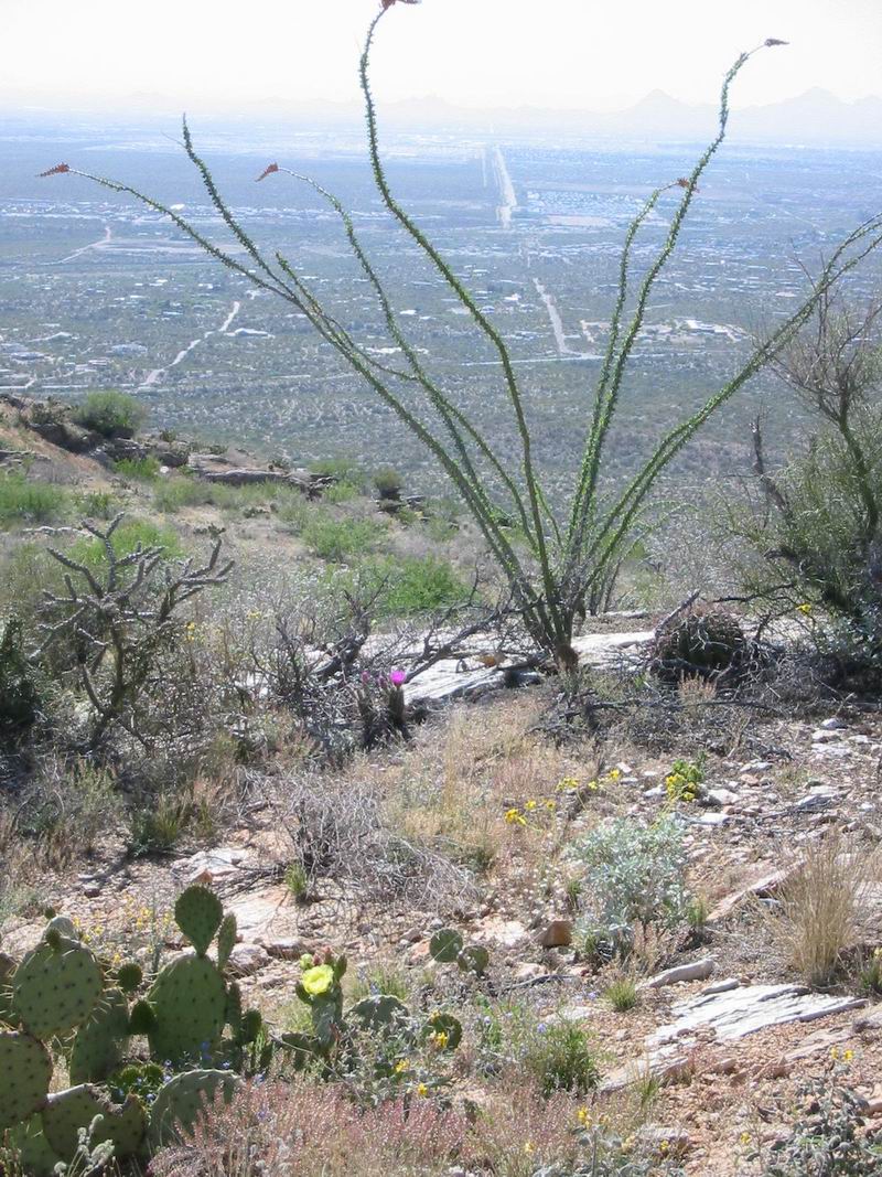
Tourists Scott and Alan headed over to the Tanque Verde picnic area to begin the long walk into the mountains. The morning was already warming up, our late start due solely to the NPS permit requirement (and late visitor center opening time). We carried 160 oz each, not knowing if we’d find water until we reached the manning camp drainage, so our packs were quite heavy. But our legs were fresh and we were anxious to get into the trees and cooler temperatures. We saw a few groups hiking the first mile or so, then no one. 2 miles from Juniper Basin we passed a couple of backpackers, staying the night at Juniper. I was surprised to find the area proceeding Juniper to be completely burned to the point of being a void wasteland. Once we dropped into the basin the trees were green and fresh.
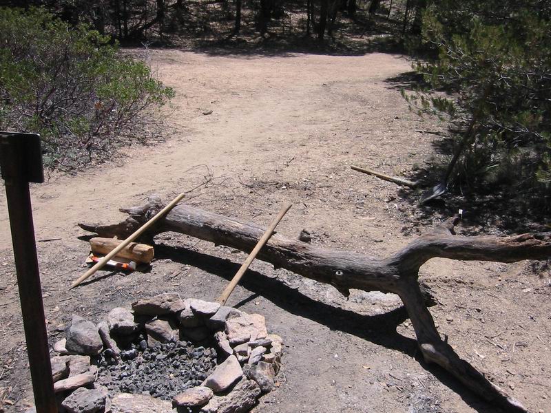
We took a look at the facilities in the campground. There were three sites, two lightly impacted and another completely void of vegetation–trampled down to the mineral soil. It was no surprise to find remnants of the trail crew at this site, including broken tools and a box full of newspapers and garbage. Leave no trace and lead by example, NPS! Unfortunately, this would not be the first time we would witness the failure of the management of this area.
There was a bit of water near Juniper, but we passed, having a full load and not wanting to add to it.
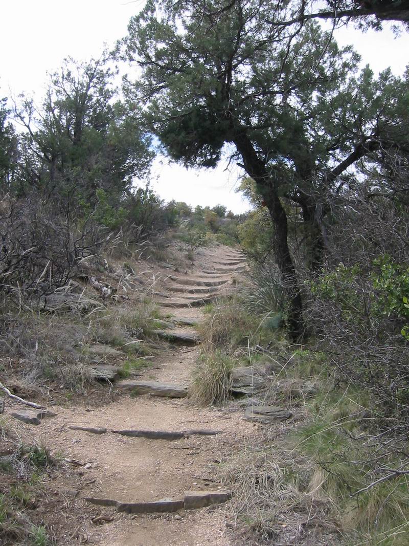
We continued on, climbing steeply towards Tanque Verde Peak. The turn off to the peak was well signed and complete with a large register, firmly dispelling any feeling of “wilderness.” The view from the peak was nice, but it was still hot even at 7000 feet. We enjoyed a snack and the view of the dusty valley. To the southeast was Rincon peak, seemingly a world away. North of us was the high country, which also seemed very far away. But it was our goal to reach it: to stand on Spud Rock.
The descent from the peak seemed very long and ate up my shins. At cow head saddle we sat to weigh our options. We had completed an arduous 11.5 miles on a hot day with full packs. 3000 ft to 7000, then dropped (with climbs) to 6100. We thought about continuing to Manning Camp, but instead opted for the original plan: dropping to Grass Shack campground, which we thought was at 5800 ft.
As we dropped it became apparent that we were wrong. 5600, 5400, 5200, ouch. All our hard fought elevation going to waste. We turned left on the Manning Camp trail and the campground. The stream was flowing with strength and the site was very nice. A snake was waiting in the trees by site 1.
4/17
The night was very warm–only 65 degrees in the morning. But I slept well despite aching legs. I thought we might be in for another very warm day, but the clouds rolled in as we packed up camp.
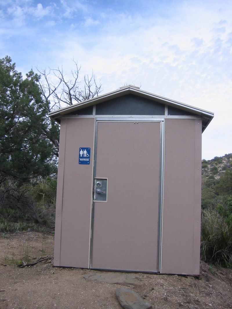
The restroom (that is the correct term) was quite a sight. It was complete with everything but running water: solar powered fan, metal floors, “Men/Women/Handicapped” and Braille sign, even TP. It was the sort of bathroom you’d expect to at the visitor’s center, not in the backcountry. We were 14 miles into the “wilderness” only to find this massive restroom. We wondered how they installed such a structure, knowing that the wilderness designation does not allow motorized transport. Alan said, “I’m not sure I buy it. They couldn’t have packed all of the parts up here.” But it’s wilderness, right?
What naive little tourists. The next half hour of hiking would soon wake us up to the reality of the management of this “wilderness.”
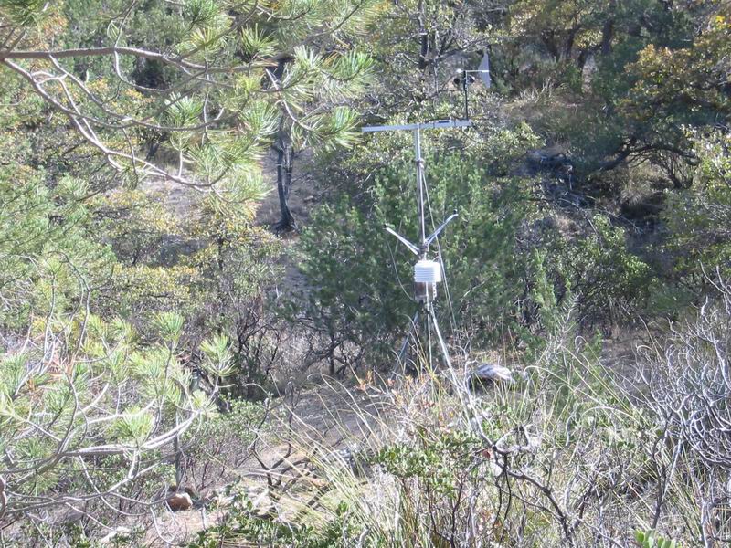
Outside of Grass Shack I spied a collection of weather equipment sitting not far off the trail. The social trails leading to it had been covered with brush, but the station was clearly visible. My immediate thought was “what kind of wilderness are they running up here?” How is a weather station not evidence of man’s development? But at least it was for science, or so I told myself.
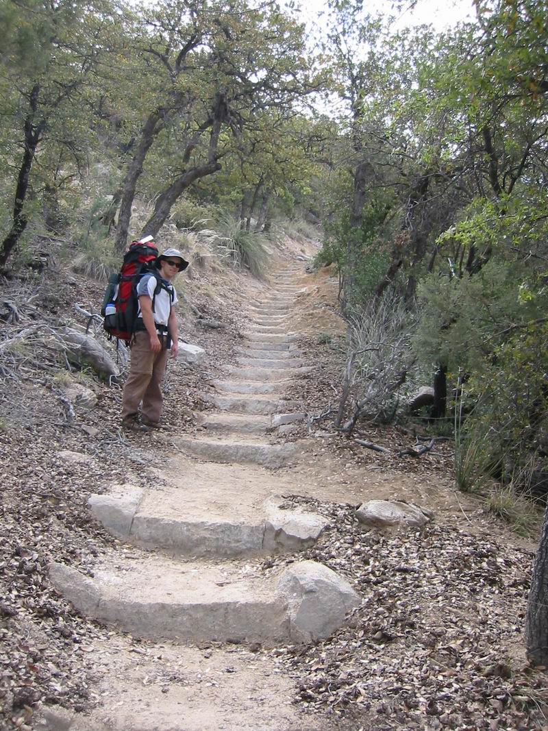
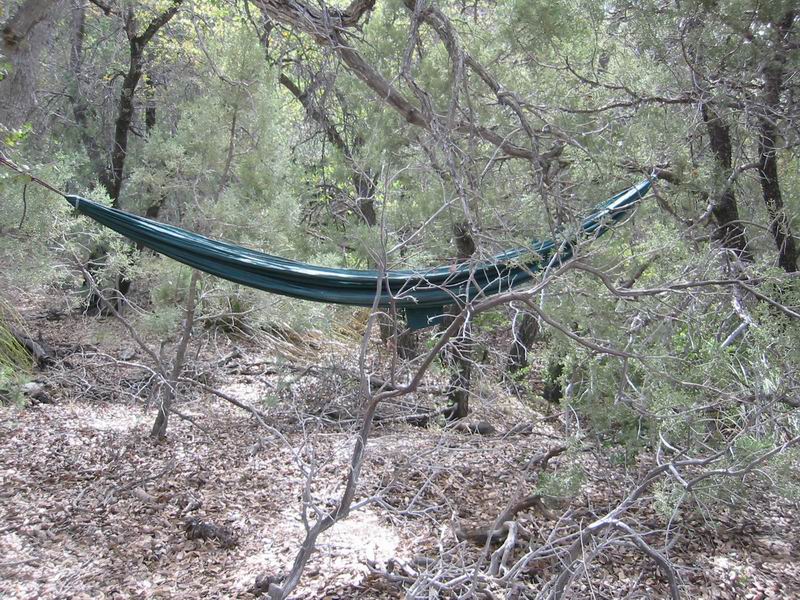
As we hiked, a few sections of stair cases began to appear. Then more, and more. Then, we reached a stair case in-progress. Trail tools were littered about, a camelbak was in the middle of the trail, a hammock was tied in a tree. Parts of stairs were on the side of the trail, next to a wheel barrow.
A wheel barrow? Excuse me? Have you ever heard of the wilderness act, which was interpreted to mean no “mechanical conveyance”, that is, no wheels are allowed? But here one was, being used to add stairs to a wilderness trail.
As the staircases grew longer and longer we marveled at the trail crew’s ability to build stairs using only human power. We knew that a ridiculous amount of work was going into these stairs.
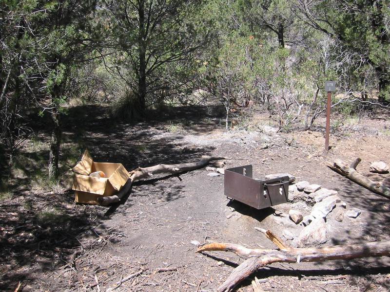
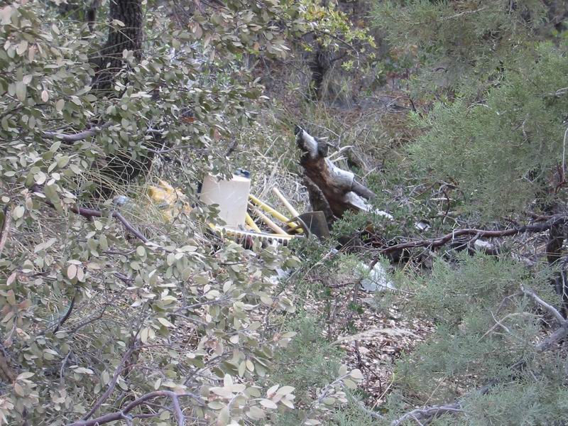
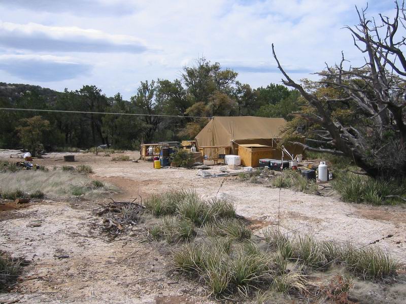
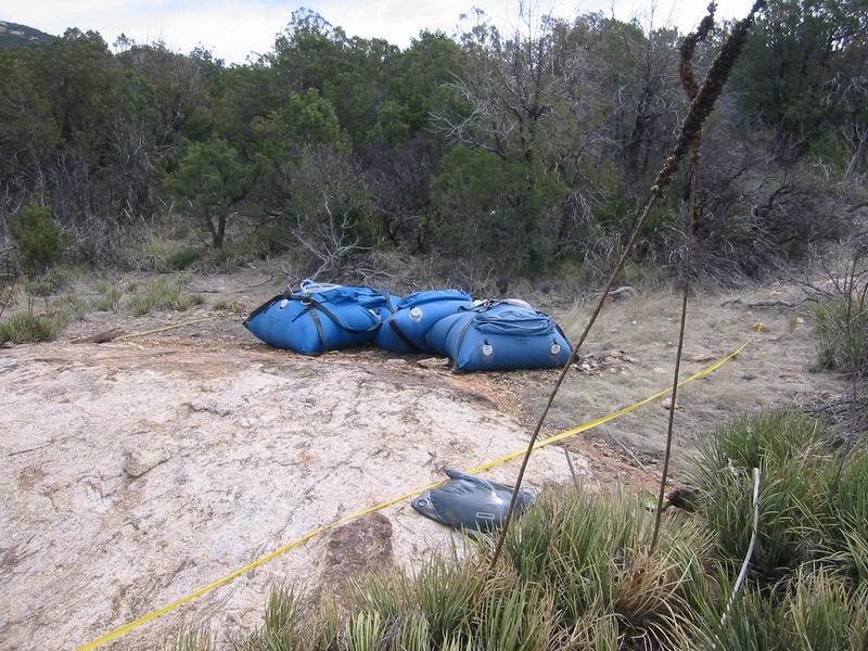
Soon after the work site we walked straight into the trail crew’s back country camp. It was deserted, so we took a walk around. We found huge bags of water, camp chairs, a large cook tent, barrels of fuel, barrels of fill material. And, of course, the power tools to complement: chainsaws, rock cutters and drills.
What?
I turned around and noticed I had walked by the fresh helipad.
—-
The trail continued, littered with stairs, as my blood slowly came to a boil.
Each step on a stair was an insult.
A twentieth the number of stairs they have installed would be 100% as effective at controlling erosion. The stairs ruins the remote and “wild” feel of the back country and also are unpleasant to walk on. I’ll take a steep and rutted trail any day over a 50 piece, irregularly spaced staircase.
It’s one thing to be wasting money on something as ridiculous as adding staircases overzealously to backcountry wilderness trails. But, it simply defies reason to do in a manner that so egregiously violates the wilderness act.
Stair after stair, then we finally reached the pine trees of the high country. Here you cannot even make an erosion argument–the trails hold together remarkably well in all of Arizona’s sky islands. After what we had seen I wouldn’t have put it past the NPS to install stairs simply for the sake of stairs; or simply because there was nothing better to do.
The trail neared the stream, which was quite beautiful. Here the trail was built up nicely with crib walls–a completely justified form of trail work. We continued climbing up to Manning Camp.
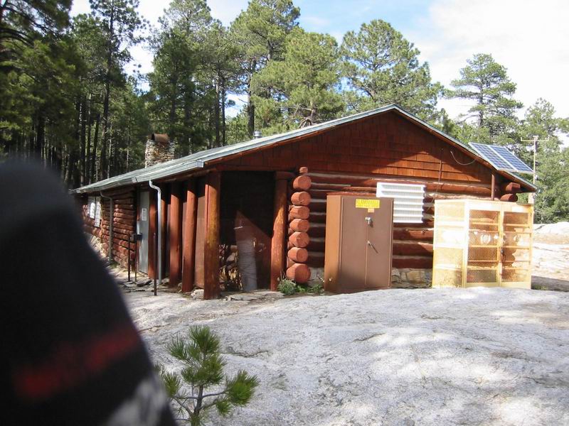
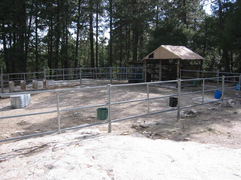
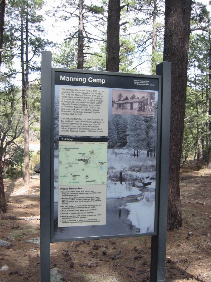
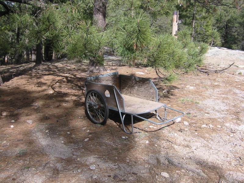
The campground and cabin were deserted as we poked around. More signs of human development and of “man remaining” : several structures, a huge corral, a pond with a piping system, weather equipment, large informative plaques and even garbage littered about (rusty cans, boards, buckets). But I took offense to none of them as much as I did this.
Why? Because bicycles are not allowed in the Rincons (you wouldn’t know by visiting, but it’s wilderness), yet this push cart has two bicycle wheels on it.
If you were somehow dropped off at Manning Camp you might wander around to find the dirt (or paved) road leading to it. No one would think they were anywhere near a wilderness area.
The whole irony of the situation up there was something to marvel at. No bicycles on the trails, but all of this?
Still, the camp site was very pleasant. The wind howled around us and the deer walked in and out of our camp, snacking on the grasses around us. They were not afraid of us.
We headed off to hike to Spud Rock, leaving the camp and wonderful irony behind. The hike on the fire loop and various other trails (there are far too many to name) was an absolute treat. The high country of the Rincons is truly a special place. I love it that there are no roads, making them very inaccessible. The upper trails have a different feel than all of the other sky islands–Lemmon, Graham, Santa Ritas. And they were thankfully free of stairs.
The view from Spud Rock was incredible. I have too many times stared at Spud from the trails and 4×4 roads down in the Redington area, wondering what it is like up there. Our attempt last year to ride/hike up the Italian Spring trail failed. It was definitely worth the effort to finally stand on top of this rock.
We sat for a while naming mountain ranges and wondering at the new perspectives being presented. It wasn’t the clearest day, but we could still see very far. The view of some of the burned area from last year’s Helens Dome fire was also impressive.
The walk back to Manning was also quite nice. The signs were a bit confusing, but we knew where we were going. I felt like I could wander around all day on those trails, but I knew we had a long walk ahead of us tomorrow, so we headed back to rest and eat at camp.
4/18
The night was quite a contrast to last. Instead of 65 in the morning it was 27. Sleep did not come as easily with the wind and cold temps.
We were up soon after the sun was up, packing up and preparing for the trip back. Once we were moving on the trail it was quite comfortable and I tried to enjoy the last moments in this special area. We walked down the ridge towards Cowhead saddle, grasping views wherever we could. There are some huge rock formations all along the trail. For a while we followed a stream in a beautiful side valley.
As the pines faded to oaks and manzita the trail crew made their presence known. Again we hobbled down ridiculous and completely inappropriate stair cases. In many sections the stairs had failed completely–horses and hikers alike had walked around the stairs, creating a new trail to the side of them. This trail was, not surprisingly, an erosion channel.
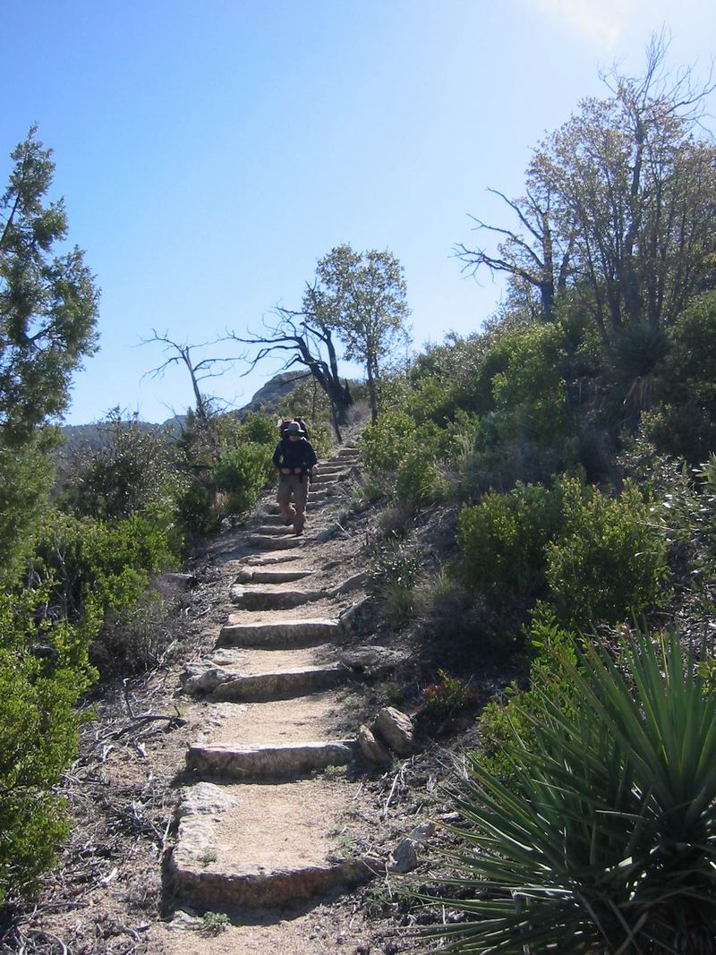
At the saddle we took a brief stop, then headed uphill to Tanque Verde peak. The trail here is in much worse condition (it’s rarely traveled). It is quite faint and sometimes hard to follow. It’s also very steep and extremely rutted in places. But it was so much more pleasant to walk on that the stairs on the other side of the pass. The difference was quite striking.
At the peak we met two other backpackers, who stayed at Juniper and were heading to Manning. Lunch on the peak gave us a good break–from there it is all downhill. 9 miles of rough downhill, that is, that seemingly never ends. But the day was cool, not as cool as yesterday, but cool enough to keep things very nice. The ridge went to infinity–I thought several times that it was going to end, but it did not.
Although little was blooming on our way up two days ago, new hedgehogs and quite a few prickly pear had just begun to open up. The trail was also littered with wildflowers. It made the warm hike through the low country quite nice, but it was nice to be back in the car, with legs dying for rest.
Stats (by GPS): 37.2 miles, 12,000 feet of climbing.

I savour, result in I discovered just what I used to be looking for. You have ended my 4 day lengthy hunt! God Bless you man. Have a great day. Bye