Show Posts

This section allows you to view all posts made by this member. Note that you can only see posts made in areas you currently have access to.


Topics - ScottMorris

Pages: [1] 2 3
1
TopoFusion Anouncements / Site updated to SSL
« on: August 22, 2024, 10:57:37 AM »

Finally got around to adding an SSL certificate to topofusion.com and going full https.

We don't collect or interact with anyone's personal data so there wasn't much need for it (purchasing the software has ALWAYS been secure).

But browsers started complaining, so it was time.

Do let me know if you notice anything wonky on the site anywhere. There are probably some regular http references around still, causing 'mixed content' errors.

Thanks for the support everyone. Nice to see some purchases still coming in.

TopoFusion forever!

2
TopoFusion Anouncements / Landsat maps temporarily out
« on: December 18, 2023, 12:27:21 PM »

The server that gives TF the Landsat tileset has changed it's access method. So it is temporarily not able to load in the latest version of TF.

An update will come soon. Thanks for the patience and happy end of 2023!


3
TopoFusion Anouncements / v5.72 released
« on: January 25, 2021, 04:46:51 PM »

Released a new version of the software today.  The PADUS version one data set seems to be going away.  Land owner will be restored with this version and also be more up to date.

http://topofusion.com/images/LandOwner-PADUS-legend.png


Plus the below changes.


5.72 - 1/25/21

Upgraded support for US Landownership layer to PADUS_2 - the most current data
  Old data may become unavailable in for older versions of TopoFusion
Fixed 'downloading' toggle not shown on 'disabled' dialog
UTM and LL grid lines can now be disabled by setting grid width to 0 or grid
  alpha to 0
New 2021 Splash Screens
Fixed inconsistent climbing elevation in Profile Window.  Profile mouse tool
  was not using box filtering, vs right click - Profile and active list were

5.71 - 6/9/20

Fixed intermittant crash when panning/downloading maps, introduced in 5.7
Fixed swapped UTM East/North coordinates in waypoint dialog
Returned 'D' shortcut key for Draw Tracks Tool
Fixed about screen to display Basic version

4
Beta Testing / Beta 5.61
« on: April 28, 2020, 11:56:02 AM »

Got new NZ/OZ/Tasmania maps and a new 'advanced track tools' dialog in the latest beta -- 5.61.

Advanced Track Tools is a collection of algorithms generally geared towards those that are in the business of producing 'clean' GPX files.  Race directors, surveyors, tracking companies (raises hand!   ;D), that sort of thing.

It'll help you find errors/noise along the track, remove time data (important), add elevation, smooth elevation and simplify, among a few other things.

Also added a basic track naming on the map.  It's a new toggle.  It's quite useful for picking out which track is what when you have a bunch of tracks loaded.

Any issues, by email, or post here.  Thanks.  And drop a note if you're like to try out the new beta, or as always, have something you'd like the software to do.

Cheers

5
Beta Testing / Testing
« on: January 20, 2020, 11:45:12 AM »

Server migration test.

6
TopoFusion Anouncements / Want to register here -- send email?
« on: July 25, 2019, 03:13:22 PM »

I just had to shut off registrations temporarily -- getting spammed badly.

Send me a note if you'd like to register here -- smorris@topofusion.com.

Thanks and sorry for the inconvenience!


7
Beta Testing / Worldwind shutting down May 3 -- get v5.55
« on: May 01, 2019, 09:47:01 AM »
One of the key servers TopoFusion uses is going to shut down May 3, 2019.

After many years of service, it is sad to see Worldwind go.  It was a great project and one
we all benefited from.

All previous versions of TF will not be able to download Elevation data and Landsat tiles
starting on the 3rd (or 4th?).  This version restores access using different servers.

Please note that starting with this version all elevation data downloaded from
Worldwind servers will not be accessible -- new data will be downloaded
from the new server.

Version 5.55 Beta is now available.
Download it using your registration name and code at:

http://www.topofusion.com/beta.php

Questions?  Thanks!

8
TopoFusion Anouncements / 5.54 - new Land Ownership
« on: November 16, 2018, 12:13:21 PM »

Land ownership maps in TF -- wahoo!

Details and revhistory here:

http://topofusion.com/news/2018/11/16/v5-54-released-us-land-ownership-blend/

Cheers!

9
Beta Testing / 5.54 - Land Ownership
« on: November 05, 2018, 01:22:46 PM »

I am excited to have a viable and public source of Land Ownership data in the USA -- the new Land Ownership layer in TF provides BLM/USFS/NPS/State/Local/Private designations.

I have yet to find a good legend, but chances are if you are interested in this layer you can figure out what the colors mean.  Or if you know your local area well.

If you use the 'Blend' option in the Map menu it will use combo blending to show you land ownership overlayed on whatever map type you are currently looking at.  Nifty.  Or find it in the tileset dropdown in the upper right to go direct to it.

Fixed a number of other servers, including an update to Elevation that was a little tricky.

Beta 5.54 is in the usual place.  Cheers!

10
TopoFusion Anouncements / v5.51 - Fixes elevation data
« on: August 06, 2018, 09:47:35 AM »

Get it while it's hot!

Details and revhistory here:

http://topofusion.com/news/new-release-v5-51-elevation-data-fixed

Cheers!

11
Beta Testing / V5.5 beta - Elevation and Landsat restored
« on: July 23, 2018, 10:05:50 AM »

Version 5.5 is out in beta form:

http://topofusion.com/beta.php

This fixes access to elevation data and landsat tiles.  Please let me know if you have any issues with it, either here or by email.  Looking to turn this around quickly into a public release.

Thanks!

12
TopoFusion Pro / Juicy Trails gone
« on: April 16, 2018, 02:44:28 PM »

Sadly we've lost the Juicy Trails map layer.  The owner has decided to not host the tiles anymore.

I plan to look into other similar options.  Thanks for the patience, folks.

13
TopoFusion Anouncements / 5.48 - USGS Imagery + Fixes
« on: November 16, 2017, 10:01:43 PM »

I've released a new version of both the Basic and Pro software, before leaving 'on holiday' to New Zealand for a couple months.

A couple tilesets are restored and a few smaller fixes as well.  Complete list below:

Apologies if email and forum responses are slow -- I'll be checking in periodically in Dec/Jan and will do my best to stay on it, but I won't have the usual quick turnaround.

Cheers everyone!

Scott

5.48 – 11/16/2017

Restored access to USGS Imagery due to server change – expanded coverage?
Added support for “Dark” colors in gpxx:displaycolor – read/write
Fixed hang/crash in “goto coordinate”
Updated hidden sat tiles
Fixed hang in loading many photos at one time (looped linked list)


5.47 – 8/21/17

Fixed Runtime error in Batch Download tool
Added help/explanation to Batch Download tool

14
Beta Testing / v5.48 - fixes
« on: October 30, 2017, 02:57:10 PM »

USGS Imagery is back, so are hidden aerials, plus dark colors and a couple of fixes.

Thanks to anyone who tests this out and/or provides feedback/bugs!

http://topofusion.com/beta.php

5.48 – 10/30/2017

Restored access to USGS Imagery due to server change - expanded coverage?
Added support for “Dark” colors in gpxx:displaycolor - read/write
Fixed hang/crash in “goto coordinate”
Updated hidden sat tiles
Fixed hang in loading many photos at one time (looped linked list)

15
TopoFusion Anouncements / v5.46 is out
« on: August 11, 2017, 02:38:23 PM »

Got the fix for a persistent and random "SSL refcount error", plus more.

See:

http://topofusion.com/news/2017/08/11/new-version-5-46-ssl-and-simplification/

16
Beta Testing / v5.46 - SSL refount error
« on: August 07, 2017, 02:01:54 PM »
Hi all,

In this version we need some help with an "SSL refcount" error that is mysteriously random.                                                     
We think v5.46 should take care of it, but if you do encounter it (when downloading tiles)                                                     
please let us know, or submit a crash report using the crash reporter.                                                                         
                                                                                                                                               
Thank you!                                                                                                                                     
                                                                                                                                               
Recent Changes:                                                                                                                                 
                                                                                                                                               
                                                                                                                                               
5.46 - 7/26/17                                                                                                                                 
                                                                                                                                               
Further work on SSL refcount error                                                                                                             
Added API key for Open Cycle Map tiles (removing watermark)                                                                                     
Added support for ?Basic? type authenticated proxy servers                                                                                     
Fixed 'divide by zero' in mercator tilesets when at extreme latitudes                                                                           
Improved error checking for lat/lon 'Goto-coordinate'                                                                                           
Added ?Toggle Downloading? to the Toggles menu                                                                                                 
Restored access to Juicy Trails maps                                                                                                           
Changed Tileset dropdown to always be in 'simple' mode (removing 0.003, 0.062                                                                   
  numbered tilesets), for easier use.                                                                                                           
Increased precision of track distance in File Properties (only)                                                                                 
Removed menu options and tileset dropdown for old style Topo/BW Aerial maps                                                                     
  MSRMaps.com continues to be offline, does not seem to be coming back                                                                         
  To enable on legacy copies of TopoFusion, edit TopoFusion.ini file and change                                                                 
  UseMSRMaps=0 to UseMSRMaps=1

17
TopoFusion Anouncements / v5.43 - Elevation download outage
« on: April 17, 2017, 10:28:38 AM »

Just a quick note that TopoFusion's source for elevation data is currently out.  All users will need to update to a new version of TopoFusion in order to restore it.

If you are experiencing widespread 'TopoFusion is having trouble contacting...' errors, this would explain it.

The fix is simple, and a new version will be out today.  Pushing it through now.

Thanks for the patience.


18
TopoFusion Anouncements / V5.40 out - added Security
« on: January 25, 2017, 10:41:07 AM »

There's a new version of the software out, restoring access to a number of servers.  Details here:

http://topofusion.com/news/2017/01/25/version-5-40-added-security-tilesets-restored/

19
TopoFusion Anouncements / Mapquest restored - v5.30
« on: July 17, 2016, 04:45:07 PM »

A new public release of the software is ready -- download v5.30 to restore Mapquest tile access, and add some new stuff too.

Details here:

http://topofusion.com/news/v5-30-mapquest-restored-tracks-dialog-smoothing

20
TopoFusion Anouncements / 5.20 out - details on the main site
« on: February 08, 2016, 07:42:44 PM »

Check the details here:

http://topofusion.com/news/2016/02/08/5-20-released-instantaneous-grade-juicy-trails/

MSRmaps continues to be flakey.  Use myTopo instead!

21
Beta Testing / 5.20 Beta
« on: January 20, 2016, 09:24:59 PM »

Got a few fixes and updates.  Loving the easy Grade measuring ability now in the draw tool.

5.20 – [1/20/16]

Added instantaneous Grade display to track drawing
New 2016 Splash Screens
Fixed potential crashes with splining and simplifying, especially multiple times
  In a session
Fixed access to Juicy Trails tileset
Clarified text on spline dialog
Added text to Download Disabled dialog when using MSRmaps tiles (server
  Continues to work intermittently

22
TopoFusion Anouncements / MSRMaps intermittent - use myTopo
« on: November 10, 2015, 10:01:18 AM »

Howdy folks,

Just wanted to make a quick announcement about the general stability of MSRmaps maps in TopoFusion.  Right now the server is not responding at all, so none of the classic topo tilesets will download (e.g. Topo16, Topo 4m).

We've received a number of emails from folks that have noticed, and we always respond that the myTopo maps should be used as the primary topo tileset.  MyTopo is much more reliable, and also has more recent and higher quality maps.

It's still nice to have the older Topos as a reference, and we do expect MSRMaps server will come back online soon, but it is highly likely that intermittent outages will continue.

Thanks!  Topo-on!


23
TopoFusion Anouncements / Topo and MyTopo out
« on: June 29, 2015, 12:10:13 PM »

For the past couple of days both the myTopo and regular Topo (msrmaps.com) tilesets in TopoFusion have not been functional.

We are working on a new version of the software, to be released soon, to address this.  Thanks for the patience.

24
Beta Testing / v5.1 Beta Out
« on: June 18, 2015, 05:26:21 PM »

This release adds new European topo maps and cleans up or improves a number of issues.  See notes below!

5.1 – [6/18/15] (Beta)

Added new European topo maps (OpenTopoMap.org)
Added support for gpxx:DisplayColor attribute in GPX files
Improved memory usage for files with large number of waypoints
Added support for KMZ exports from google maps ‘engine’ (.kmz without doc.kml)
Improved speed (clipping) for selection and manipulation of large files
Added download support for Garmin Fenix units (.fit format)
Fixed Insert point not always inserting points (after deleting points)
Fixed Canadian Topos access string (2 insignificant layers removed)
Fixed reading missing elevations in .FIT files
Fixed access for GM tiles
Removed reporting of elevations below -200m
Fixed bug loading .kml files with more than 100 track segments

25
Beta Testing / V5.05 - Server fixes and live tracking
« on: October 08, 2014, 08:48:45 PM »
Hey guys,

The forum is back!  Sorry about the absence.  I'm back on my development computer and aiming to give TF some quality time.

First thing first, as the outage notice said, the Color Tileset went out in the summer.  It was followed by a few other USGS tilesets, such as USTopo and the high res USGSImagery.

I've got all those working again, and also fixed a possible Live Tracking bug.  Oh, and added a way to merge many track segments (within a file) into one continuous track, without having to click on them all.  Drop a note or post here if you're interested in that -- it's very beta and on the debug menu.

As usual, for registered users, the beta is here:

http://topofusion.com/beta.php

Notes:

5.05 - [10/8/14]  (Beta)

Fixed Color Aerial tileset due to server change
Fixed USTopo tileset due to server change
Fixed USGSImagery tileset due to server change
Fixed source of crash in Live Tracking with Garmin USB devices
Added experimental auto track join to Debug menu

26
TopoFusion Anouncements / v5.0 Released!
« on: April 30, 2014, 02:43:28 PM »

v5.0 new splash screen

We're excited to announce the release of TopoFusion version 5.0!  Over four years of development went into version 4.0, arriving at where the software is today.  The list of new features, fixes and improvements is too long to list here.  Thanks to all our users for coming along for the ride.  You see, much of TopoFusion development is user driven.  We love to hear about cool projects or off-the-wall ideas for cool things you can do with maps, GPS, trackers, trails and everything in between!

Since the last revision 4 release the most notable change is in the map tilesets.  We've improved download reliability, added a very high res "USGS" color aerial layer, and replaced the dragging "US Topo" with a unique topo layer. 

Update your TF and check it out (full list of changes below), or if you are new to TopoFusion, please try the demo.  And as always, let us know what you think, especially if you have a suggestion for a new feature or different way the software should work.

Thanks!

<strong>Team TopoFusion</strong>


Head over to the Download Page to try TopoFusion out, free of charge.

Registered users refer to your registration email for the download link, or go here to request your code and the download URL.

<strong>Full list of changes</strong>

For a complete list of changes see the Revision History, or keep reading here for what has changed since the last public release:

5.0 – [4/30/14]  (Full Release)

Public release of version 4.86.  New version 5.0!

4.86 – [4/18/14]   (Beta)

Added new “USGS Imagery” tileset (Color Aerials, some very high res).  Find it
  in the map menu.  Shortcut key “U” reassigned from Urban to USGS Imagery.
US Topo DRG server deprecated.  Replaced with new USGS Topo basemap server, with
  faster response and more up to date maps.  Not topo quads, though.
Color Aerial tileset response significantly improved.  Less “retry” tiles and   
  server errors.
New 2014 Splash/About screens
Added 38400 baud rate to GPS dialog
Added error message for newer google map kml files (while https support is being
  investigated for addition to TF).
Updated google sat tileset request string.
Fixed runner icon coming up on profile when profiling tracks without elevation
Fixed intermittent crash when switching from merging tracks to drawing a new one
Fixed issue removing (clearing) a track segment’s name
Fixed erroneous <trksg> elements in .FIT download (e.g. Edge 800)
-   Caused uploaded tracks to be invisible on some GPS units
Updated NSIS installer, to remove "This program may not have installed
   Correctly” message on Windows 7/8.

4.85 - [11/14/13] (Beta)

Added Trackleaders off-road penalty scoring system to debug dialog (under dev)

4.84 - [11/6/13] (Beta)

Added auto track splitting for MiniHomer download

4.83 – [10/31/13] (Beta)

Fixed issue saving out live track, causing “TopoFusion is not responding”
Added debug dialog support for MiniHomer GPS, via GPSBabel
Further forced Garmin mass storage GPS units to upload in GPX, not TCX

4.82 – [10/13/13] (Beta)

Added true north bearing to comment field of PhotoFusion placed photos/waypoints
Fixed date input for NMEA raw log imports (.txt)
Fixed double clicked GPX file association when TF not already running
Changed Garmin 705 (and others) upload from TCX to GPX
Fixed jittery playback in profile tool (single track playback) when zoomed out
Fixed profile tool positioning for tracks with sub-second GPS data

27
TopoFusion Anouncements / Out on the trail - no forum support
« on: March 19, 2014, 11:56:57 AM »
Hi,

I'm heading out on the Arizona Trail for 2-3 weeks.  In that time there will be no support on these forums.

Feel free to post questions here, as others may answer, and I will eventually reply.

Sorry in advance about the SPAM that gets through the filters, too.

Purchasing of TF is still fully active and emails monitored for support.

Thanks for the patience!

Scott

28
TopoFusion Anouncements / Gov't shutdown - Color and US Topo out
« on: October 07, 2013, 04:30:15 PM »

Two of the tilesets available in TopoFusion have been rendered inoperable due to the government shutdown.  From usgs.gov: Due to the Federal government shutdown, usgs.gov and most associated web sites are unavailable.  Only web sites necessary to protect lives and property will be maintained.

We are sorry for the inconvenience this has caused, however, luckily there are good alternate tilesets available in TF.  Both myTopo and the 'old' MSRMaps topos are coming in fine, and Open Aerial is server color aerials quickly.  We suggest you use those tilesets until the USGS servers are back online.

Thanks for the patience.

29
TopoFusion Anouncements / v4.81 - new servers
« on: August 18, 2013, 12:09:20 PM »

new Landsat, new elevation data

As posted in the announcements forum, our trusty OnEarth server ceased giving out Landsat and Elevation tiles in the last week.  Version 4.8 replaces OnEarth with a different NASA server, and there are some improvements!  First, elevation data is global -- before TopoFusion had no elevation data in extreme latitudes (60*+).  3D in Alaska!  Second, the Landsat imagery is higher quality, better true color, and still covers the whole world.  This is definitely an improvement for non-US users.

We also added the Juicy Trails tileset, which is a very nice rendering of OSM street, topo and (most importantly) trail data.  See http://juicytrails.com for more info, but this is a very nice tileset to have available in TF.  Please consider adding trails to the OSM database (which will then be reflected on Juicy Trails, too).

Thanks!

4.80 – [8/14/13]

Added new server for Landsat and Elevation data
  OnEarth server has been retired
  Elevation data now available above 60* and below 60*!
  Removes issues between NED (US only) and SRTM (global)
  Option for force SRTM removed
  Landsat imagery now true color reflectance (instead of Mars-like color)
  Better resolution, especially outside the USA
Fixed moving time calculation for reversed tracks in profile tool
Increased possible size of KMZ tiled map exports

4.79 - [7/26/13]   (Beta)                                                                                                                                             
                                                                                                                                                                                 
Fixed profile errors with tracks missing time, introduced in 4.78                                                                                                                 
Added Trackleaders FastMarker export

4.78 – [7/25/13]  (Beta)

Added Juicy Trails tileset – ‘J’ key shortcut
Fixed KMZ tiled map exports for over 500 tiles at a time
Fixed speed display for sub-second GPX files

30
Beta Testing / v4.8 - new Elevation/Landsat server
« on: August 14, 2013, 08:09:16 PM »

new Landsat, new elevation data

As posted in the announcements forum, our trusty OnEarth server ceased giving out Landsat and Elevation tiles in the last week.  Version 4.8 replaces OnEarth with a different NASA server, and there are some improvements!  First, elevation data is global -- before TopoFusion had no elevation data in extreme latitudes (60*+).  3D in Alaska!  Second, the Landsat imagery is higher quality, better true color, and still covers the whole world.  This is definitely an improvement for non-US users.

We also added the Juicy Trails tileset, which is a very nice rendering of OSM street, topo and (most importantly) trail data.  See http://juicytrails.com for more info, but this is a very nice tileset to have available in TF.  Please consider adding trails to the OSM database (which will then be reflected on Juicy Trails, too).

We had some other small fixes, but needed to push this new version with the server change out ASAP.  Please let us know of and issues or feedback you have.

Thanks!

4.80 – [8/14/13]

Added new server for Landsat and Elevation data
  OnEarth server has been retired
  Elevation data now available above 60* and below 60*!
  Removes issues between NED (US only) and SRTM (global)
  Option for force SRTM removed
  Landsat imagery now true color reflectance (instead of Mars-like color)
  Better resolution, especially outside the USA
Fixed moving time calculation for reversed tracks in profile tool
Increased possible size of KMZ tiled map exports

4.79 - [7/26/13]   (Beta)                                                                                                                                             
                                                                                                                                                                                 
Fixed profile errors with tracks missing time, introduced in 4.78                                                                                                                 
Added Trackleaders FastMarker export

4.78 – [7/25/13]  (Beta)

Added Juicy Trails tileset – ‘J’ key shortcut
Fixed KMZ tiled map exports for over 500 tiles at a time
Fixed speed display for sub-second GPX files

31
TopoFusion Anouncements / Elevation and Landsat down
« on: August 13, 2013, 10:51:16 AM »
Hi Folks,

At this time the NASA OnEarch server has ceased operation.  I'm not 100% certain that it is a permanent downtime, but it may be.

I am working on replacements, and will have a new release out as soon as I can.

What this means is that current copies of TopoFusion cannot download Elevation Data or Landsat tiles.  You'll get a "TF is having trouble contacting..." error.

Thanks for the patience, and stay tuned for further updates.

Scott

32
TopoFusion Anouncements / Version 4.76 out
« on: May 01, 2013, 10:42:21 AM »
We released version 4.76.  Some cool SAR (search and rescue) features, a handy address searching tool and better map downloading.

Read all the details here:

http://www.topofusion.com/news/2013/04/30/version-4-76-released-sar-features-and-better-downloading/

Thanks!

33
TopoFusion Anouncements / Out of the office until 5/1
« on: April 19, 2013, 10:18:11 PM »
I'm out on the AZ trail.

I have a beta that'll be pushed to full release soon after I get back from the trail.

Purchasing is fully automated (and email monitored).  No answers here on the forum though.  Thanks!

34
Beta Testing / Beta 4.76
« on: April 16, 2013, 05:17:52 PM »
Got new beta out.  Feedback welcome.  Thanks!

4.76 - [4/16/13]

Added address searching feature (Goto->Search Address)using MapQuest's nominatim
  service, based On Open Street Map data.  CTRL-F brings up search dialog.  Requires
  Internet access.  Replaces old "GIS Layers" city search.
Improved handling of bad/down/slow server responses
  "Downloading disabled" message only appears when tileset you are viewing is
  having trouble
Added "Retrying" tiles to better show server response times/errors
Increased size and length of time photos stay visible in upper/right during
  Single track playback
Improved time/elevation reading of raw NMEA log files (.log import)
Fixed reporting of free memory, disabled display of tile memory cache size
Fixed thread errors loading networked KML files
Fixed memory leak in tile downloading stack
Reordered Map Menu to better reflect priority/reliability of tilesets/servers

35
TopoFusion Anouncements / Out of the office until 3/5/2013
« on: February 20, 2013, 11:20:14 AM »
I won't be monitoring these forums while out cycling in Alaska, along the Iditarod Trail.

Purchasing and emails are still active and automatic.  Drop a note to support@topofusion.com if you need help with registration or purchases.  Alan is monitoring and there to help.

For general support queries or forum posts here, thanks for your patience -- I'll get back to you when back from Alaska.

Thanks!

36
TopoFusion Anouncements / v4.7 - temperature, .FIT, info mode
« on: November 01, 2012, 02:01:56 PM »


TopoFusion displaying temperature data for a long ride

We're happy to release TopoFusion 4.7!  This version offers some significant improvements to the software in usability, some needed fixes and cool new stuff too.  New is support for Garmin's Tempe sensor, an inexpensive temperature sensor that can be paired with many Garmin GPS units.  With that support comes temperature profiles (see above screenshot) and temperature-based track shading.  In the new support department we also have new Edge 800/500 and Fenix support, in the form of .FIT file reading.  Plug your Edge 800 up and you can pull up any file from your history in TopoFusion!

We've also got a new mouse tool mode -- the info mode, which gives you track and waypoint data simply by moving the mouse near points in the map.  This is a user requested and highly useful form of additional track/trip analysis.  Thanks for the suggestion!

TopoFusion's "Export View" function is a very powerful way to output high resolution maps, with any of TF's map sets and user track/waypoint data as well.  But one issue was that tracks and waypoint text were pretty tiny when exports are at 8000x8000 pixels.  Now there's a handy checkbox that adds automatic scaling of line width and font size.

Update your TF and check it out (full list of changes below), or if you are new to TopoFusion, please try the demo.  And as always, let us know what you think, especially if you have a suggestion for a new feature or different way the software should work.

Thanks

Team TopoFusion


Head over to the Download Page to try TopoFusion out, free of charge.

Registered users refer to your registration email for the download link, or go here to request your code and the download URL.

<strong>Full list of changes</strong>

For a complete list of changes see the Revision History, or keep reading here:

4.7 - [11/1/12]  (Full Release)

Added support for per GPS point temperatures (e.g. Garmin Tempe sensor)
  Including profile tool, track shading, track properties
Added ability to read .FIT files
Added support for Garmin Edge 800/500, also Fenix and any other units that
  communicate by .FIT files
Added new mouse mode: Info Tool.  Use to query tracks and waypoints to
  get on-screen stats.  Clicking on a point brings up it's properties view.
Added option to scale line width, fonts and waypoint sizes when exporting maps
  (Export View function).  Checkbox turns on scaling to match what is seen in
  current map view
Added shortcut to "Reset TopoFusion to default settings" to start menu on
  install.  Useful for debugging issues with the software (more effective than
  uninstall/reinstalling).
Improved download queue behavior when a tileset (server) is unresponsive
Improved shaded relief quality in highest detail setting (when zoomed in)
Improved speed of filling track points table in File Properties
  Files with less than 8000 points now loaded by default
Fixed access violation in using "Merge Files and save as..." when using edited
  tracks with deleted points or files with multiple un-named tracks
Fixed crash in using the merge tool to save out empty files (nothing merged)
Fixed error disabling downloading with modal forms shown (about, options)
Fixed 'Real Time Playback' option in multi-playback when using skip stopped time

4.66 - [9/7/12]  (Beta)

Changed Astro live tracking centering to only center, not zoom on track
Fixed off by one error(s) converting trackpoint to waypoint
Improved display of downloading tiles while drawing tracks
Added ability to save kml/tcx/shp file when creating a new file with waypoints

37
Beta Testing / Beta 4.67 - Temperature, .FIT, Edge 800, Info Mouse Tool
« on: October 22, 2012, 11:05:30 AM »
Beta 4.67 is up and ready for testing.  Lots of new stuff here.  I'll let the changelog do the talking.

Here are the changes:

4.67 – [10/21/12]  (Beta)

Added support for per GPS point temperatures (e.g. Garmin Tempe sensor)
  Including profile tool, track shading, track properties
Added ability to read .FIT files
Added support for Garmin Edge 800/500, also Fenix and any other units that
  communicate by .FIT files
Added new mouse mode – Info Tool.  Use to query tracks and waypoints to
  get on-screen stats.  Clicking on a point brings up it's properties view.
Added option to scale line width, fonts and waypoint sizes when exporting maps
  (Export View function).  Checkbox turns on scaling to match what is seen in
  current map view
Added shortcut to “Reset TopoFusion to default settings” to start menu on
  install.  Useful for debugging issues with the software (more effective than
  uninstall/reinstalling).
Improved download queue behavior when a tileset (server) is unresponsive
Improved shaded relief quality in highest detail setting (when zoomed in)
Improved speed of filling track points table in File Properties
  Files with less than 8000 points now loaded by default
Fixed access violation in using “Merge Files and save as...” when using edited
  tracks with deleted points or files with multiple un-named tracks
Fixed crash in using the merge tool to save out empty files (nothing merged)
Fixed error disabling downloading with modal forms shown (about, options)
Fixed 'Real Time Playback' option in multi-playback when using skip stopped time


4.66 – [9/7/12]  (Beta)

Changed Astro live tracking centering to only center, not zoom on track
Fixed off by one error(s) converting trackpoint to waypoint
Improved display of downloading tiles while drawing tracks
Added ability to save kml/tcx/shp file when creating a new file with waypoints


----

Comments or questions here or in email!  Thanks guys.

38
TopoFusion Anouncements / Nasa Server not responding
« on: September 28, 2012, 03:33:11 PM »
Looks like NASA's onearth server has stopped responding today, 9/28/12.

Check this link to see if it is back up yet:

http://onearth.jpl.nasa.gov/

Downtimes do happen, but they are usually short.  TopoFusion will be unable to download Landsat or Elevation data in the meantime.

Thanks for the patience.

39
TopoFusion Anouncements / v4.65 - Server fixes
« on: August 07, 2012, 12:24:27 PM »

We've pushed out a new version of both TopoFusion Basic and Pro to address some server changes.  The changes on the server end have rendered older versions of TopoFusion unable or hindered in downloading tiles from the Color Aerial tileset ("Color") and newly added US Topo tilesets.  So if you have been experiencing "TopoFusion is having trouble contacting..." errors, or missing map tiles, you will want to update to the latest.  We've also cleaned up a few things in the error handling of some other tilesets, and enabled batch downloading and combo blending for the reinstated MSRMaps tilesets, as requested.

We have bigger changes in the works, but not ready for prime time yet.  Just needed to get this very important maintenance release out.  Check it out below.


Head over to the [url=http://topofusion.com/download.php]Download Page
to try TopoFusion out, free of charge.

Registered users refer to your registration email for the download link, or go here to request your code and the download URL.

Full list of changes

For a complete list of changes see the Revision History

40
TopoFusion Anouncements / v4.6 - MSRMaps is back!
« on: June 23, 2012, 06:27:52 PM »

After announcing that MSRMaps.com (formerly Terraserver) will be closing permanently, the Microsoft has decided to keep the service alive.  They received enough requests from longtime users and folks that rely heavily on the service.  If you send a note in, thank you!

This has, in turn prompted us to release another revision that re-enables access to new MSRMaps tiles.  So the traditional Topo maps, B/W aerials (still useful!) and urban imagery for some cities, are all back!  The new USTopo layer is still available as well, so now there are three sources of Topo maps in Terraserver!  The array of maps available to TF users continues to grow...

v4.6 also fixed a bug created by the massive size of this year's Tour Divide race.  The Trackleaders spot replay interface had a problem replaying the current race.  Tour Divide is an exciting race that continues for weeks, so there is still time to get in on the action and do your own replays in TF.  Check out more at:

Trackleaders / TopoFusion.


Head over to the Download Page to try TopoFusion out, free of charge.

Registered users refer to your registration email for the download link, or go here to request your code and the download URL.

Full list of changes

For a complete list of changes see the Revision History

41
GPS, Trails, Training / GPS garage sale - CHEAP
« on: May 13, 2012, 03:37:12 PM »
I am cleaning house, trying to move on some GPS units to someone that will use them.


First up is an almost new Delorme PN-30.  A lot of people like this platform of GPS.  I bought it wanting to add support to TF for it, but the protocol proved far too complex.  $50 including shipping (US only).  Includes handlebar mount.

Close up of GPS.


Next up is a Magellan Sportrack Pro, including manual and serial cable:


Cover shipping (US only - $10) and it's yours.

Last one is an oldie, an original Lowrance iFinder:


Same as the Magellan, cover shipping (US only - $10) and it's yours.

Paypal preferred, other options considered.

42
TopoFusion Anouncements / Version 4.5 released - new Topo Map server
« on: April 30, 2012, 11:21:18 PM »


We're happy to announce the release of v4.5 of both the Pro and Basic product.  The main new feature is the addition of the "US Topo" tileset, which replaces the now deprecated "Topo" tileset.  The old Topo tileset was downloaded from MSRMaps.com (formerly Terraserver) which has been shut down (read details here: MSRMaps shutting down).

Previously downloaded maps in the old Topo tileset will still be available to existing users, but future downloads have been disabled.  For more details, read the forum thread:

http://www.topofusion.com/forum/index.php?topic=7159.0


Head over to the Download Page to try TopoFusion out, free of charge.

Registered users refer to your registration email for the download link, or go here to request your code and the download URL.

Full list of changes

For a complete list of changes see the Revision History

43
TopoFusion Anouncements / Terraserver (MSRMaps) shutting down May 1st
« on: April 24, 2012, 03:33:33 PM »

Terraserver gives TopoFusion its base "topo" and B/W Aerial tilesets.  After May 1, copies of TopoFusion will no longer be able to pull new tiles for either of these tilesets.  Might be time to do some batch downloading!

Here is the official announcement:

http://msrmaps.com/About.aspx?n=AboutShutdown

Fortunately we still have great tilesets like MyTopo, Open Cycle Map, Color Aerials, Open Aerial, Canadian Topo's, etc.

44
TopoFusion Anouncements / Forum upgrade
« on: April 02, 2012, 07:20:27 PM »
Howdy all,

Today I upgraded to the next major version (2.0) of SMF software, and also loaded up a new theme to give it a fresh look.  All the old posts and accounts were transferred over, so it should be pretty seamless.

My hope is that the new version's better spam fighting features will keep the forum free of all the bot-posted garbage that I have been struggling to keep in check.

We will see how it goes.  Please let me know, either in this thread or by email / PM if you notice any issues. 

Thanks a lot!

Scott

45
TopoFusion Anouncements / Color Aerials down
« on: February 26, 2012, 09:23:46 AM »
Looks like the USGS server is having some issues and is unreachable as of yesterday 2/25/2012.

Let's give it another day, then I will start investigating further. I don't see any notices of server changes or planned downtime.

46
TopoFusion Anouncements / TopoFusion basic v4.4 - major update
« on: February 06, 2012, 09:13:46 PM »


Lee Blackwell, Gila River Country, Arizona

TopoFusion Basic has received a major overhaul and now joins the same codebase as TopoFusion Pro.  It's a slimmer, more easy to use version of our Pro software with some of the advanced features disabled.  The old version of TopoFusion Basic (v2.975) is now known as TopoFusion Legacy, since it still runs well on older version of windows (95/98).

Any users of TF Basic should update to get a host of new imagery and other updates found in the Pro codebase.  We're confident that the new Basic product will suit many of our users, while the Pro version is the flagship product with all the bells and whistles.

TF Legacy will remain available to license holders of both the Pro and Basic versions, and also in demo form.

See all details here:

http://www.topofusion.com/news/2012/02/01/topofusion-basic-version-4-4-released-major-update/

47
TopoFusion Anouncements / v4.31 - myTopo and TopoFusion
« on: October 17, 2011, 01:37:32 PM »

myTopo maps in TopoFusion

TopoFusion Pro version 4.31 is out, a quick response to a change in one of the software's key tilesets -- the myTopo layer, courtesy of myTopo.com.  Originally introduced in v4.0, July 2010, myTopo maps are a major improvement over MSRMaps/Terraserver topo maps, featuring better clarity, more current maps and forest service updates (like forest road and trail numbers).

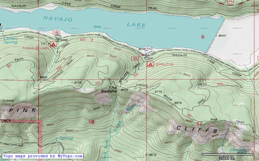
Last week (10/12/11) a server change caused new maps downloaded by TopoFusion to come in jumbled and corrupted.  If you are getting myTopo maps that look like this:


this update is for you.  Once you update you can use the reload maps tool (looks like this on the toolbar: ) to point-click and force a re-download of any maps that came in corrupted.

If you haven't checked out myTopo's other services, you should.  Besides the awesome (and free!) set of Topo map tiles for the entire US (and Canada) they offer some really nice printed map services.  If you're in the market for a printed map, buying one from MyTopo is a great way to say thanks for the free maps in TopoFusion.  Check them out by clicking on their logo.


For full details on what else has changed, check the revision history linked below.


Head over to the Download Page to try TopoFusion out, free of charge.

Registered users refer to your registration email for the download link, or go here to request your code and the download URL.

Full list of changes

For a complete list of changes see the Revision History

48
Beta Testing / Beta 4.3 - MyTopo Fix, KMZ
« on: October 13, 2011, 03:38:10 PM »
If you are getting MyTopo maps that look like this, you should download the new version, out in beta form now.


http://topofusion.com/beta.php

(for registered users)

Other additions/fixes/etc:

4.3 [10/13/11] (Beta)

Fixed corrupt myTopo maps due to server change (chunked responses)
Added ability to read .KMZ files (zipped .kml)
Added new unit type "Nautical" for nautical miles and knots
Added ability to expire all maps for OSM, Open Cycle, Mapquest, Open Aerial and
  myTopo maps (Options->Preferences->Tilesets)
Improved accuracy/detail when adding elevation data to tracks
Changed encoding of all xml files (GPX, KML, etc) to ISO-8859-1 from UTF-8 to
allow special characters
Fixed error 380 with Garmin Astro Live Tracking
Fixed "place waypoint" button on Goto form to copy both coordinates

49
TopoFusion Anouncements / MyTopo tile corruption
« on: October 12, 2011, 08:18:11 PM »
As of sometime this week, myTopo tiles are coming into TopoFusion corrupted, resulting in jumbled or odd colorizations on some tiles (not all, but enough that it's significant).

This is due to a change in the way the tiles are served.  I've got a fix and will get a beta/full release out very soon, hopefully tomorrow 10/13/11.

Thanks for the patience.

50
TopoFusion Anouncements / v4.22 Released - Land Ownership fixed
« on: August 03, 2011, 01:51:12 PM »

Land Ownership map set legend

TopoFusion Pro version 4.22 is out, with some nice fixes and enhancements to the software.  One key change was the reinstatement of the Land Ownership Layer, which had a very serious server change, rendering previous versions of the software unable to download/display new Land Ownership maps.  The land ownership layer has been incredibly useful for our Search and Rescue as well as Trail Planning users, so we are very happy to have it back.  Full details on the Land Ownership change: http://www.topofusion.com/forum/index.php?topic=6270.0

For full details on what else has changed, check the revision history linked below.


Head over to the Download Page to try TopoFusion out, free of charge.

Registered users refer to your registration email for the download link, or go here to request your code and the download URL.

Full list of changes

For a complete list of changes see the Revision History

Pages: [1] 2 3