
Version 5.40 – Added security, tilesets restored
January 25th, 2017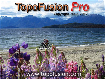
New 2017 Splash Screen – Manipouri Lake, Fjordlands National Park, New Zealand
The latest revision of TopoFusion, version 5.40, has been released. We added support for secure tiles and secure transfer to/from map servers. Several servers are now requiring https in order to transfer tiles, and it also means that third parties cannot snoop on what you are doing.
As a consequence, several map servers that have not been working in TopoFusion for the last month or so (while TopoFusion author Scott Morris was away in New Zealand, see pic above), have been restored. This includes US Topo, Color, and Open Topo Maps. The latter, we should mention, has been expanded to worldwide coverage and has some nice tiles (previously it only covered Europe).
So if you’ve been having issues downloading maps lately, please update to the latest version. Also a reminder that to get more reliable access to Mapquest based tiles (such as Open Aerial, Mapquest Street) we recommend getting your own (free) map API key so you can download 15,000 tiles per month. We are still seeing outages on this every month on the default key. You can get a key here http://tinyurl.com/gvcuqg8 And the key is added in (Options->Preferences->Tiles->Mapquest API Key).
Update your TF and check out the new version (full list of changes below), or if you are new to TopoFusion, go ahead and try the demo. And as always, let us know what you think, especially if you have a suggestion for a new feature or different way the software should work.
Thanks!
Team TopoFusion

Head over to the Download Page to try TopoFusion out, free of charge.
Registered users refer to your registration email for the download link, or go here to request your code and the download URL.
Full list of changes
For a complete list of changes see the Revision History, or keep reading here for what has changed since the last public release:
5.40 1/24/17
Public release of previous betas
New 2017 Splash Screens
5.39 1/15/2017
Added ability to read SSL-encrypted (secure) tiles
Restored access to the following tilesets: US Topo, Color, Open Topo Maps (which
now works worldwide), also ‘7’ key.
Changed ‘isMoving’ to include missing time stamps and negative times, for
better consitency in files that have bad time data (e.g. merged files)
PhotoFusion thumbnails now scale up with Export View exports, using the
Scale fonts/etc option.
5.32 10/15/2016
Added prompts in ‘download disabled’ dialog about Mapquest tiles and API key
Switched Find->Search to separate API key, due to continued usage of tile key
5.31 9/12/2016
Added ability to add Mapquest API key (Options->Preferences->Tiles->Mapquest API
Key) , so users can have their own 15,000 tile allocation of tiles. Sign up
for a key at: http://tinyurl.com/gvcuqg8
Removed Topo/Aerial/Urban from KMZ export, due to server being down indefinitely
Fixed issue with Lat/Lon grid in datums other than WGS84
Changed PhotoFusion HTML export to use USTopo and Color tilesets instead of
deprecated Topo/Aerial
5.30 – 7/17/2016
Restored access to Mapquest’s Open Aerial and Street tilesets
5.26 – 7/2/2016
Fixed additional issues with waypoints coming up in right click when not near
Fixed zero length segments (tracks within a file) in new Tracks area of File
Properties
5.25 – 5/27/2016
Added a Tracks area in File Properties, giving a list of tracks within the file
Double click to zoom map to a track. Right click to fill the table with
points and for other options (delete, edit track properties).
Added Smooth Elevation data (filter) button to Climbing Analysis (and File
Properties dialog). Button applies a box filter of width 5 to the data for
each press.
Changed global elevation gain algorithm to include a box filter of width 5.
This affects the profile tool and elevation gain stats in active file list.
The change was made to help give more realistic climbing numbers.
Added shortcut key for opening/closing the active file list – Spacebar
Fixed issue with cursor changing to magnifying glass with certain files loaded
Fixed issue with waypoints always coming up in right click with certain files
Improved response of Climbing Analysis when missing DEM tiles or with
downloading disabled
Changed “Training Center” preset to “Strava/Garmin Connect”
Fixed individual point NO_TIME loading .KML files without time
When saving, filled
one track