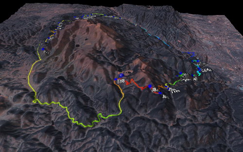
My first ride in Manitou Springs (after moving here this summer) was on the Intemann Trail. I was in a totally new place and the signs were confusing. But occasionally I’d see a carsonite with the words “Ring the Peak” on them. There’s only one peak they could be talking about!
My curiosity was more than a little piqued, because I absolutely love it when people establish long distance trails. A web search led to:
Excellent. 80% done, and 100% open to bikes. The obsession began.
I devoured every bit of the website, impressed with the hard work by all associated with the Friends of the Peak. I loaded the waypoints, and traced a rough GPS line based on the online maps. I forbade myself from “pre-riding” any more of the trail, not wanting to spoil the surprise. I found that a guy named Marshal had ridden the entire thing in a day, but his first attempt was a 19 hour debacle. His second try took 15. I approached the endeavor with respect — it was very likely it could kick my ass.
Knee woes derailed my first planned attempt, for about a month, but the time finally came.
I pedaled up Ruxton Ave under cover of darkness. I planned to get through the exposed climbing on the Ute Trail before it was, well, exposed, to the sun. It worked well, but the Ute trail is somewhat of a rude wakeup at 5am. I pedaled the first 0.2 miles, then hopped off to begin hiking. I knew I had no chance of cleaning this hill, especially with a pack full of supplies and rain gear.
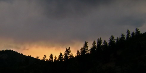
Sunrise on the Ute Trail
Rollers ensue, though I knew you can bypass one of them by following singletrack along an old water line:
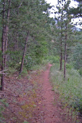
I’m usually stickler for adhering to a route, no matter what, and the RTP signs clearly tell you to stay on the road. But when the choice is contouring singletrack vs. steep dirt road, it’s a no brainer.
My advance route knowledge ended here. I dropped down to the Waldo trailhead for a brief section on Highway 24 to Cascade. The early start paid off here, too. But the real reason for the early start was to improve my odds versus the daily thunderstorms that seem to build on Pikes. It’s not even monsoon season yet, but it sure feels like it.
So I was running scared of T-storms, even when the sky was blue. I dropped to granny gear climbing Picabo Road, refusing to get off and walk pavement, even though Marshal warned me that I might later regret it.

Mt. Esther Trail started well enough, contouring…
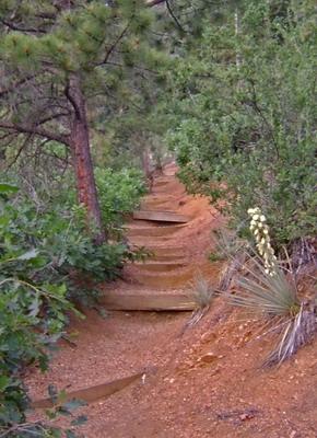
Then… hike a bike! Grr… stairs…
It was a bit of a grunt, but the ridge was attained soon enough.
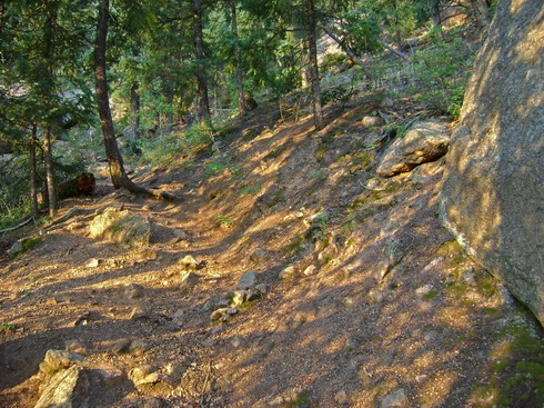
Beautiful morning light
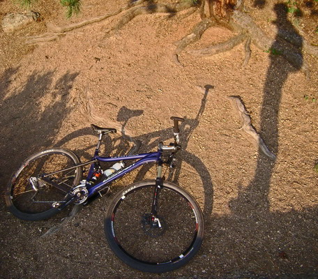
Bike, and rider
Once on the ridge, the rewards were sweet…
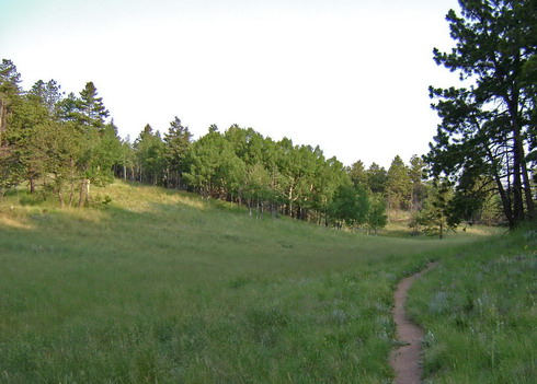
Tasty singletrack
I was really impressed with this section of little used trail, all the way to crystal creek reservoir. Great flow, good climbing, and even some technical sections.
Singletrack segued into water company access roads, sometimes steep. This was all new territory for me, so my head was on permanent 360 degree sweep mode, trying to take it all in. I remember looking at my GPS and seeing 11 miles and 2.5 hours moving time. Basic math led to a late finish, if things continued at this rate.
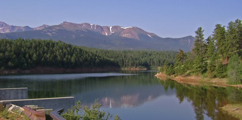
North Catamount Reservoir
Seems like every time I started thinking the dirt roads were getting old, a Ring the Peak sign would direct me onto singletrack. The piece above Catamount Reservoir was just perfect for bikes. I dug deep into the pedals, in middle ring, cresting all the hills. This was immensely satisfying, especially given the lack of knee pain.
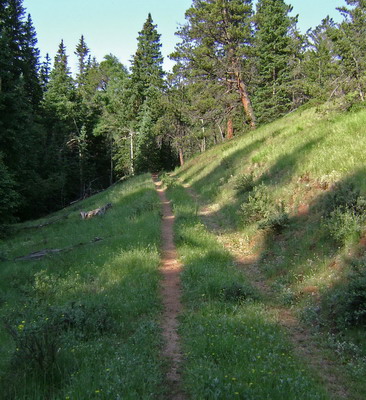
Singletrack led to forgotten double track
It was COLD as I climbed by the Crags campground (it was barely 9 o’clock). I almost pulled out my rain pants to keep my poor little knees warm, but the future promised much climbing, so I knew I’d warm up.
Fall line dirt road crested to awesome singletrack descending. One section was quite obviously freshly built:
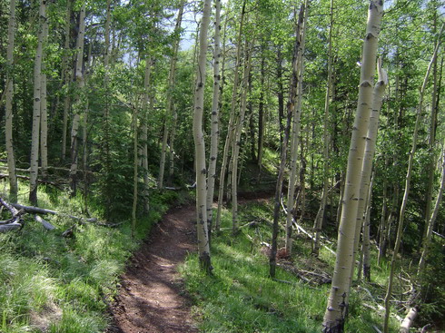
Great work by the Friends of the Peak! Much appreciated.
In Putney Gulch I stopped to filter water. I knew it was likely that the next valley would have water, but water running by your feet is worth six rivers supposedly flowing in the next valley.
I hoofed it up the next hill, which was a ride slash hike affair. The descent led to wonderfully flowing trail, hugging the fringes of Horsethief Park:
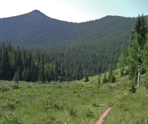
From here the RTP continues to Pancake Rocks, but it’s currently a dead-end. I turned down the meadow, got behind my seat, and hung on for the rip roaring ride down to highway 67. I bumped into several groups of hikers just starting out here, which was a shock since I’d seen no one on the trail thus far.
I saw plenty of people (cars) on Highway 67, making it by far the worst section of the ride. I actually couldn’t understand where all these people were going. Is Cripple Creek really that big?!
On a bike it went pretty fast, though, and I was soon being waved through the construction area on road 81 out of Gillett. That construction meant I was now on smooth-as-a-baby’s-butt tarmac. Combine that with gradual downhill, and these were by far the easiest miles of the loop.
More easy miles continued on railroad grade Gold Camp road. The scenery was out of this world, and once again my head was dancing around, not to mention my camera’s lens.
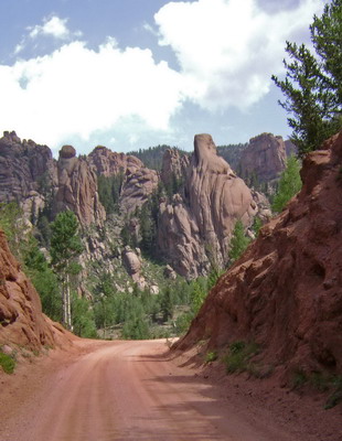
Rocks on Gold Camp Road

Railroad tunnel!
Gold Camp continues the slight downhill trend, and these should have been the second easiest miles of the ride. But it was here, about six hours into the ride, that I started falling apart.
I regretted every single hill I had let loose on, every time I’d let my heart rate skyrocket pushing my bike up some steep hill. I stopped at the intersection of Gold Camp and FR 379, convinced I was about to puke. Well, at least I now had some idea on the cause. I surmised the cliff shot I was carrying was old/expired. Indeed it’s been my ’emergency gu’ that has been carried around in my pack for some time without being used. For some reason it sounded appealing to me about an hour ago, so I ate it.
I hate the all-over-body feeling of fatigue you get with an upset stomach. I thought for sure I was done for, destined to a few hours of struggling back into town on Gold Camp. But it’s not over til it’s over. I took my first actual break, forced some tortilla chips down, and ate some candy.
It was at this point that I checked my map, curious as to how large of a climb I was now facing. Almost 2000 feet! Gulp. I thought it was MAYBE 1000 feet. It was not looking good.
The feeling passed in a few minutes, so I saddled up to keep making progress on the climb. Not five minutes up the STEEP road, I heard a frightening sound — rain drops on the surrounding greenery. Soon enough I felt them — large, but widely spaced. Uh oh!
This was the only part of the route that approached tree-line, and it was storming at 11 am. Perfect.
Making things worse, the roaring creek to my left was providing sufficient disguise for any distant thunder. I strained my ears, trying to hear over the creek, but I was pretty much riding into the unknown. I was ready to turn my bike 180 degrees at the first confirmed thunder clap.
That never came. What did come was some really good climbing. I had pushed right through the ‘low’ and was feeling great.
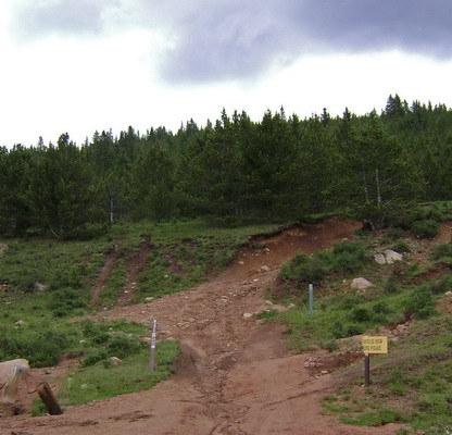
A RTP sign pointed me up a steep mess of a 4×4 road.
Nothing like a little hike-a-bike at 11,000+ feet get you fired up. It was actually quite fun, as approaching tree line always is. I got a better view of the clouds and though plenty were looking ominous, there were no signs of imminent doom, and still no thunder. I continued on, still desperate to get well below 11,000 feet.
Cows sat in the bogs of Elk Park (I must say I was surprised to see cows this high). I traversed around the shoulder of Alamgre Mountain, still climbing at a much higher elevation than I was comfortable with.
Then, finally, relief — a major descent to the fringes of Frosty Park. Now began the challenge of a different sort. Instead of physical strain and endurance, it was time to test my technical skills.
I still don’t quite understand the network of moto trails, but the Ring the Peak signs were clear, and the riding was off the charts fun and challenging. It was a real mix — sometimes terrible trail conditions, but hard to ride, other times some great flow AND good challenges. It definitely required a hefty investment of mental focus. I did dismount for a few sections, riding in conservative solo mode, and on my XC bike.
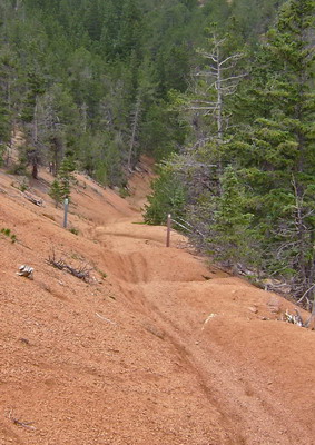
Jumps and more fun on the moto trails
Where the water starts running down the trail I ran into a guy on a motorcycle. He was kind enough to stop and ask how I was doing and where I’d been. I filtered some water low on Bear Creek, then resumed the never-ending descent towards Colorado Springs. I was amused by one section of deep gravel that forced some serious counter-steering to stay on the trail. Classic Pikes Peak decomposed granite, I guess. The whole Bear Creek Trail (closed to motos) was just a blast–I understand it’s recently been revived by the Friends of the Peak.
A final punishing climb remained on Palmer Trail — as if that downhill was really never-ending. Fortunately it was contoured well, but it still took a good chunk of energy. The descent was awesome! I had to adjust my brakes (pad wear?) to grab some more power. It was that steep and deliciously technical. By this point in the ride my mind was micro-adjusted to the feel and handling of my bike. I was in ‘the groove’ you might say. Riding that good, when everything just flows naturally, is really a gift.
Palmer/Section 16 dumped me off onto well known territory — the Intemann Trail. This trail is no piece of cake. It alternates between wonderfully contoured trail and steep fall line sections. But compared to the previous miles, it’s really no big deal. Knowing the nuances of the trail meant I knew where to expend my energy. More groove riding continued. The descent down to Crystal Park road disappeared beneath my wheels. It was effortless.
Here I was in Manitou Springs, with a pizza joint in view and a short, flat ride back to my house. But a final challenge remained. Due to an access issue on the Intemann Trail I now needed to climb up the cemetery and ride some more trail back to Ruxton. I was happy to do it, really, though I could tell the heat/humidity was taking a toll on me. One final hike-a-bike remained:
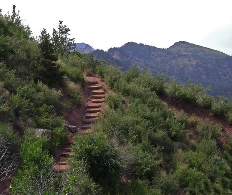
What a nutty little piece of trail. But once at the top, it was all coasting back home to the completion of the Ring the Peak.
68 miles, 10:40 total time, 12,000 feet of climbing
GPX file: Ring the Peak Trail – Mon Jul 09 2007.gpx
Definitely an epic, epic loop. It doled out heaps of suffering, but it was suffering of quality, and I wouldn’t have it any other way. Big thanks to everyone involved in the development and construction/maintenance of this awesome loop! Well done. Also thanks to Marshal for the trail ‘beta’ from a cyclist’s perspective. It’s always easier to follow than it is to lead.
Oh, and when the loop is finished (through Pancake Rocks and bypassing all that easy pavement/dirt road I took), it’s going to be tough to do it in a day. I look forward to taking that challenge someday.


Man Scott, what an epic! I amd impressed at what you find and the routes that you put together. I’d love to do that ride sometime myself.
Hey, great to see your knee came around and you got in the RTP ride. 10.40 is a impressive time for a 1st time around, what with all the pictures and a bit of bad Gu
Hey Scott – Enjoy your adventure ride across CO with MC this week.
This RTP ride looks awesome and may be a fall ride for me. Thanks for posting it up.
Let’s ride soon –
Ed
Thanks for an awesome trip report! I think I will take on the challeng this weekend—I’m pumped. Happy Riding!!
Laura A.
Ahhh, I sure miss Colorado and all it’s open spaces.I spent 3 1/2 yrs stationed at Ft Carson-it was like a vacation.Know that area well-thx for the memories.
So is this trail still open, just wondering as it is approaching 2 years since anyone has posted on it, and since the logical part of my left handed brain has kicked in, I have decided to work up to the ADT instead of going big all at once, maybe it would be smarter work up to it.
Great write up by the way.
Mezagog
Sounds like fun omw !!!
And yeah check out the website its still open
there is one section Trail Between Gillett and Forest Service Road 376
This section of trail is not complete. Friends of the Peak is currently negotiating with the Colorado Springs Utilities for a trail corridor throught the South Slope watershed.
Have fun!
hey i just wanted to say thanks for posting this. it helped spark the idea for riding it in my head. we talked about it for a few years and used your blog as a guide in some ways. the .gpx file was very helpful. it took us a little longer but we were on single speeds and did a fair amount of stopping. i posted a little thing about it here.
http://epicrides.wordpress.com/2009/07/20/ring-the-peak/
The section between Pancake Rocks and Forest Road 376 will be some of the most spectacular in the Ring. I have hiked some of the possibilities. Most of it will be new trail construction, that with the political challenges means it is still a long way off.
Eric Swab
Webmaster for the RTP web site.
Exceptionally beautiful pics! Surely, it was a very nice adventures of yours.
I love the “Beautiful morning light” pic but actually all. It encourages me into going some kind of adventure again!
Thanks for posting! So great!
[…] also highly recommend Scott Morris’ excellent blog post and beautiful GPS map of his […]
I did this ride last summer ended up sleeping on the backside overnight. My buddy bonked so we could not continue however we did finish the next day.Lots of hike a bike for this 46 year old.
But it was worth it.
[…] next photo is from Scott Morris’ blog to show the turn. After getting a little wet, the camera decided to stop working, so no more photos […]
Impressive time! We did this suffer-fest in July 2006 in 12hrs, I couldn’t imagine knocking 1:20 off of that! What a classic way to see all sides of Pikes Peak. I’m glad you took pics to bring back some memories since we were camera-less that day. Kudos!
http://www.jeffkunkle.com/Ring%20The%20Peak.htm
[…] when I hiked on the Pikes Peak South Slope. I remembered it as being steep and the GPS track from Scott Morris’ ride report also showed it as a steep […]