TopoFusion.com

Archive for the ‘Uncategorized’ Category

400 miles of Oregon Singletrack Bliss

Saturday, August 9th, 2008


The folks behind TopoFusion took a break from code monkeying (and from the Arizona heat) to tour the Cascades of Oregon.

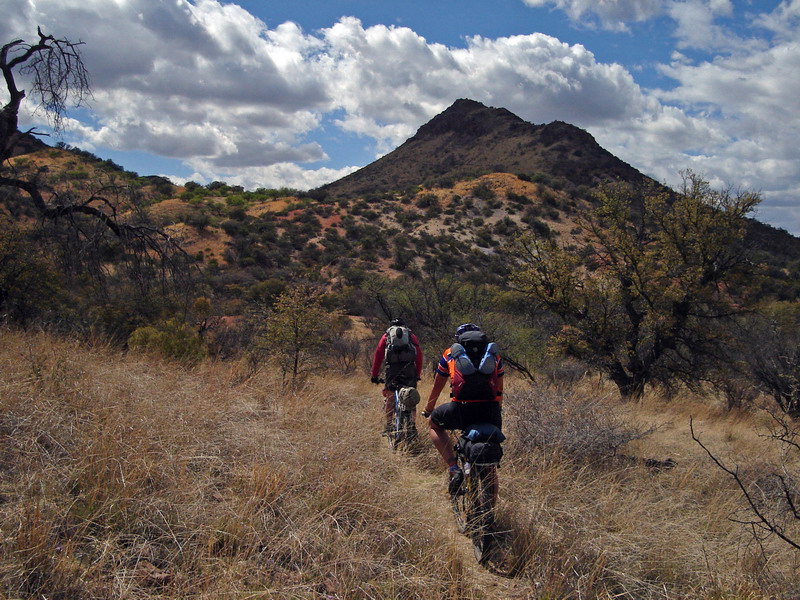
We’re self supported bikepacking fanatics, and this trip was one of the best yet. 400 miles of singletrack, including the three legendary river trails: North Umpqua, Mackenzie and the Middle Fork of the Willamette. Oregon has some wonderful trails, and they we very well suited to bikepacking!

It was a long trip, so the journal is quite long. But it’s chock full of some amazing photos.

In three chapters, read along as we eat candy bars for dinner, get swarmed by mosquitoes so thick they blocked the sun, break our most valuable repair tool (5mm allen wrench) and, of course, enjoy many an endless mile of sinuous, beautiful trail.

Oregon Singletrack Tour Chapter 1

Oregon Singletrack Tour Chapter 2


Oregon Singletrack Tour Chapter 3

Racing the Colorado Trail with TopoFusion

Friday, August 1st, 2008

The second annual Colorado Trail Race is underway right now. 23 mountain bikers lined up to race 530 miles of singletrack from Denver to Durango. This race is epic with a capital E!

Some of the racers are carrying SPOT tracking units, and there’s a leaderboard showing current positions. But the leaderboard is pretty static — we at TopoFusion knew we could do more.

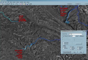
Using TopoFusion’s newly updated and revamped Multi-track playback feature, it’s possible to replay the race so far and watch it unfold, overlayed on any of the host of imagery supported by TopoFusion.

Check out the replay of the first four days of the race, hosted on vimeo:


Colorado Trail Race Replay, Days 1 – 4 from Scott Morris on Vimeo.

Here’s just the third and fourth days, this time overlayed on a topo map:


CTR Days 3-4 from Scott Morris on Vimeo.

Version 3.38 out – improved trail networks, arrows, multi-playback

Monday, July 7th, 2008


We’re pleased to announce the release of version 3.38 of TopoFusion Pro.

Released in both demo and registered versions, this new version offers a host of new features and improvements.

  • Multi-track playback is now much more exciting with the addition of “on screen” stats. Choose from an array of stats to display, per track, as the simulation rolls on. Some examples are: speed, elevation, grade, heart rate, power, file date.
  • Directional arrows – a new toggle on the tool bar controls whether small arrows are automatically drawn on GPS tracks, showing their direction. Very useful for producing maps but moreso, just understanding your GPS data!
  • GPS Networks – Major improvements in the network algorithm have been released in this version. The interface has been upgraded, a huge increase in network reduction speed, lower memory overhead and several bug fixes are just some of the improvements.
  • Live tracking – Improvements here include a special tracking mode for Garmin Astro users, periodic saving of the recorded track to disk and better NMEA GPS unit support.
  • User interface – Additional features like right click disambiguation, “highlight track in active list”, “send to GPS…”.

For full details on all changes, see the Revision History.

Follow Divide Racing — 2500 miles across the country

Saturday, June 21st, 2008

It’s June and the Great Divide Race is just now underway. The goal is to race 2500 miles, unsupported, across Adventure Cycling’s Great Divide Mountain Bike Route.

TopoFusion author Scott Morris participated in the race in 2005. He also toured the divide in 2004. That trip is chronicled on the TopoFusion Divide Pages. Pay attention to the GPS data there. It is still the definitive GPS track for the Divide route, at a staggering 140,000 points. The track was used to make the official divide elevation profiles now on the latest maps.

This year there are two versions of divide racing. TopoFusion’s GPS data was used for the .kml file highlighting the route on the SPOT leaderboard. Competitors in that race are carrying satellite trackers enabled with GPS devices, so the results are realtime.

Back on the original Great Divide Race, we’ll be once again maintaining the GDR leaderboard. This was a huge hit last year, and we’ll be keeping it up to date with the help of TopoFusion software.

Official links:

Great Divide Race
Tour Divide

Tour of the White Mountains race maps ready

Friday, June 13th, 2008

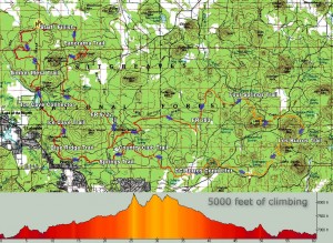
The 60 mile Tour Map

For years Epic Rides has been using TopoFusion to map all of its quality events. As the software has improved, so have the maps.

The latest batch of maps are ready to go, for this fall’s Tour of the White Mountains. This is a classic Arizona endurance event, featuring cool temperatures, pine trees and endless singletrack.

These maps show off a new feature of TopoFusion — automatic directional arrows. Currently available in the beta version, the arrows are highly configurable. Size, color, transparency and frequency are some of the options available. No more guessing which direction a track is going! And it’s essential for event mapping!

Head over to TopoFusion’s race/event sponsorship page to check out the maps.

Or go straight to The main Tour Page to sign up or for more info on the event.

Auto Trail Finding–Research using TopoFusion published in CVPR.

Thursday, May 8th, 2008


Results from three different trail finding algorithms

Finding roads in images is hard. Finding trails is even harder. But we’ve taken the first crack at it.

There’s a wealth of original research on extracting roads from aerial and satellite images. But no one has studied the more interesting problem — can we program a computer to find and follow narrow and twisty trails?

That has been the question of ongoing research for us, and the results have been accepted to 2008’s Computer Vision and Pattern Recognition conference. CVPR is one of the top vision conference, with competitive acceptance rates.

The answer is that we’ve made some progress and things look promising, but we are a ways off from an automatic trail extractor. Computer Vision, as a field, is a challenging one, and it’s often difficult to write software that can even approximate the recognition ability of the human vision system and brain. It makes it an exciting and rewarding area of study.

TopoFusion was used throughout the research effort. It provided the testbed, visualization and access to Terraserver’s database of aerial photos. We trained the model using aerial photographs from across the United States (using GPS data collected by Scott on his Great Divide Trip). Having access to this data proved quite handy, and improved the applicability of the techniques developed.

You can read the full 8-page paper here:

FindingTrails-cvpr08.pdf [PDF, 1.4 mb]

Win a free copy of TF – Write a ride report

Friday, May 2nd, 2008


At TopoFusion, we’re all about the ride.

Exploration, adventure, exercise… exhilaration.

TopoFusion author Scott Morris has been logging his rides on his diary since 2003. We love ride reports.

So we’re running a little promotion. Post a ride report in the new Trail Talk forum on or before May 16th, 2008. We’ll choose our favorite and the winner gets a free copy of TopoFusion. And everyone will get a 15% off coupon code just for posting.

Note: it doesn’t need to be a ride! Could be a hike, a run, a mountain climb, a 4×4 excursion, etc. Any adventure will do.

Details are on the forum..

Arizona Trail 300 starts April 18th

Monday, April 14th, 2008

azt300 map

The Arizona Trail 300 is a self-supported mountain bike race covering 300 miles of the Arizona Trail in southern Arizona. It’s pretty unique among today’s endurance events in that competitors are completely on their own during the ride. Things like outside support and caches are not allowed.

No other self-supported race provides competitors with an official GPS route to follow. This allows racers from out of state who are completely unfamiliar with the trails used to not only stay on course but be competitive.

You can download and check out the course in full detail by going to the AZT 300 GPS Page.

TopoFusion software was once again used to do all the GPS data crunching. This includes cutting, merging and cleaning up the data (2008’s course features more freshly built Arizona Trail). Finally, TopoFusion’s simplify and split features were used to make a ready-to-upload GPX file (a 20 track, 500 point file).

The race goes off April 18th, 2008 at 9am. TopoFusion author Scott Morris holds the course record at 2 days and 17 hours. With strong local and out-of-state riders expected to show (there is no registration, no fees, no race organization whatsoever) there is a good chance that someone will make a bid for the record.

Watch Scott’s diary for a race report after he’s had a few naps and consumed a few thousand recovery calories.

canelo

Even if you’re not able to get out for 300 miles, we hope you’re getting a chance to enjoy the beautiful spring weather. It’s a great time to be out on the bike.

Version 3.32 out – minor revision

Thursday, April 10th, 2008

We released a minor revision of TopoFusion Pro today.  It clears up a few issues that have arisen since V3.31 which is otherwise quite stable.

Details:

3.32 – [4/9/08] (Full Release)

Fixed power .CSV import for iBike exports (no torque info)
Fixed possible crash with “interpolate GPS at 1 sec intervals” function
Fixed min/max computation for grade (was setting cut-off based on average
uphill grade and average downhill grade)
Weakened grade and speed smoothing in profiler (smoothing options to come)
Fixed added waypoint fields in Lap Analysis (were always coming out as
“stopped time” style waypoints)
Changed Saved Tracks to display “No time” instead of “Dec 31, 1989”
Added distance field to CSV exports (for RaceDay software)

Version 3.31, Edge 705/605 support – Mapping power!

Friday, March 21st, 2008

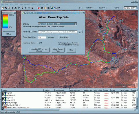
With the release of version 3.31, TopoFusion becomes the first mapping application to be power enabled. What does this mean? Well, first, TF supports the new Garmin Edge 605/705 units, which can store cycling wattage data with each GPS point (in new power enabled TCX format).

Don’t have a 705 yet? No problem, also in this version of TopoFusion an exclusive new feature – GPS and Power data syncing. Simply load up a GPX file for your ride and point TF to a .CSV (comma separated file) with your PowerTap data and TF will do the rest.

Once you have power data married with location (GPS) data, you can do things like: shade tracks by power, profile by power and look at average and max power over specific intervals.

For more information head over to this tutorial on Mapping Power in TopoFusion.

Power features aren’t the only new thing in TopoFusion Pro Version 3.31. We’re continuing to push the program further, so download the latest free/demo version here:

TopoFusion Download Page

Or, registered users refer to their registration email for download instructions. If you’ve lost the download URL or your name/code, you can request it here:

http://topofusion.com/lostcode.php