It can’t take us more than 3 hours to get to Argentine Pass, can it? We’ll have plenty of time to beat the storms.
For being a map guy, I sure didn’t check the maps. I assumed it would be a hair over 12,000 feet. Why? I’m not sure.
Eszter knew better. The top is 13,200′, dwarfing everything we’ve ridden so far other than Coney Summit back by the yurt. That trail is a lot more rideable too.
We tried to get up as early as we could and hit the trail (bike path out of Dillon). It had been a bit of a junkshow evening in Summit County, so it was hard to get up and get motivated, but we had to.
After the gumbo mud and waiting out the drizzles, I managed to leave my phone at the apartment building stairwell. I knew it was going to happen at some point on this trip. The resident of the apartment we were huddled by came home just as the rain let up, so we left in a hurry and didn’t do the usual idiot check.
I didn’t realize it until we were in Summit Cove, at Dan’s pizza place. Luckily he let me borrow a car to go fetch it — no small distance away. From there we got a few slices of pizza (whew Dan was busy!) and then started to try to find his house in Dillon. There are bike paths all over Summit County, but they are anything but intuitive. There are no maps, and if you don’t know the area, or where you are going, it can be pretty frustrating as they climb and descend around. I remember struggling to follow the paths here, backwards on the GDMBR touring 10 years ago. It’s not a good place to be a non-local bike tourist. We did eventually find his place in the dark and got to bed late after chatting some about Montezuma’s revenge, crazy cool ideas of riding up by the I70 tunnel and CTRs/Coconinos past. It was great to have a roof over our heads, thanks Dan!
We retraced our bike path steps, this time with the aid of daylight. The goal was Peru Creek, which is the CDT, and then the trail to Argentine Pass.
We rolled past Keystone looking for our enduro friends (race this weekend) but didn’t see any sign of big bikes or team vans. They must have all been still asleep.
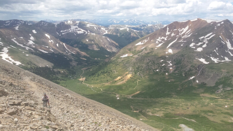
We hopped across the flooded out creek, heading to Peru Creek to climb into the Horseshoe Basin. Some of the mine buildings were impressively decaying — looked like a sneeze would knock them over.
We looked for footprints, but it seems most CDT hikers take a totally different route, skipping Ten Mile, Georgia Pass and Argentine, despite it being ‘official’ CDT. It’s a choose your own adventure type of trail!
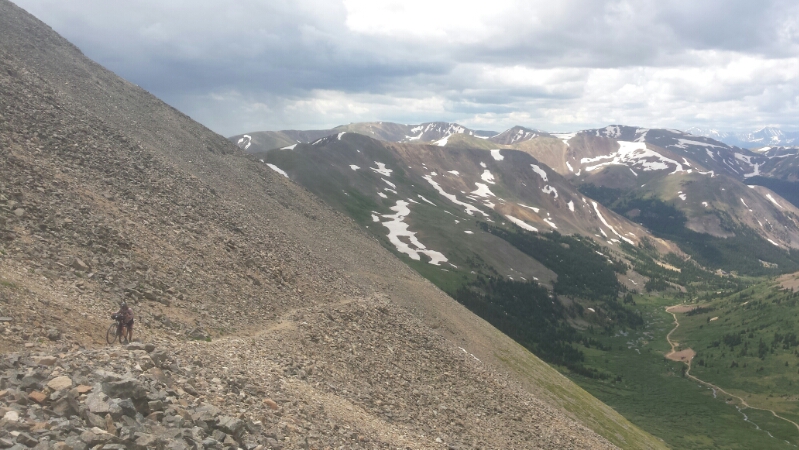
Looking up towards the divide, it became pretty clear my 12000 foot assumption was way off. We could see a trail cutting across, but even Eszter didn’t think it could be us.
But it was. An old mining road that has deteriorated into a trail. We expected to push the entire thing.
But parts were rideable! Wahoo. Views of the basin and of Gray’s Peak were out of this world. Clouds were building, but not looking too bad yet.
A snowfield with only one set of footprints across looked a serious enough obstable to try to bypass. I think it was a smart choice, with bikes that don’t dig in like feet, but it cost us 20 or 25 minutes of hard effort.
“Oh, that’s not good,” I muttered between breaths.
“What?” Eszter asked while turning around.
“Oh. Let’s keep moving.”
Double time. Dark clouds behind us, gaining lots and lots of energy. Still plenty of climbing to go.
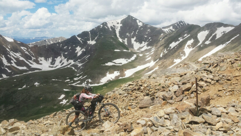
I rode on ahead, stopping to return heart rate to non-atmospheric levels, and pushing too. A short rock fall required handing bikes up. The top couldn’t come too soon.
Sunlight still graced us at the top. We didn’t linger, which was sad. No CDT signs up here. No signs at all. Several columns of rain strafed the valleys below us, on the east side of the divide.
The 4000+ foot drop to Georgetown was almost purely downhill. The top was incredibly abusive, having not recovered from all the bike pushing and hard effort on the other side. Eventually the road mellowed out, into the trees, becoming a fun slalom between rocks.
As we sat at Ed’s Cafe in town in started pouring. Impeccable timing!
The next stretch of trail goes above 13000 feet again, and follows the divide for some miles. Given the state of the atmosphere, and the energy available in our legs and bodies, we opted for a motel room and a little rest. Early start tomorrow and more high altitude divide riding! Yes!


Somehow reassuring that I’m not the only one that does stuff like that with my cell phone. Nothing like a little lightning to increase motivation!
185mm cranks glissade better.