TopoFusion support forums

TopoFusion Support => TopoFusion Pro => Topic started by: chuckt on December 27, 2008, 05:12:28 PM

Title: Color Aerials
Post by: chuckt on December 27, 2008, 05:12:28 PM
I'm getting some strange results with the color aerials. Everything is tinted red, I don't think this is what you meant by "color". The image is from Austin, TX.

Title: Color Aerials
Post by: ScottMorris on December 27, 2008, 07:35:20 PM
Unfortunately that's just how they are for Texas (and PA, too).

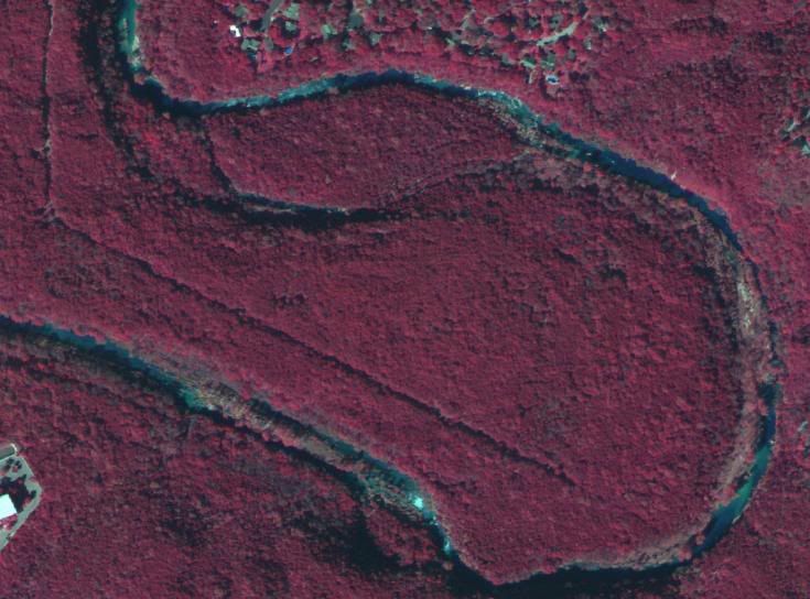
Check the coverage map here:

http://topofusion.com/color-coverage.php

You can see that those two states are red (no idea why).  Everywhere else is normal color.
Title: Color Aerials
Post by: chuckt on December 27, 2008, 07:45:31 PM
??? ... :( ... :angry:
Title: Color Aerials
Post by: ScottMorris on December 27, 2008, 08:05:15 PM
Yup.

Perhaps someone should inquire at your state gov't as to why they'd like to think they live on Mars.

 ???
Title: Re: Color Aerials
Post by: BobBailey on April 13, 2009, 07:03:22 PM
Republicans in TX, no idea about PA.
Title: Re: Color Aerials
Post by: sprock on April 20, 2009, 07:26:44 PM
Just to end the confusion, these "color" aerial photographs are infrared aerial photographs. Below is a short description copied from here. (http://www.colorado.edu/geography/gcraft/notes/remote/remote_f.html)  My guess is these states probably haven't re-flown the state with newer photography yet.

The primary use of color infrared photography is vegetation studies. This is because healthy green vegetation is a very strong reflector of infrared radiation and appears bright red on color infrared photographs.