Author Topic: v3.55 Beta out  (Read 6855 times)

ScottMorris

  • Administrator
  • Sr. Member
  • *****
  • Posts: 2756
  • TopoFusion Author
    • View Profile
    • http://www.topofusion.com/diary
v3.55 Beta out
« on: November 07, 2008, 09:13:04 AM »
I'm pretty excited about this release of TopoFusion.  I dug deep into the internals of TF and extended the map caching / tiling engine to work with any number of custom WMS servers.

WMS is an open server format, and more and more free servers are popping up these days.  The latest two additions to TF -- Australian and Canadian Topo maps -- were both WMS servers.

Now TF can auto-download high resolution color aerials from Arizona, Utah, Oregon and New Mexico.  As many of you know, I live in Arizona, so I'm pretty psyched about the AZ images, which are stunningly beautiful and in many cases better than Google Earth:


Google Earth
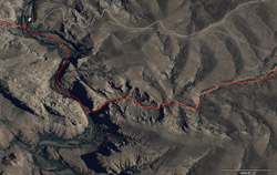


TopoFusion


No patchwork effect either -- it's a very consistent dataset.

One thing to note is that these new servers are not as fast as Terraserver and OnEarth -- expect some delays and perhaps a "error connecting" message every now and again.  The great thing about TF, though, is that once you have a map, you always have it.

We need more servers!

I looked around and found the ones in the Western US, and I'm still working on more.  But I know there are other servers out there.  If you know of a WMS server or want to have a look around, we would be glad to help you get it working in TF.  Just let us know!

For more details on adding WMS servers head to:

http://topofusion.com/wms.php

Complete list of changes:

3.55 - [11/07/08] (Beta)                                                                                                          
                                                                                                                                  
Added new imagery servers:                                                                                                        
 * Arizona statewide color aerials (1 meter resolution)                                                                            
 * New Mexico statewide color aerials (1 meter resolution)                                                                        
 * Oregon statewide color aerials (<1 meter resolution)                                                                            
 * Utah statewide color aerials (1 meter resolution)                                                                              
 * Mexico countrywide BW aerials (~1 meter resolution)                                                                            
Added Custom WMS server support!                                                                                                  
 * Any WMS server can be added, provided output is EPSG:4326                                                                      
 * Custom tilesets are added - full range of resolution                                                                            
 * All downloaded maps permanently stored in on-disk cache                                                                        
 * Details at:  http://topofusion.com/wms.php                                                                                      
Added checkbox to disable "blue sphere" at position in 3D mode                                                                    
Added "number of sats" and error estimate displays to live tracking (NMEA only)                                                    
Improved robustness of NMEA live tracking, preventing bad/invalid fixes                                                            
Fixed problem (TF closing) when loading certain JPEGS as User Maps                                                                
Fixed problem where tracks named "ACTIVE LOG" always went into the active log,                                                    
even if the "to saved tracks" option was selected.                                                                                
Fixed problem with persistent HTTP connections to the wrong server                                                                
Added "Help" button to User Map dialog                                                                                            
Added confirmation dialog when removing a User Map (Are you sure?)
Scott Morris - founder and co-author of TopoFusion
email: smorris@topofusion.com

Larry

  • Sr. Member
  • ****
  • Posts: 157
    • View Profile
v3.55 Beta out
« Reply #1 on: November 08, 2008, 09:15:24 AM »
Hey Scott,

The bike trip must have really refreshed and inspired you. The beta works great (as far as I have tested it) on my machine. I really like the ability to turn off the little blue ball, in particular because just now I'm preparing a 3D view of a weekly snowshoe walk lead by FS personnel here. I'm exporting a 4000 x 3000 images and editing them in Photoshop. No sweat. Now no distracting blue ball. I notice that you now have full color coverage for Oregon. Any possibilities for Washington? ':blues:'

Larry

KenF

  • Sr. Member
  • ****
  • Posts: 137
    • View Profile
v3.55 Beta out
« Reply #2 on: November 08, 2008, 10:01:36 AM »
Quote (ScottMorris @ Nov. 07 2008,10:13)
Now TF can auto-download high resolution color aerials from Arizona, Utah, Oregon and New Mexico.  As many of you know, I live in Arizona, so I'm pretty psyched about the AZ images, which are stunningly beautiful and in many cases better than Google Earth:


Wow! The color aerials are absolutely great!
Now if they just included Colorado ....

ScottMorris

  • Administrator
  • Sr. Member
  • *****
  • Posts: 2756
  • TopoFusion Author
    • View Profile
    • http://www.topofusion.com/diary
v3.55 Beta out
« Reply #3 on: November 08, 2008, 11:38:21 AM »
I hear ya.  I have looked into a few options for Colorado, but none have completely panned out, as of yet.

Working on it.

Haven't looked for Washington, yet, Larry, but would be happy to add it too.
Scott Morris - founder and co-author of TopoFusion
email: smorris@topofusion.com

ScottMorris

  • Administrator
  • Sr. Member
  • *****
  • Posts: 2756
  • TopoFusion Author
    • View Profile
    • http://www.topofusion.com/diary
v3.55 Beta out
« Reply #4 on: November 08, 2008, 07:30:47 PM »
Did somebody say Colorado?


3D shot with new color aerials, looking at Copper Mtn (Searle, Kokomo, etc), with the Colorado Trail GPS track loaded.  

No promises yet, but it looks like we'll have the following states in the next release:

CA,NV,OR,ID,MT,UT,CO,ND,SD,NE,OK,SD,TX,WY,IA,KS,LA,MI,MN,TN,WI,AL,IN,KY,LA,NC,OH,NC,NY,CT,
VA,SC,PA,MA,RI,NH
Scott Morris - founder and co-author of TopoFusion
email: smorris@topofusion.com