TopoFusion.com

Archive for the ‘Uncategorized’ Category

New version 5.46 – SSL and simplification

Friday, August 11th, 2017

Got a new version out that fixes a bug that has been quite mysterious. If anyone out there has done much multi-threaded programming, you know how random certain problems can be. In this case I could not reproduce the problem on my main development machine no matter how hard I tried, and despite near daily use of the software (Yes, I am still the primary user of TopoFusion — use it all the time).

Finally, it started occurring, for unknown reasons, while using the WiFi at the Salida Public Library. From there, the game was afoot!

The error cropped up with an “SSL refcount error” then oftentimes a crash in the Downloader Thread. Turns out the documentation on the OpenSSL library is pretty lacking, but I believe the bug is vanquished! Cheers! Applause!

Also restored in this version are OpenTopoMaps, Juicy Trails and Open Cycle Maps.

I’ve finally given up on MSRMaps.com (formerly Terraserver) coming back online. That was the server that got TopoFusion off the ground, but it seems at last to be dead. RIP Terraserver, thanks for all the many maps and adventures!

As a result, the software has been simplified to remove those tilesets so as to not cause confusion to new users. If you have a bunch of those maps cached, they’ll still work, but you may need to enable by editing the TopoFusion.ini file and changing UseMSRMaps=0 to UseMSRMaps=1

Update your TF and check out the new version (full list of changes below), or if you are new to TopoFusion, go ahead and try the demo. And as always, let us know what you think, especially if you have a suggestion for a new feature or different way the software should work.

Thanks!

Team TopoFusion
Scott Morris
Version compiled and distributed from the mountains of Colorado, at near 10,000 feet.


Head over to the Download Page to try TopoFusion out, free of charge.

Registered users refer to your registration email for the download link, or go here to request your code and the download URL.

Full list of changes

For a complete list of changes see the Revision History, or keep reading here for what has changed since the last public release:

5.46 – 8/11/17

Fixed SSL refcount error

5.45 – 7/25/17

Further work on SSL refcount error
Further work on SSL through proxy server

5.44 – 7/16/17

Added API key for Open Cycle Map tiles (removing watermark)
Added support for “Basic” type authenticated proxy servers
Fixed ‘divide by zero’ in mercator tilesets when at extreme latitudes
Improved error checking for lat/lon ‘Goto-coordinate’
Added “Toggle Downloading” to the Toggles menu
Restored access to Juicy Trails maps
Changed Tileset dropdown to always be in ‘simple’ mode (removing 0.003, 0.062
numbered tilesets), for easier use.
Increased precision of track distance, in File Properties dialog only.
Removed menu options and tileset dropdown for old style Topo/BW Aerial maps
MSRMaps.com continues to be offline, does not seem to be coming back
To enable on legacy copies of TopoFusion, edit TopoFusion.ini file and change
UseMSRMaps=0 to UseMSRMaps=1

5.43 – 4/17/17

Fixed elevation download (server now requires HTTPS)
Fixed waypoint symbols in KML files with spaces

5.42 – 3/27/17

Added waypoint icons (all 96 suported in TopoFusion’s GPX format) to KML
exports. Icons now import to google maps, for example.
Added quicker reporting of Open Aerial/Mapquest over quota download errors
Improved prompts for Open Aerial/Mapquest over quota error

5.41 – 3/10/17

USGS Imagery restored (now using HTTPS)

5.40 – 1/24/17

Public release of previous betas
New 2017 Splash Screens

5.39 – 1/15/2017

Added ability to read SSL-encrypted (secure) tiles
Restored access to the following tilesets: US Topo, Color, Open Topo Maps (which
now works worldwide), also ‘7’ key.
Changed ‘isMoving’ to include missing time stamps and negative times, for
better consitency in files that have bad time data (e.g. merged files)
PhotoFusion thumbnails now scale up with “Export View” exports, using the
“Scale fonts/etc” option.

Version 5.43 – Elevation download restored, USGS Imagery

Monday, April 17th, 2017


3D view of the Grand Canyon, South Rim

We’ve output a quick revision to the software, in response to some server changes. Elevation data is a key component of TopoFusion — for 3D views, shaded relief, adding to tracks, trail grade computation. The server requires the use of HTTPS now, which we added in the previous release. This release restores access to Elevation and the USGS imagery tiles.

So if you’ve been having issues downloading maps lately (getting “TopoFusion is having trouble…” messages), please update to the latest version. Also a reminder that you can get more reliable access to Mapquest based tiles (such as Open Aerial, Mapquest Street) by getting your own (free) map API key so you can download 15,000 tiles per month. We are still seeing outages on this every month on the default key. You can get a key here http://tinyurl.com/gvcuqg8 And the key is added in (Options->Preferences->Tiles->Mapquest API Key).

This version also adds some waypoint symbol exporting features for KMLs. Waypoint symbols that show up in TF now work when opened in google maps, google earth, etc.

Update your TF and check out the new version (full list of changes below), or if you are new to TopoFusion, go ahead and try the demo. And as always, let us know what you think, especially if you have a suggestion for a new feature or different way the software should work.

Thanks!

Team TopoFusion
Scott Morris
Version compiled and distributed from the South Rim of the Grand Canyon, a place where elevation data and 3D are essential, or at least more fun.


Head over to the Download Page to try TopoFusion out, free of charge.

Registered users refer to your registration email for the download link, or go here to request your code and the download URL.

Full list of changes

For a complete list of changes see the Revision History, or keep reading here for what has changed since the last public release:

5.43 – 4/17/17

Fixed elevation download (server now requires HTTPS)
Fixed waypoint symbols in KML files with spaces

5.42 – 3/27/17

Added waypoint icons (all 96 suported in TopoFusion’s GPX format) to KML
exports. Icons now import to google maps, for example.
Added quicker reporting of Open Aerial/Mapquest over quota download errors
Improved prompts for Open Aerial/Mapquest over quota error

5.41 – 3/10/17

USGS Imagery restored (now using HTTPS)

5.40 – 1/24/17

Public release of previous betas
New 2017 Splash Screens

5.39 – 1/15/2017

Added ability to read SSL-encrypted (secure) tiles
Restored access to the following tilesets: US Topo, Color, Open Topo Maps (which
now works worldwide), also ‘7’ key.
Changed ‘isMoving’ to include missing time stamps and negative times, for
better consitency in files that have bad time data (e.g. merged files)
PhotoFusion thumbnails now scale up with “Export View” exports, using the
“Scale fonts/etc” option.

5.32 – 10/15/2016

Added prompts in ‘download disabled’ dialog about Mapquest tiles and API key
Switched Find->Search to separate API key, due to continued usage of tile key

5.31 – 9/12/2016

Added ability to add Mapquest API key (Options->Preferences->Tiles->Mapquest API
Key) , so users can have their own 15,000 tile allocation of tiles. Sign up
for a key at: http://tinyurl.com/gvcuqg8
Removed Topo/Aerial/Urban from KMZ export, due to server being down indefinitely
Fixed issue with Lat/Lon grid in datums other than WGS84
Changed PhotoFusion HTML export to use USTopo and Color tilesets instead of
deprecated Topo/Aerial

5.30 – 7/17/2016

Restored access to Mapquest’s Open Aerial and Street tilesets

5.26 – 7/2/2016

Fixed additional issues with waypoints coming up in right click when not near
Fixed zero length segments (tracks within a file) in new Tracks area of File
Properties

Version 5.40 – Added security, tilesets restored

Wednesday, January 25th, 2017


New 2017 Splash Screen – Manipouri Lake, Fjordlands National Park, New Zealand

The latest revision of TopoFusion, version 5.40, has been released. We added support for secure tiles and secure transfer to/from map servers. Several servers are now requiring https in order to transfer tiles, and it also means that third parties cannot snoop on what you are doing.

As a consequence, several map servers that have not been working in TopoFusion for the last month or so (while TopoFusion author Scott Morris was away in New Zealand, see pic above), have been restored. This includes US Topo, Color, and Open Topo Maps. The latter, we should mention, has been expanded to worldwide coverage and has some nice tiles (previously it only covered Europe).

So if you’ve been having issues downloading maps lately, please update to the latest version. Also a reminder that to get more reliable access to Mapquest based tiles (such as Open Aerial, Mapquest Street) we recommend getting your own (free) map API key so you can download 15,000 tiles per month. We are still seeing outages on this every month on the default key. You can get a key here http://tinyurl.com/gvcuqg8 And the key is added in (Options->Preferences->Tiles->Mapquest API Key).

Update your TF and check out the new version (full list of changes below), or if you are new to TopoFusion, go ahead and try the demo. And as always, let us know what you think, especially if you have a suggestion for a new feature or different way the software should work.

Thanks!

Team TopoFusion


Head over to the Download Page to try TopoFusion out, free of charge.

Registered users refer to your registration email for the download link, or go here to request your code and the download URL.

Full list of changes

For a complete list of changes see the Revision History, or keep reading here for what has changed since the last public release:

5.40 – 1/24/17

Public release of previous betas
New 2017 Splash Screens

5.39 – 1/15/2017

Added ability to read SSL-encrypted (secure) tiles
Restored access to the following tilesets: US Topo, Color, Open Topo Maps (which
now works worldwide), also ‘7’ key.
Changed ‘isMoving’ to include missing time stamps and negative times, for
better consitency in files that have bad time data (e.g. merged files)
PhotoFusion thumbnails now scale up with “Export View” exports, using the
“Scale fonts/etc” option.

5.32 – 10/15/2016

Added prompts in ‘download disabled’ dialog about Mapquest tiles and API key
Switched Find->Search to separate API key, due to continued usage of tile key

5.31 – 9/12/2016

Added ability to add Mapquest API key (Options->Preferences->Tiles->Mapquest API
Key) , so users can have their own 15,000 tile allocation of tiles. Sign up
for a key at: http://tinyurl.com/gvcuqg8
Removed Topo/Aerial/Urban from KMZ export, due to server being down indefinitely
Fixed issue with Lat/Lon grid in datums other than WGS84
Changed PhotoFusion HTML export to use USTopo and Color tilesets instead of
deprecated Topo/Aerial

5.30 – 7/17/2016

Restored access to Mapquest’s Open Aerial and Street tilesets

5.26 – 7/2/2016

Fixed additional issues with waypoints coming up in right click when not near
Fixed zero length segments (tracks within a file) in new Tracks area of File
Properties

5.25 – 5/27/2016

Added a Tracks area in File Properties, giving a list of tracks within the file
Double click to zoom map to a track. Right click to fill the table with
points and for other options (delete, edit track properties).
Added Smooth Elevation data (filter) button to Climbing Analysis (and File
Properties dialog). Button applies a box filter of width 5 to the data for
each press.
Changed global elevation gain algorithm to include a box filter of width 5.
This affects the profile tool and elevation gain stats in active file list.
The change was made to help give more realistic climbing numbers.
Added shortcut key for opening/closing the active file list – Spacebar
Fixed issue with cursor changing to magnifying glass with certain files loaded
Fixed issue with waypoints always coming up in right click with certain files
Improved response of Climbing Analysis when missing DEM tiles or with
downloading disabled
Changed “Training Center” preset to “Strava/Garmin Connect”
Fixed individual point NO_TIME loading .KML files without time
When saving, filled element in GPX with name of file, if file only has
one track

v5.30 – Mapquest restored, Tracks dialog, smoothing

Sunday, July 17th, 2016


tracksdialog

We’ve released version 5.30 of the software, featuring a number of enhancements to both the Pro and Basic version. A few days ago Mapquest started requiring an API for use of their mapping services. Previous versions of the software started showing an error tile. This update restores access to the Open Aerial and Mapquest OSM layers.

The ‘file properties’ dialog has seen a revamp, such that individual tracks within a file are now listed, and can be deleted, highlighted and drilled down into. (See dialog above). This has been a weakness of the software before. It should be easier to work with files containing multiple tracks now.

Some improvements to the elevation functions have been added. There’s a ‘smooth elevation’ function in Climbing Analysis and File Properties. This is useful for noisy data, processing with a box filter of width 5.

Speaking of box filters, the default climbing algorithm used in TF now employs a filter. This is something that is long overdue for being dealt with. Now that most people collect data at 1 point per second (or greater!) the possibility for error in computing climbing numbers has risen since the humble release of the software some 14 years ago. We changed to include some basic filtering by default, to bring our numbers more in line with popular ‘apps’ like Strava and Garmin Connect. Climbing Analysis is still there and has received a bit of an update, as well. It’s still a great place to look at different ways of computing that all important number — how much vert did I log?

Lots of other small fixes — we definitely recommend updating!

Update your TF and check out the new version (full list of changes below), or if you are new to TopoFusion, go ahead and try the demo. And as always, let us know what you think, especially if you have a suggestion for a new feature or different way the software should work.

Thanks!

Team TopoFusion


Head over to the Download Page to try TopoFusion out, free of charge.

Registered users refer to your registration email for the download link, or go here to request your code and the download URL.

Full list of changes

For a complete list of changes see the Revision History, or keep reading here for what has changed since the last public release:

5.30 – 7/17/2016

Restored access to Mapquest’s Open Aerial and Street tilesets

5.26 – 7/2/2016

Fixed additional issues with waypoints coming up in right click when not near
Fixed zero length segments (tracks within a file) in new Tracks area of File
Properties

5.25 – 5/27/2016

Added a Tracks area in File Properties, giving a list of tracks within the file
Double click to zoom map to a track. Right click to fill the table with
points and for other options (delete, edit track properties).
Added Smooth Elevation data (filter) button to Climbing Analysis (and File
Properties dialog). Button applies a box filter of width 5 to the data for
each press.
Changed global elevation gain algorithm to include a box filter of width 5.
This affects the profile tool and elevation gain stats in active file list.
The change was made to help give more realistic climbing numbers.
Added shortcut key for opening/closing the active file list – Spacebar
Fixed issue with cursor changing to magnifying glass with certain files loaded
Fixed issue with waypoints always coming up in right click with certain files
Improved response of Climbing Analysis when missing DEM tiles or with
downloading disabled
Changed “Training Center” preset to “Strava/Garmin Connect”
Fixed individual point NO_TIME loading .KML files without time
When saving, filled element in GPX with name of file, if file only has
one track

5.20 released – Instantaneous grade, Juicy Trails

Monday, February 8th, 2016


2016 Pro splash screen – Alexis Ault, bikepacking near Castle Peak, Idaho. Sadly now closed to bikes due to Wilderness designation

We’ve put the final touches on version 5.20 of the software. We had a nice suggestion from a user that works in trail design — how about a way to quickly measure grade (steepness) while drawing out a track? Brilliant idea — why didn’t we come up with it earlier?

TopoFusion author Scott Morris just spent a couple weeks doing a trail design / survey on a re-route of the Arizona National Scenic Trail, outside of the town of Kelvin. Measuring grade and not exceeding tolerances (like 10%!) is key to designing and building sustainable trail.

Even after many years of use, the software still continues to get a little bit better with age. Thanks to everyone that has used the software over the years, and especially those that have offered their feedback.

In this release we’ve also brought back the Juicy Trails tileset, fixed some simplifying/splining issues and added a clarification for the MSRtopo maps (old style Topo 4M, etc). We still believe that server will continue to be up, but it’s proving quite unreliable these days. So it is really better to move toward using MyTopo instead.

Update your TF and check out the new version (full list of changes below), or if you are new to TopoFusion, go ahead and try the demo. And as always, let us know what you think, especially if you have a suggestion for a new feature or different way the software should work.

Thanks!

Team TopoFusion


Head over to the Download Page to try TopoFusion out, free of charge.

Registered users refer to your registration email for the download link, or go here to request your code and the download URL.

Full list of changes

For a complete list of changes see the Revision History, or keep reading here for what has changed since the last public release:

5.20 – [2/08/16]

Added instantaneous Grade display to track drawing
New 2016 Splash Screens
Fixed potential crashes with splining and simplifying, especially multiple times
In a session
Fixed access to Juicy Trails tileset
Clarified text on spline dialog
Added text to Download Disabled dialog when using MSRmaps tiles (server
Continues to work intermittently)

v5.13 Out – Address search, menu rework, many fixes

Saturday, September 26th, 2015


TF’s address search

Version 5.13 of the software is now out. We’ve brought back the mapquest/nominatim address search function. A week or so ago it was disabled since mapquest now requires an API key to use it. Every version 5.13+ of TopoFusion will now work with our API key.

The Map menu has be reconfigured to be more intuitive — it’s grouped by map type. Thanks to TF user Wayne for the excellent suggestion on that one.

We’ve also fixed a couple of long standing and very difficult bugs — one is a persistent one that affects crashes on startup. We’ve counseled lots of folks over the years to use the “Reset TF to default settings” option in the Start Menu in order to get their copy of TF to be able to start up. That should not be needed nearly as much now!

Another is in saving out the ‘live track’ in Live Tracking. We believe intermittent (and system-dependent) issues should now be a thing of the past. Thanks to the several users that helped us debug that one.

There’s a new button in the Download Tracks dialog that helps you determine if you’ve already downloaded a day’s ride/run/hike/drive/whatever — it’ll highlight files that are not in your logbook — meaning you haven’t downloaded it yet.

In other news,msrmaps.com, the old Terraserver, has been serving up maps again. The server can be a little finicky yet, but maps are coming down.

Update your TF and check out the new version (full list of changes below), or if you are new to TopoFusion, go ahead and try the demo. And as always, let us know what you think, especially if you have a suggestion for a new feature or different way the software should work.

Thanks!

Team TopoFusion


Head over to the Download Page to try TopoFusion out, free of charge.

Registered users refer to your registration email for the download link, or go here to request your code and the download URL.

Full list of changes

For a complete list of changes see the Revision History, or keep reading here for what has changed since the last public release:

5.13 – [9/26/15]

Reworked ‘Map’ menu to be more intuitive and grouped by map type
Created ‘Toggle’ menu, with toggles originally in Map menu
Set ‘US Topo’ minimum zoom to 15, while server continues to give 503 errors
Added ‘Highlight files missing from Logbook’ function to download tracks dialog
Fixed crash issues in Live Tracking when saving out live track to GPX
Fixed issue with uploaded tracks not showing up on newer Garmin units (due to
being stored as not in GPX). (e.g. files from 14ers.com)
Fixed Address Search function (due to Mapquest requiring API key)
Fixed issues with startup crashes due to invalid starting UTM position
Fixed issues with crash reporter
Removed Trackleaders SPOT replay function – replays available direct at
Trackleaders.com

v5.11 Released – OpenTopoMaps and more topo fixes

Friday, July 3rd, 2015


v5.11 new 2015 splash screen

We’ve released version 5.11 of our software — both the Pro and Basic versions. This mostly improves on a number of areas in the software. Notably, it fixes access to my-Topo tiles, and adds a new European topo map tileset, courtesy of OpenTopoMap.org. We’ve made things a little faster, added support for Fenix units, fixed a long-standing and seemingly un-squishable bug in the insert points command, among other things.

We are still seeing issues with msrmaps.com, the old Terraserver, which has been returning a 503 (service unavailable) error for the last week. We do expect that server to return to working order, but it appears to be an extended downtime right now.

Update your TF and check out the new version (full list of changes below), or if you are new to TopoFusion, go ahead and try the demo. And as always, let us know what you think, especially if you have a suggestion for a new feature or different way the software should work.

Thanks!

Team TopoFusion


Head over to the Download Page to try TopoFusion out, free of charge.

Registered users refer to your registration email for the download link, or go here to request your code and the download URL.

Full list of changes

For a complete list of changes see the Revision History, or keep reading here for what has changed since the last public release:

5.11 – [7/03/15]

Added new European topo maps (OpenTopoMap.org)
Fixed access to my-Topo server
Added support for gpxx:DisplayColor attribute in GPX files
Improved memory usage for files with large number of waypoints
Added support for KMZ exports from google maps ‘engine’ (.kmz without doc.kml)
Improved speed (clipping) for selection and manipulation of large files
Added download support for Garmin Fenix units (.fit format)
Fixed Insert point not always inserting points (after deleting points)
Fixed Canadian Topos access string (2 insignificant layers removed)
Fixed reading missing elevations in .FIT files
Fixed access for GM tiles
Removed reporting of elevations below -200m
Fixed bug loading .kml files with more than 100 track segments

v5.06 – Post-CDT Revisions

Monday, October 20th, 2014


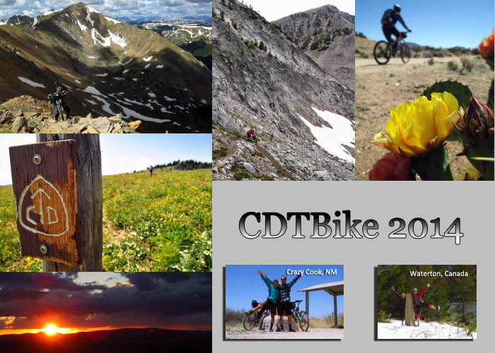
author Scott Morris, thru-rode the CDT, summer 2014

TopoFusion author Scott Morris is back from the trail, after a 4+ month break from the computer. He spent the summer cycling and hiking the Continental Divide National Scenic Trail (CDNST) along with his partner Eszter Horanyi. It’s believed they are the first people to traverse the trail from end to end by mountain bike.

Scott is back on the computer now and a new version of TopoFusion is out, version 5.06. This revision updates a number of server access methods, so if you are getting lots of stuck ‘downloading’ tiles, it’s time to update! It also fixes a number of bugs, including one that has been longstanding and difficult to squash. See below for full revision details.

To read more about “CDTBike” — traversing the CDT by bike, head over to Scott’s CDT 2014 Journal for full journal entries, tons of photos, and of course, some GPX data.

Thanks!

Team TopoFusion


Head over to the Download Page to try TopoFusion out, free of charge.

Registered users refer to your registration email for the download link, or go here to request your code and the download URL.

Full list of changes

For a complete list of changes see the Revision History, or keep reading here for what has changed since the last public release:

5.06 – [10/20/14] (Full Release)

Fixed “Access Violation in Paint” bug when dealing with bad server tiles
-Possible source of many intermittent crashes
“Correct Elevation using DEM” button now affects/assigns waypoint elevations
(previously only trackpoints were affected)
Fixed D3D errors when using GPS Livetracking and coming back from
Hibernation/Sleep mode

5.05 – [10/8/14] (Beta)

Fixed Color Aerial tileset due to server change
Fixed USTopo tileset due to server change
Fixed USGSImagery tileset due to server change
Fixed source of crash in Live Tracking with Garmin USB devices
Added experimental auto track join to Debug menu

Version 5.0 released!

Wednesday, April 30th, 2014


v5.0 new splash screen

We’re excited to announce the release of TopoFusion version 5.0! Over four years of development went into version 4.0, arriving at where the software is today. The list of new features, fixes and improvements is too long to list here. Thanks to all our users for coming along for the ride. You see, much of TopoFusion development is user driven. We love to hear about cool projects or off-the-wall ideas for cool things you can do with maps, GPS, trackers, trails and everything in between!

Since the last revision 4 release the most notable change is in the map tilesets. We’ve improved download reliability, added a very high res “USGS” color aerial layer, and replaced the dragging “US Topo” with a unique topo layer.

Update your TF and check it out (full list of changes below), or if you are new to TopoFusion, please try the demo. And as always, let us know what you think, especially if you have a suggestion for a new feature or different way the software should work.

Thanks!

Team TopoFusion


Head over to the Download Page to try TopoFusion out, free of charge.

Registered users refer to your registration email for the download link, or go here to request your code and the download URL.

Full list of changes

For a complete list of changes see the Revision History, or keep reading here for what has changed since the last public release:

5.0 – [4/30/14] (Full Release)

Public release of version 4.86. New version 5.0!

4.86 – [4/18/14] (Beta)

Added new “USGS Imagery” tileset (Color Aerials, some very high res). Find it
in the map menu. Shortcut key “U” reassigned from Urban to USGS Imagery.
US Topo DRG server deprecated. Replaced with new USGS Topo basemap server, with
faster response and more up to date maps. Not topo quads, though.
Color Aerial tileset response significantly improved. Less “retry” tiles and
server errors.
New 2014 Splash/About screens
Added 38400 baud rate to GPS dialog
Added error message for newer google map kml files (while https support is being
investigated for addition to TF).
Updated google sat tileset request string.
Fixed runner icon coming up on profile when profiling tracks without elevation
Fixed intermittent crash when switching from merging tracks to drawing a new one
Fixed issue removing (clearing) a track segment’s name
Fixed erroneous elements in .FIT download (e.g. Edge 800)
– Caused uploaded tracks to be invisible on some GPS units
Updated NSIS installer, to remove “This program may not have installed
Correctly” message on Windows 7/8.

4.85 – [11/14/13] (Beta)

Added Trackleaders off-road penalty scoring system to debug dialog (under dev)

4.84 – [11/6/13] (Beta)

Added auto track splitting for MiniHomer download

4.83 – [10/31/13] (Beta)

Fixed issue saving out live track, causing “TopoFusion is not responding”
Added debug dialog support for MiniHomer GPS, via GPSBabel
Further forced Garmin mass storage GPS units to upload in GPX, not TCX

4.82 – [10/13/13] (Beta)

Added true north bearing to comment field of PhotoFusion placed photos/waypoints
Fixed date input for NMEA raw log imports (.txt)
Fixed double clicked GPX file association when TF not already running
Changed Garmin 705 (and others) upload from TCX to GPX
Fixed jittery playback in profile tool (single track playback) when zoomed out
Fixed profile tool positioning for tracks with sub-second GPS data

US Government shutdown affecting TopoFusion

Friday, October 4th, 2013

Two of the tilesets available in TopoFusion have been rendered inoperable due to the government shutdown. From usgs.gov: Due to the Federal government shutdown, usgs.gov and most associated web sites are unavailable. Only web sites necessary to protect lives and property will be maintained.

We are sorry for the inconvenience this has caused, however, luckily there are good alternate tilesets available in TF. Both myTopo and the ‘old’ MSRMaps topos are coming in fine, and Open Aerial is server color aerials quickly. We suggest you use those tilesets until the USGS servers are back online.

Thanks for the patience.