TopoFusion.com

Archive for February, 2008

1100 unsupported miles across Alaska

Sunday, February 24th, 2008
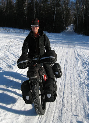
Adventure cyclist Mike Curiak asked us here at TopoFusion to help track his latest journey. He already holds the human powered world record for the Iditarod trail. Now he’s going back and trying to ride the whole thing completely unsupported. That means he’s carrying all the food, water, gear and muscle needed to travel all 1,100 miles to Nome.

Racers in the Iditarod Trail Invitational (who travel the trail by bike, foot and ski) have the “luxury” of staying in various lodges and checkpoints along the way. They pick up drop bags, buy food and perhaps most importantly, warm up! But Mike will be forgoing all that, testing the limits of what has been done with human powered winter travel.

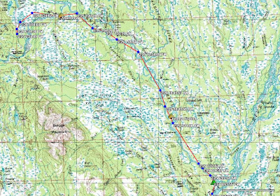
He is carrying a findmespot beacon, which (if all goes well) will send a breadcrumb point every 10 minutes. We’ll be able to load these points (Spot’s site exports GPX files) in TopoFusion and view his progress. We’ll also be able to do things like track playback and speed computations.

Head on over to Mike’s blog to get the latest update on his progress, using TopoFusion software:

lacemine29.blogspot.com

Pro Version 3.23 Released!

Wednesday, February 20th, 2008

Version 3.23 was released today.

Major changes:

* Due to a change in the server, version 3.20 can no longer download Canadian Topos. The latest release fixes this.

* Extensive support for Edge/Forerunner units:

– downloading HR/Cadence data
– profiling HR/Cadence
– track shading by HR/Cadence
– save/load files in .TCX/.CRS
– upload tracks as “Courses”

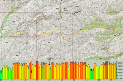
Example of Heart Rate shading with corresponding HR profile:

* More FUSION in your TopoFusion. You can now choose the tilesets you wish to combine in combo mode. Examples include tiger/aerial, urban/aerial, urban/topo, etc. Look for the tileset dropdowns in the Image Processing dialog.

Example combo Urban/Tiger tilesets:

* Smart merging of tracks – less use of the “reverse last segment” feature.

* The profiler in general got a makeover and is now more useful.

* Check out the “moving intervals” analysis in the Lap Analysis menu. I’ve been having fun placing waypoints labeled with the amount of time spent stopped on my GPS tracks. The results are sometimes quite surprising!

* many smaller additions, tweaks and general improvements.

Full the revision list