We're pleased to announce the release of a new version of TopoFusion.
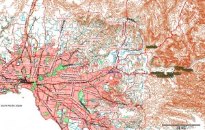
The biggest addition to this version is access to topographic maps for all of Australia:
http://www.topofusion.com/news/wp-content/uploads/2008/08/aus_sample1.jpg'>
For more details on these maps see
available imagery. We're excited about this addition since it has been a long requested feature, and we have a few potential projects in OZ as well. Find the Australian maps paired with the Canadian Topo tileset -- there's no overlap so they share the same tileset.
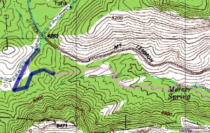
The other major addition is "GPX styles." This allows users to set and display attributes such as width, color, opacity and patterns to GPS tracks and drawn lines. This is a great improvement for map making, and is especially useful for
Trail Networks.
http://www.topofusion.com/news/wp-content/uploads/2008/08/linestyles.jpg'>
To change these settings, right click on a track in the map window and choose "Track Properties". The dialog looks like this:

These attributes are saved in the "GPX styles" schema, an extension to the GPX format that is supported by several other mapping programs.
Full list of changes since v3.39:
3.41 – [08/15/08]
Cut tracks now inherit the original track’s color/width/pattern/etc
Fixed File Properties to only apply color to all tracks when color is
actually changed
Fixed bug when merging tracks while download box or drawn track is active
3.40 – [08/12/08]
Added Australian Topo Map server!
Covers all of Australia
Shares tileset with Canadian topo – “Can Topo” now “Can/Aus” tileset.
Can/Aus downloads Canada Topo in northern Hemisphere, Aus Topo in southern
Added support for GPX_style extension (also KML Styles)
Added per track line width
Added per track coloring
Added per track opacity
Added per track pattern (dash/dot, et cetera)
Added track names to KML exports
GPX files now saved as GPX 1.1
Drag and Drop of files now supported for main map window
(previously only active file list could be dropped into)
Fixed synchronization issues between profile/simplify/waypoint/track dialogs
Fixed infinite loop with large GIS waypoint files, skipping at high zoom levels
Fixed false clipping for long track segments
Fixed problem reloading tiles when clicked outside current UTM zone