Show Posts

This section allows you to view all posts made by this member. Note that you can only see posts made in areas you currently have access to.


Messages - Krein

Pages: 1 ... 3 4 [5] 6 7 ... 25
201
Archived Support / Show stopper bug
« on: July 09, 2007, 05:16:00 PM »
Great, glad you're back up and running.

You probably wouldn't notice the difference in the .ini file unless you had a program do a "diff" on them.  It's probably something stupid like a string in quotes vs. no quotes.  We make the same function call, but it can give different results depending on windows language settings, even though it really has nothing to do      with it.  Thanks for the ini file, I'll see if I can come up with a workaround.

202
Archived Support / Color Aerial Map Mismatched with Other Maps
« on: July 09, 2007, 05:11:57 PM »
Funny, I was riding around at Ute Valley yesterday too.  Though I live in Manitou Springs, so I don't get out to Ute much.

Today's ride was:


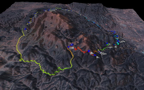
That's Pikes in the middle.  '<img'>  Definitely an epic.

Yep, the color aerials are something else.  You can check the year on any Terraserver map by going to that spot on www.teraserver-usa.com.  It seems like the color aerials are 2002 or later.

Cheers.

203
Archived Support / Color Aerial Map Mismatched with Other Maps
« on: July 08, 2007, 01:43:27 PM »
Yep, there's the "Correct Map Offset" feature found in the "Window" menu.  

Are you in Colorado Springs?  There a preset to fix the systematic terraserver error in all of the color aerials.  If you're somewhere else, I'd love to hear what preset works (and your location) so we can add it to the program.

Thanks.

204
Archived Support / Question on New download method?
« on: July 08, 2007, 01:41:44 PM »
Quote (m38a1guy @ July 08 2007,2:12)
Did you have a reason why TF is downloading tiles already downloaded? I was testing this out and it was going through the lengthy proceedure of downloading them again, or atleast taking the length as if it was. Is there some way to make them bypass the tiles downloaded already and go straight for ANY tiles NOT downloaded already? It would be faster when trying to add to existing map sections since as you know Terrasever can hang on long downloads. I get about only 560k download speeds. Bypassing the existing Tiles in the download box will save me hours, software should know already not even to count the tiles that are downloaded.

TF won't re-download any tiles.  There was a problem introduced in 3.0 that caused the totals to not be computed given the tiles already download, but this was fixed in a later revision:

3.02 - [2/21/07 - 2/23/07]

Turned DXT1 compression on user maps
Speedup - user maps loading using IJL instead of D3DX
Fixed batch download totals not updating
Fixed bug causing fuzzy networks and stray lat/lon points
Fixed bug causing hang with downloading disabled
Fixed runtime 13 error with logbook and international settings
Added ability to cancel a calibration point
Added airplane icon

But even when the totals were not correct, it still wasn't re-downloading any tiles that already existed.

205
Archived Support / Question on New download method?
« on: July 08, 2007, 11:33:56 AM »
Quote (Larry @ July 08 2007,6:27)
Krein, any progress on a DXT1 converter? For what it's worth, on my computer if I enable DXT1 compression the old maps, of which I have plenty   '<img'>  are just slow enough to load to be annoying.

Yep, definitely slower.

Haven't made any progress on the converter.  Started a project for it and got some of the necessary libraries, but it's not a trivial program to write, unfortunately.

206
Archived - Feedback and Comments / Feedback on GlobalSat BU 353 & TF
« on: July 06, 2007, 03:16:39 PM »
Glad you got it sorted out and found a good GPS.  Thanks for sharing your experience with it.

For other TF users, this simple USB GPS can be attached to a laptop and then used with the "Live Tracking" (see GPS menu) feature.  This will show your current position on the moving map, and also gives the option of recording a tracklog.

Most of these USB GPS units will emulate serial (com port) NMEA protocol.  So you should choose NMEA gps type, and then the appropriate com port, and likely 4800 baud.

207
Archived Support / Question on New download method?
« on: July 06, 2007, 03:12:57 PM »
Hi,

Sorry about the post not showing up.  This forum (and this forum only) is moderated by hand, due to spambots constantly posting.  This one fell through the cracks.

Quote
I was thinking about adding to my map file through Nasa's server but you added that new format to the new version, can I download and add to my dat files or am I going to have to redownload everything to add more content?


No need to redownload.  If the "Use DXT1" checkbox is not checked, TF will continue to operate as before -- downloading and saving in .jpeg (and .gif) format.

If you enable DXT1 compression, new tiles will be downloaded and saved as DXT1, but your old maps will still be there (again, no need to redownload).  Your old maps will just be slower to load from the HD than newly downloaded maps.

Quote
Also this new format has nothing to do with the DEMS right? So those should work in TF with or without the new format for image maps?


Correct.  No change in local DEMs or 3D download.

Quote
Another question is how much space is saved with the new format? Lets say I Have 10GB of data what would the new download format be? 5gb?


No, the size of map files is about the same, with the newer format being slightly LARGER than the old.


Quote
I wished you could take this Cache files at import them into Topofusion. lol They got a great compression rate.


Keep in mind that the google cache file is not permanent.  Meaning, just because you download it once, doesn't mean it will always be there.  That's probably why your cache file is small.

With TopoFusion, once you download, you'll always have it.

Thanks for the questions, Grant.  Hopefully it'll help clarifiy some stuff for other folks, too.

208
Archived Support / Show stopper bug
« on: July 06, 2007, 03:06:34 PM »
Great, thanks for the updated and patience with it.

For that particular error message, during the splash screen, just moving the .ini file is enough.  Doing a fresh install is unlikely to have any effect.

Let us know how it goes, and then it would be great for you to incremental go along in versions to pinpoint the bug.  My guess is there is something wrong reading a setting from the .ini file.

Thanks.

209
TopoFusion Anouncements / Pro Version 3.12 Released
« on: July 02, 2007, 05:55:38 PM »
This was actually released over a week ago, but it was released just before a trip, so we never sent the announcement.

3.12 is a major improvement over previous versions of TopoFusion PRO.

Changes since the latest full release (v3.07) include:

3.12 - [6/21/07]  (Full release)

Fixed "automation error" when simplifying a track multiple times
Fixed bug popping up area calculation and edit track introduced in 3.11

3.11 - [6/15/07]  (Beta)

Added custom symbols.bmp and sprites.bmp ability
  (download and place in default tracks directory)
Added "Delete Track" to track right-click menu
Added all available GPX symbols to dropdown in waypoint dialog
Fixed intermittent "unknown exception" on finishing track download
Fixed multi-track playback in landsat tiles
Fixed multi-track playback "author" text label placement
Fixed some problems with deleted points and photos
Improved waypoint clipping
Fixed intermittent black squares in upper corners of map (since 3.03)
Increased opacity of photo thumbnails
Fixed pan/zoom between tracks in landsat
Fixed crash with D3D_OUT_OF_MEMORY at startup

3.1 - [6/6/07]  (Beta)

Added waypoint symbols!  (icons)
Added "split track" function to simplify/spline dialog
  --Used for splitting a large track into smaller chunks for
    for upload to a Garmin's "saved tracks"
Fixed some problems across zone boundaries
  Fixed scale bar in landsat tilesets
  UTM coordinate display now changes zones
  Fixed draw (pencil) distance in landsat
  Fixed dropping waypoints across zones
Improved .kml import (waypoints)
Added "Map" menu
  Allows switching to all map types without changing zoom level
  Also provides menu options for all map state toggles
  Reworked a few minor keyboard shortcuts
    Profile tool is now "F" key
    "O" key now switches directly to Combo Maps
Added "Make New Folder" button to Photofusion HTML directory chooser
Other Misc. fixes

3.09 - [5/31/07]  (Beta)

Added shapefile import
Improved .kml import
Added basic .kml export
Added GPS config dialog to GPS transfer dialog
Added confirmation dialog (y/n) to file renaming
Added purchase links to installer
Added "run TopoFusion" option to installer
Changed "no map" message for tiles outside UTM zone
Added "zoomed too far out" message

3.08 - [5/22/07]  (Beta)

Split profile/merge tool into two tools
  Profile now only profiles tracks
  Merge tool is used to join tracks
Added support for GT-3 USB GPS
Fixed possible crashes in NMEA live tracking
Fixed problem editing/selecting tracks/points when map
  display is disabled
Fixed problem reading UTM text files (from TopoUSA)
Fixed crash editing track properties

Head on over to

http://www.topofusion.com/download.php

To get the latest demo.  For registered users, refer to your registration email for the URL to download the full version.

Thanks!!!


210
Archived Support / Text File Open/Import
« on: July 02, 2007, 05:53:12 PM »
That sounds about right considering they are just waypoints at key places.  It should be much less distance and elevation gain.

I'm still thinking about the CT myself.  It's either going to happen as a tour or race this year.  Just not sure which yet.

Looking forward to it in any case.

211
Archived Support / Show stopper bug
« on: July 02, 2007, 05:51:33 PM »
Well, I had a look at this today and couldn't duplicate the problem.  It doesn't make much sense.

I installed the east asian files, switched to Korean mode, then did a clean install of 3.0.  I then upgraded to 3.12 (both times demo versions) and it loaded with no problems, still in Korean mode.

Windows is kind of dumb about the way it handles changes between language settings, sometimes behaving unpredictably.  So it is likely something we can fix, but I don't know how to approach it.

One thing to try is deleting (or temporarily moving to another directory) your TopoFusion.ini file.  There may be a setting there that is not reading correctly.  It'll reset your TopoFusion to default values.

Let me know if that helps or not, or if you have any guidance on how to get my computer set up to match yours.  Maybe I'm not doing something right.

Thanks.

212
Archived Support / Text File Open/Import
« on: July 02, 2007, 02:06:07 PM »
Hey Chris,

I don't know what that text format is.  It's close to what TF reads, but evidently not close enough.

I used the .gdb files, opened them in Mapsource, then saved as GPX.  If you don't have Mapsource, just let me know and I can email you the GPX files I have.

Have the GLR memories faded enough that you're on-board for the CTR?

213
Archived Support / Show stopper bug
« on: July 01, 2007, 07:59:08 PM »
Wow, thanks for reporting the problem.  And special thanks for letting us know you are using the Korean setting.  I will be willing to bet we introduced a bug that only shows itself with non-english setting.

We'll check it out and let you know what we find.  Sorry about the bug.

I tried changing to Danish, and a few other settings, and it worked OK.  But I don't have a setting for Korean.  Must be a separate download?  I'll see what I can find.

214
Archived Support / UK mapping and User Maps
« on: June 23, 2007, 09:15:33 PM »
Yeah, well, you can use google maps from a browser, but you can't cache them locally.  We're going to look at having TF do exactly that, though.

Good luck with the user maps.

215
Archived Support / UK mapping and User Maps
« on: June 23, 2007, 06:29:23 AM »
1.  Unfortunately, it seems the answer is no.  The data is more highly protected in terms of licensing, etc.

2.  The best way is to use waypoints.  If you have some coordinates of known landmarks, you can enter a new waypoint.  Or, you can even load up a track or two and "line up" the map with the track, in TopoFusion.  It's easier when you have a high quality terraserver map, but you should be able to do it OK.

Sorry about the confusion with the map availability.

216
Archived Support / Help with Pocket PC
« on: June 20, 2007, 04:26:58 PM »
Quote (Guest @ June 20 2007,5:13)
Will TopoFusion work with the GPS data from my iPAQ 5915 GPS/PocketPC?

Yep, if you can get it into GPX format or one of the other import formats supported by TopoFusion:

    * GPS eXchange Format (.GPX)
    * ESRI Shapefile (.SHP) [Pro version only]
    * Google Earth (.KML)
    * Magellan eXplorist Track files (.LOG)
    * Magellan eXplorist Waypoint files (.UPT)
    * Timex NMEA exports (.TXT)
    * UTM Text files [Example] (output by Delorme's TopoUSA)
    * Lat/Lon Text files [Example](output by Delorme's TopoUSA)
    * Maptech Track Export Files (.TXF)
    * Maptech Waypoint Export Fiels (.MXF) [Example]

If it outputs NMEA realtime sentences, you can also use TopoFusion to display your position on topo/aerial/etc maps.

217
TopoFusion Anouncements / Nasa Server Upgrading
« on: June 18, 2007, 01:40:34 PM »
This upgrade passed without any problems.  I didn't notice any downtime or problems.  Nor were any reported.

Looks like it's good to go.


218
Beta Testing / 3.1 Beta - symbols
« on: June 16, 2007, 07:30:39 PM »
Sorry about the confusion.  The default tracks directory starts out as simply c:\program files\topofusion.  Unless you've changed it, you should put the .bmp files there.

It is set in the General Tab in Options->Preferences.

This will all be explained in the manual when it's actually released.

219
Beta Testing / 3.1 Beta - symbols
« on: June 16, 2007, 02:42:55 PM »
Quote (roger8604 @ June 16 2007,3:23)
Hello,
I found link to way point icons. how do I download them..?
The link I found opens a window with the icons but I do not see a "download" button.
Thanks,
Roger

You need to right click on the link and choose "save as.." to save the files as a .bmp on your computer.

220
FYI, guys, TopoFusion Pro works in the latest version of Parallels, which supports 3d acceleration.

See:

http://www.topofusion.com/cgi-bin....;t=1107

221
Archived Support / New version on Mac Parallels or Bootcamp?
« on: June 16, 2007, 02:17:29 PM »
FYI, guys, TopoFusion Pro works in the latest version of Parallels, which supports 3d acceleration.

See:

http://www.topofusion.com/cgi-bin....;t=1107

222
Beta Testing / Version 3.11 out
« on: June 16, 2007, 01:49:37 PM »
Quote from: Larry,June 16 2007,8:05
Quote

Thanks much for the .bmp files that can be changed. I'm gonna see if I can turn the runner sprite into a tired old backpacker.  '<img'>


Cool.

Quote

The 'delete track' option on the right click menu will be handy. I'm assuming that this does not delete the .gpx file and send it to the recycle bin, but only deletes the track portion of the file. Right?


Correct.  It'll be most useful for GPX files with multiple tracks.  I got sick of going to the track properties dialog and shift clicking all the points in a given track.

Quote

And to confirm, the only way to access the delete track right click option is to first right click on the the file at the bottom of the window and choose 'center map on file'. This highlights the track, which then will respond to the right click. Or is there another way?


No, there's no need for your first step.  When in the pan (hand) mouse mode you can simply right click on any track and get the same context menu (with profile, edit track properties, spline/simplify, delete, etc options).

I'm finally going to cover this somewhat hidden menu in the user manual.  It's been getting some updates lately.

Thanks for the positive feedback and the good questions.

223
Beta Testing / Version 3.11 out
« on: June 15, 2007, 07:57:46 PM »
3.11 – [6/15/07]

Added custom symbols.bmp and sprites.bmp ability
  (download and place in default tracks directory)
Added “Delete Track” to track right-click menu
Added all available GPX symbols to dropdown in waypoint dialog
Fixed intermittent “unknown exception” on finishing track download
Fixed multi-track playback in landsat tiles
Fixed multi-track playback “author” text label placement
Fixed some problems with deleted points and photos
Improved waypoint clipping
Fixed intermittent black squares in upper corners of map (since 3.03)
Increased opacity of photo thumbnails
Fixed pan/zoom between tracks in landsat
Fixed crash with D3D_OUT_OF_MEMORY at startup


To change the symbols or sprites in TopoFusion, first download the appropriate file:

http://www.topofusion.com/images/symbols.bmp


http://www.topofusion.com/images/sprites.bmp


If you place either of these files in your default tracks directory, TF will load them instead of the default files.  Of course everything maps to a particular portion of the files, so you need to be careful what you change, and need to stay within the current size.

Any bugs or issues, please let us know.

224
Archived Support / A few Questions...
« on: June 15, 2007, 07:50:59 AM »
1. Use the scissors tool to cut at intersections.  Then use the profile/merge tool to select each segment.  Right click after selecting one and choose save as...

2. It's not called anything, just CSV.  The intended purpose is pretty much for usage in Excel, where other calculations can be performed.  The coordinates are in WGS84, and in UTM so that distance calculations can be performed.

3. Where are they not lined up?  Go to Window->Correct Map offset.  You can correct any errors in a single tileset or groups of tilesets here.  If you have find a correction for your area, please let us know so we can make it a preset.

Thanks.

225
TopoFusion Anouncements / Nasa Server Upgrading
« on: June 12, 2007, 05:40:28 PM »
Note that this only affects Landsat and 3D downloads, not topo, aerial or color aerial tiles.

226
TopoFusion Anouncements / Nasa Server Upgrading
« on: June 12, 2007, 05:39:04 PM »
From Lucian at NASA's JPL:  (0n 6/12/07)

Quote

Just a warning:

We'll be updating apache on the server in the next few days, there might be problems.  Let me know if you see anything out of the ordinary, other than down/flaky service.


Please post here if you notice anything strange.  It sounds like any down times should be brief.

227
TopoFusion Anouncements / Nasa Server is up
« on: June 12, 2007, 09:36:45 AM »
Back up as of 10:30am (MDT).

228
TopoFusion Anouncements / Nasa Server is up
« on: June 12, 2007, 09:34:57 AM »
Just got email back from Lucian, the man behind the OnEarth server.  He says:

Quote
The server is down by mistake, due to overactive sysadm. I'll fix it shortly.

229
Archived Support / New to Topofusion - a couple of questions
« on: June 12, 2007, 08:51:05 AM »
Hi,

Yep, poor timing with the downtime.  Terraserver, however, is still up and running just fine.  So you should be able to get topo and aerial tiles.

Try this: open up TF, and switch to one of the Topo tilesets.  You may still get an error message about the server being down.  But that's because it was trying to download landsat tiles.

Now close TF and open it back up.  As long as you stay in a topo or aerial tileset, you shouldn't get any messages about the server being down.

Hoping to get an update about the server's status soon.

230
Archived Support / Fatal Exception Reseting D3D Device Failed?
« on: June 11, 2007, 07:26:39 PM »
As of a few hours ago, the OnEarth server is down.  That might be causing some troubles, but not a D3D device reset error.

Is this your first install of TopoFusion, or have you been using it for a while?

You might try deleting your TopoFusion.ini file.  That will reset your settings to default.  

Otherwise, it sounds like a video driver problem.  Try updating your video card's drivers, or post your TopoFusion.log file here -- it should give us some clues as to what's going on.

Thanks.

231
TopoFusion Anouncements / Nasa Server is up
« on: June 11, 2007, 04:09:53 PM »
Unfortunately, just on the heels of a Terraserver downtime, it seems that the Nasa server is experiencing some problems.  It has been down for the last hour or so.

Until the server is back up (you can check here for updates), TopoFusion won't be able to download Landsat maps or download elevations for 3D views.

Sorry about the downtimes.

232
Excellent, thanks for posting this!

Definitely good to know.  Glad you got it working.

233
Archived - Feedback and Comments / Port scan upon tile download
« on: June 11, 2007, 09:16:43 AM »
Hmm.  Not sure, I've never noticed this before.  I'm running Outpost Firewall and occasionally see that it is blocking port scan "attacks", but haven't seen this one, nor do I get a port scan when I fire up TF and start downloading tiles.

That IP is:

  Search results for: 64.105.163.108


    OrgName:    Covad Communications Co.
    OrgID:      CVAD
    Address:    2510 Zanker Rd.
    City:       San Jose
    StateProv:  CA
    PostalCode: 95131
    Country:    US


No idea who Covad is, but I think Terraserver is physically located in the bay area (can't confirm this, though), so it might be Terraserver related.

Let us know if you discover anything else, and I'll do the same.

234
Beta Testing / 3.1 Beta - symbols
« on: June 06, 2007, 04:01:42 PM »


!!


3.1 – [6/6/07]

Added waypoint symbols!  (icons)
Added “split track” function to simplify/spline dialog
  --Used for splitting a large track into smaller chunks for
    for upload to a Garmin’s “saved tracks”
Fixed some problems across zone boundaries
  Fixed scale bar in landsat tilesets
  UTM coordinate display now changes zones
  Fixed draw (pencil) distance in landsat
  Fixed dropping waypoints across zones
Improved .kml import (waypoints)
Added “Map” menu
  Allows switching to all map types without changing zoom level
  Also provides menu options for all map state toggles
  Reworked a few minor keyboard shortcuts
    Profile tool is now “F” key
    â€śO” key now switches directly to Combo Maps
Added “Make New Folder” button to Photofusion HTML directory chooser
Other Misc. fixes

235
Beta Testing / Version 3.09 - More import/export options
« on: June 06, 2007, 03:59:50 PM »
Check out 3.1, just out.  KML reading is much improved.

Also, waypoint symbols!

I've ridden the Chubb Trail before (your file).  It was cool to recognize the data as somewhere I've been before.  Good ride, as I recall.

236
Archived Support / Spline tool not in demo version?
« on: June 06, 2007, 10:07:54 AM »
Are you sure that you have map tiles enabled?

There is a bug in 3.07 that makes it so you can't select anything if you have the map tile (little checkerboard toggle on the toolbar) off.

I can select your file just fine.

Oh, wait, you're not using the select points tool (the regular mouse arrow) to try and select the track, are you?  There is no right click menu for that tool.  You need to be in the pan (hand) mode to select a track.

It's funny this came up right now.  I'm just in the process of adding a "simplify/spline" menu option that simply asks you to click on the track you want to work on.  Should make the UI a little more friendly.

237
Archived Support / Spline tool not in demo version?
« on: June 06, 2007, 08:26:33 AM »
Hi,

That's strange.  The spline tool is active in the demo version -- everything is, in fact.  Very strange that you can't get the right click context menu to come up.

Are you viewing in Landsat or topo/aerial mode?  Whatever your answer, try switching to the other and see if you can get the menu to come up.

There have been a few bugs related to this, so there could be another one lurking.  Try restarting TopoFusion to force it to re-load the .GPX file.

Otherwise, if you're still having trouble, please email the file to support@topofusion.com and we'll gladly take a look.  If there's a bug, we'll have it fixed ASAP.

Thanks.

238
Beta Testing / Version 3.09 - More import/export options
« on: June 04, 2007, 04:56:15 PM »
Got it.  I'll get it fixed for the next go round.

Thanks.

239
Feature Requests / Geo tagging images
« on: June 04, 2007, 04:53:35 PM »
Yeah, my biggest question was whether the Lat/Lon data could be added "in place", without rewriting other data, and w/o re-encoding the jpeg.

On cursory glance, it seems that the GPS headers are additional, meaning that space is not already allocated in a standard EXIF header.  It still might only be a matter of appending the data on at the end, but it doesn't look like it's going to be *that* easy.  We have some code now that reads the EXIF headers, but nothing that deals with the additonal GPS stuff.

240
Feature Requests / Grid Line Thickness
« on: June 04, 2007, 04:50:18 PM »
OK.  Yeah, the lines are anti-aliased now in TF Pro.

We can add a configurable grid line width parameter so you can make them as large as you want.  I'll see if I can turn off the anti-aliasing as well.  Makes sense to, I guess.

Thanks.

241
TopoFusion Anouncements / Terraserver Back up
« on: June 04, 2007, 04:48:27 PM »
Quote (jmstacey @ June 04 2007,5:41)
Larry,
I think you can redownload the faulty region using the Load Maps Tool on the toolbar. Just select the affected area and it should download all the tilesets you have checked in preferences.

The load maps tool is what he wants, but drawing a box over the area won't force a reload--it will only download maps that haven't been downloaded yet.

A single click on a map tile will force it to reload from the server, however.

Larry, that's strange that you got some permanent fuzzy tiles.  I got plenty of fuzzies panning around over the weekend, and also checking for the server coming back up.  But I haven't seen any fuzzy tiles now.

You must have gotten a slightly different white fuzzy tile that didn't match the one in TopoFusion (that it's checked against).

If they are too many of them, you may want to go to a backup, I guess.

242
TopoFusion Anouncements / Terraserver Back up
« on: June 04, 2007, 11:22:58 AM »
Terraserver is back up, as of 12pm MST.

243
Beta Testing / 3.09, error generating HTML ImageMap
« on: June 04, 2007, 09:48:51 AM »
Well, it's not obvious that you'd have to place the waypoints first.  I'll add a sentence about that to the error message that pops up.

Yep, you can move and delete the photos now, which is a big improvement.

244
Beta Testing / 3.09, error generating HTML ImageMap
« on: June 04, 2007, 08:36:21 AM »
Larry,

Did you use the "place pictures as waypoints" button first?  It is a little different than in the past.  I think it would automatically do photofusion when you hit the "generate html" button before.

Then you can either have the new style image map (thumbnails), (if the photo toggle is on), otherwise, if just the camera icons are showing, you'll get the old style, where the camera icons are the 'active' parts of the image map.

I'm going to get the docs updated for photofusion sometime this week.  They haven't been updated for the new Pro photofusion stuff.

245
TopoFusion Anouncements / Terraserver Back up
« on: June 03, 2007, 12:07:52 PM »
Quote (lcdaveh @ June 03 2007,1:02)
During an outage like this, the PTBs - powers that be - could post a head's up on the home page so bunches of us don't spend a lot of time and frustration thinking we're doing something wrong.

Thank you.

Fair point.  I've added a note to the top of the main page.

Sorry about the frustration.

246
TopoFusion Anouncements / Terraserver Back up
« on: June 03, 2007, 07:20:45 AM »
Quote (hardwire @ June 03 2007,7:25)
Boy, I hope this does not mean some thing serious.... it is a long time...   '<img'>

Yeah, but the website is still up, and Terraserver is serving tiles -- they are just blank.  I'm sure it's just a hardware issue they are dealing with.  Might be until tomorrow (end of weekend) before it's back up, though.

I still haven't received a response from them.  Will update as soon as I know something.

247
Beta Testing / problem with 3D view with beta 3.07
« on: June 02, 2007, 08:42:56 PM »
Yep, still ongoing.

Bummer.  

Thanks for the update on the 3D problem.

248
TopoFusion Anouncements / Terraserver Back up
« on: June 02, 2007, 06:47:03 AM »
Still serving fuzzle tiles as of this morning.

Larry - Good question.  The white fuzzy tiles are not stored locally.  A list is kept in memory so that they are not repeatedly downloaded within that session.  But once you restart TopoFusion that list is gone, and the program will try to download those tiles again.

Hopefully Terraserver will be back to full functionality soon.

249
Beta Testing / problem with 3D view with beta 3.07
« on: June 01, 2007, 08:30:05 PM »
I moved this to the beta forum.

That's strange.  What version were you using before 3.07?  Not *much* has changed in the 3D code since 3.0.

Terraserver is having problems right now, but you'd get white maps, not black.  If you already have the topos downloaded it should be working.

Maybe post/email your logfile and we can see if there are any clues there.

250
TopoFusion Anouncements / Terraserver Back up
« on: June 01, 2007, 05:42:55 PM »
Looks like Terraserver is having some trouble this evening.  It was working earlier today.

It's responding, but often (always?) with white "fuzzy" tiles.  So if you are getting white tiles with "No map available for this location and tileset" written on them, it's not because there aren't maps.  There's just something wrong with the server.

We'll keep monitoring this and updating.

Pages: 1 ... 3 4 [5] 6 7 ... 25