Show Posts

This section allows you to view all posts made by this member. Note that you can only see posts made in areas you currently have access to.


Messages - chuckt

Pages: [1]
1
TopoFusion Pro / Re: Can't Find Spline Dialog!
« on: May 26, 2011, 03:31:29 PM »
Thanks Scott,

I could'a swore I tried that.

c

2
TopoFusion Pro / Can't Find Spline Dialog!
« on: May 26, 2011, 11:36:15 AM »
I know I've used it before, but I can't find it anywhere now???

3
Feature Requests / Re: Google Maps: Terrain
« on: September 24, 2009, 04:45:47 PM »
Lovin' it!

Now I need to print a couple maps for a backpacking trip next month.

Thanks for all the effort Scott.

chuckt

4
Feature Requests / Re: Google Maps: Terrain
« on: July 04, 2009, 02:36:43 PM »
Awesome, I've been waiting for this for a long time!

5
TopoFusion Pro / Color Aerials
« on: December 27, 2008, 07:45:31 PM »
'<img'> ... '<img'> ... ':angry:'

6
TopoFusion Pro / Color Aerials
« on: December 27, 2008, 05:12:28 PM »
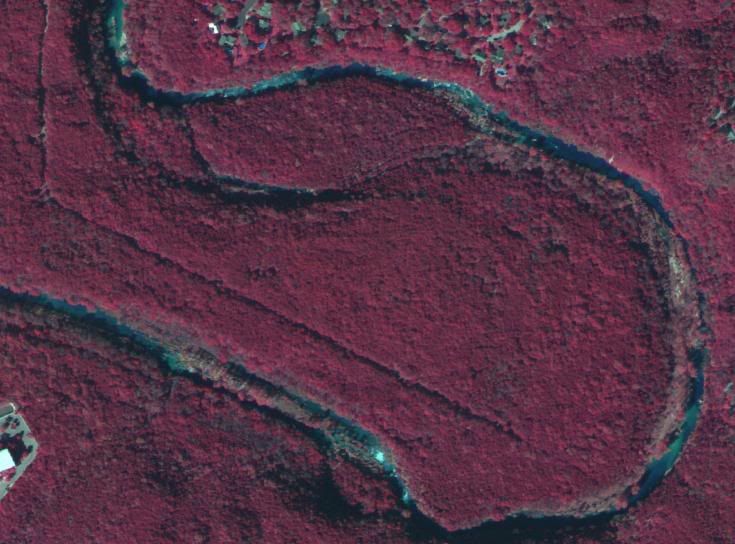
I'm getting some strange results with the color aerials. Everything is tinted red, I don't think this is what you meant by "color". The image is from Austin, TX.


7
GPS, Trails, Training / GPS Data Editing Software
« on: August 20, 2008, 07:50:52 PM »
Scott,

Thanks for all your help!

Is there any way to get Urban tile sets of the DFW area, without the huge grid lines? I haven't seen this in other areas.

chuckt

8
GPS, Trails, Training / GPS Data Editing Software
« on: August 20, 2008, 04:15:38 PM »
48 meters in the DWF urban tiles looks pretty good, but it appears to only "hold" the setting for one zoom set at a time.

I'll give the lap analysis another try...

9
GPS, Trails, Training / GPS Data Editing Software
« on: August 20, 2008, 04:03:31 PM »
I found the offset feature...

Now to split the laps...

10
GPS, Trails, Training / GPS Data Editing Software
« on: August 20, 2008, 04:02:46 PM »
Scott,

Where is this "map offset" feature?

Yes, I did hit the lap button (Garmin Edge 205). Do you have some insight as to how best to split the data? I what to be able to playback a single lap, without seeing the others in the track.

TIA,
chuckt

11
GPS, Trails, Training / GPS Data Editing Software
« on: August 20, 2008, 03:17:25 PM »
I have some track data that appears too be offset (in latitude) on the Urban tile set. It also shows this offset with google earth, though it appears fine on TF's aerial tiles.

Is there some software that will easily allow me to add this offset so that the data will appear on the map in the correct location?

I could bring the data into excel and add a correction factor, but formatting the data and re-assembling it is a real PITA. I could probably write something in VB pretty quickly, but I would think this has already been done by someone already.

I would also like to split the data at various points to separate the "laps" into individual gpx files...

On a side note, does anyone have any insight into the "grid lines" that appear on the Urban tiles for the Dallas/Ft. Worth area. One of them crosses right through my data, which totally screws up the view.

TIA,
chuckt
12
Feature Requests / Contour Shading in 2D
« on: May 10, 2007, 02:55:39 PM »

definitely high on my wishlist. It would make a big improvement to printed Topos.

13
Archived Support / Problem dloading tracks in v2.1
« on: March 13, 2005, 08:11:48 PM »
Good news... I reinstalled XP and now everything is working great. I don't know what the problem was, but at this point I don't care. Thanks for all the effort in trying to rundown this issue.

14
Archived Support / Problem dloading tracks in v2.1
« on: February 10, 2005, 05:25:36 PM »
Any progress with this problem?

15
Archived Support / Problem dloading tracks in v2.1
« on: February 03, 2005, 01:04:31 PM »
FYI

I tried it on a machine running Win2k, and it downloaded the track ok.

16
Archived Support / Problem dloading tracks in v2.1
« on: February 01, 2005, 05:46:39 PM »
There is only one entry in the log book from 1/8/05. I've never looked in there before either (kinda neat though).

17
Archived Support / Problem dloading tracks in v2.1
« on: February 01, 2005, 05:36:06 PM »
I unchecked the "add tracks..." box but it still crashed. I then moved TFlog.csv to a backup folder and tried it again with no luck. That file date was 1/15/05, probably the last time I dloaded a track in v2.01.

18
Archived Support / Problem dloading tracks in v2.1
« on: February 01, 2005, 05:15:15 PM »
There's nothing special going on. No saved tracks, just the active one. I have several tracks from 2.01. I can even get the current one if I reinstall 2.01.

19
Archived Support / Problem dloading tracks in v2.1
« on: February 01, 2005, 05:01:49 PM »
It runs now, but it still crashes when the download is complete.

20
Archived Support / Problem dloading tracks in v2.1
« on: February 01, 2005, 04:45:49 PM »
The pic didn't actually attach. The error read:

Wrong version of GPSMaster.ocx detected, looking for 2.18, but found 2.17...

21
Archived Support / Problem dloading tracks in v2.1
« on: February 01, 2005, 04:36:05 PM »
I just tried it but got this error when I ran the exe.


22
Archived Support / Problem dloading tracks in v2.1
« on: January 29, 2005, 05:15:26 PM »
It is the Vista, serial.

23
Archived Support / Problem dloading tracks in v2.1
« on: January 15, 2005, 09:17:30 AM »
I'm using a etrex Vista w/latest sw upgrade. It works fine in 2.01 but fails in 2.1. I get the error message at the end of the track dload. When I click "Don't Send" (XPHome), TopoFusion quits to the desktop. I've uninstalled 2.1 and re-installed 2.01 and it works fine. I've tried the 2.1 upgrade and the full install. Everything works fine using Maptech Terrain Navigator also.

Any ideas?

chuckt

Pages: [1]