Author Topic: v3.37 - arrows, more updates  (Read 5259 times)

ScottMorris

  • Administrator
  • Sr. Member
  • *****
  • Posts: 2756
  • TopoFusion Author
    • View Profile
    • http://www.topofusion.com/diary
v3.37 - arrows, more updates
« on: June 17, 2008, 09:49:46 AM »
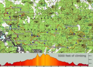
The 60 mile Tour Map


Biggest improvements this go-round are the addition of automatic directional arrows (toggle on toolbar and settings in preferences) and addition of auto-saving for live tracking (as well as some general improvements to that feature).

Here's the complete list of changes:

Added direction arrows to tracks
  Toggle on toolbar turns them on/off for all tracks
Settings for arrow size, frequency, color are in preferences->colors
Added additional context menu to help choosing tracks/waypoints
(used when right clicking on multiple tracks / waypoints)
Added "Highlight file in Active List" to right click menu
Added more descriptive title to standard right click menu
Added ability to write Live Tracking tracklog out to disk periodically
Fixed problems between interplay of live tracking log and drawing/merging tracks
Fixed memory leak in live tracking log
Live tracking dialog can now be minimized, and gives a warning when closed
Changed draw tool's bearing to True North rather than Grid North
Fixed possible bugs in very large network computations
Lowered memory overhead of network code
Added "out of memory" error to very large network computations
Added "Green" and "Blue" track shading settings
Added "Check for Updates" button to About Menu
Drag and drop of .GPX file to TF window now only re-zooms if
a single file is dropped.  Multiple files just load.
Fixed "can't get date from win.ini" error message
Scott Morris - founder and co-author of TopoFusion
email: smorris@topofusion.com

Larry

  • Sr. Member
  • ****
  • Posts: 157
    • View Profile
v3.37 - arrows, more updates
« Reply #1 on: June 18, 2008, 04:09:06 PM »
Hi Scott,

I've just given the new beta a first look. The arrows are *really cool*. This is a big help, and I very much like being able to configure them to a size the does not get in the way, but still allows me to see the direction.  Haven't checked out the other features that I might use. One suggestion: with the drawing tool info area, after the bearing might want to add "TN". Consider adding "Statute" before miles too.

Great job!

Larry

ScottMorris

  • Administrator
  • Sr. Member
  • *****
  • Posts: 2756
  • TopoFusion Author
    • View Profile
    • http://www.topofusion.com/diary
v3.37 - arrows, more updates
« Reply #2 on: July 02, 2008, 10:54:30 AM »
Thanks, I added TN, but I don't know about "statute" -- I think most people will assume we're not using survey miles, no?
Scott Morris - founder and co-author of TopoFusion
email: smorris@topofusion.com

Larry

  • Sr. Member
  • ****
  • Posts: 157
    • View Profile
v3.37 - arrows, more updates
« Reply #3 on: July 10, 2008, 05:41:22 AM »
Scott,

I was thinking about possible uncertainty with nautical miles, but then again, I don't suppose many people use TF for marine navigation. :-)

By the way, I finished my new Vista 64 bit computer, new X48 chipset mobo and new cpu. TF runs great on it. It's so fast that the maps appear before I request them. :-)

Larry