Nearly 24 hours of pure bliss at Lemolo Lake brought recharge and recovery. We were hungry for more Oregon Singletrack.
And we just happened to be in the perfect place — the top of the widely lauded North Umpqua Trail. No long drive, no messy shuttle logistics, no delays. Just wake up and roll out the door. The rhythm and flow of a bikepacking trip is hard to beat.
I rode over to the lodge wearing my Walmart camo gloves. While we gorged ourselves once again on the best bacon on planet earth (the guys at the lodge said they tried a half dozen bacon suppliers before choosing this one) a lady showed up with my lost gloves in hand. She said that her kids had “found” them. Translation – they stole them. I give her credit for being brave enough to return them. I thanked her and noticed there was something inside — a Lemolo Lodge rock bag, likely stolen from the store.
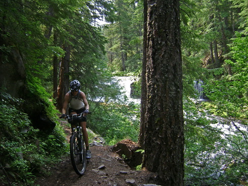
It was time for Dread and Terror. I bought a map of the Umpqua Trail from the lodge, and it described this segment as “expert.”
It was technical at times, with some healthy exposure. But we were five days into a bikepacking trip. Riding singletrack is what we do. Pretty soon we started catching other cyclists, much to our surprise.
By the third group I was thinking, “what is this, the most popular trail in the world?”
I wasn’t one to argue. Dodging trees, waterfalls every half mile, dripping moss, rocky outcroppings, technical climb challenges. It was more Oregon than I thought Oregon could be.
By the fourth group we realized we were cutting through an organized group ride.
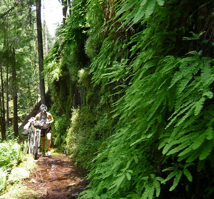
So here’s Paula, with 150 miles in her running trained legs, camping gear on her bike, and she’s passing people and cleaning sections they are walking. We didn’t tell them that she’s really not a mountain biker, but a few of the guys soon realized they were seriously getting ‘chicked.’ (They had started a little lower on the trail than us, and had shuttled it).
Paula’s pretty competitive, and given the hard nature of the trail the ‘competition’ was in cleaning sections, not racing. It was fun to watch her really nail some sections that I thought for sure she’d walk. I was a little worried she’d overdo it and risk a crash, but that never happened.
I’d been telling her all along how great she was doing, and how she’d really adjusted to the loaded 29er. But she never believed me. Until now.
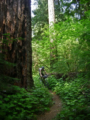
What a trail. Our favorite day of the whole trip.
Paula snapped her chain on one climb, which meant we kept bumping into more of the tour group. At the next road crossing they had a sag stop where they invited us to take a seat and eat some grub. Cool group of people having a heck of a trip along the Umpqua.
We eventually rolled on down the trail, missing some of the trail after being misdirected by some supremely stoned hippies.
Later segments of the Umpqua were faster and more flowing. What a day of descending! (All our climbing was hard earned through previous fart-mosquito efforts). Even though we’d earned every last foot of descending, it still felt like cheating.
The Deer Leap segment was a nice change, taking us away from the river on more of a “mountain” trail than a “river” trail.
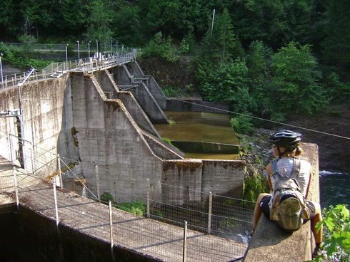
Not that we minded being close to the river…
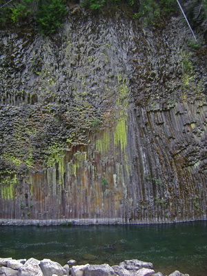
with so many interesting things to see…
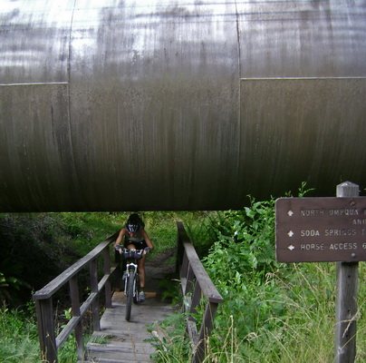
… and duck under.
I love how time becomes irrelevant out on the bike. It’s a continuous thing, yet we humans have tried to define and discretize it. With no destination other than our tent, the coming of night was not something of concern, it was just something that happens.
When it started getting dark, we started looking for a clear area to camp. We found one next to the river, complete with fire ring. We actually lit a fire since we were low on fuel. Instead Paula improvised a hobo stove with the large rocks of the ring. It was slow, but good enough to boil water for tasty alfredo pasta.
Right at dark two riders came to pick up their shuttle vehicle near our campsite. They were guides from the tour group, out scouting the trail. They told us that the Tioga section was indeed closed and had crews working on it. They also incorrectly told us there was no bridge at Steamboat, much to my dismay (Lemolo’s store didn’t have much for the bikepacker, and we were running a little low on food).
Day 5 – 38 miles
The ease of yesterday’s singeltrack descending extravaganza had lulled us into false sense of how the rest of the Umpqua Trail would roll. Right out of camp on the Marsters segment we were reminded that sometimes you have to earn your fun.
An old burn area was littered with downed trees. More a pain for loaded bikes, we got frustrated by a few of the big ones. Why? Because it was harder than before and my expectations had been colored. We reminded ourselves how easy things had been, and how impressive it was that we’d ridden 100+ miles of heavily forested singletrack and were only now hopping over logs.
Kinda puts things in perspective. Several dozen trees down, oh boo hoo!
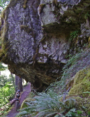
Fun riding in between the down trees and killer views of the emerald green river.
Paula snapped her chain again. I had already used our powerlink on the last break, but somehow I was able to get the pin back in without shortening the chain at all. I told Paula to expect it to break again on the next hard effort, but it ended up making it all the way back to Oakridge!
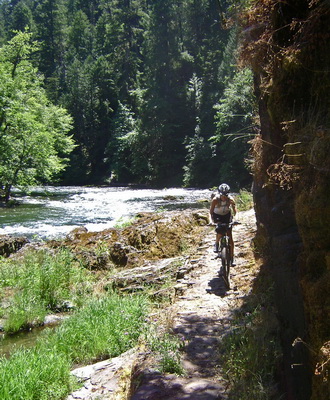
Eventually we rolled right next to the river and started seeing folks standing in the river getting their fly fishin’ on. We must be nearing Steamboat, supposedly one of the best spots to fish in the world. At one of our frequent technu wash / water purifying stops I pulled out the map and tried once more to ascertain if there was a bridge or not. If not, we’d have to ride ~5 miles past it and backtrack on the highway.
There was a circle and number covering the spot on the map that would show a bridge or road connection. The map really wasn’t set up for bikepacking the trail — no info on services or connections along the way. But in the trailhead directions I noted talk of a trailhead. I was still suspicious since the map had previously considered a junction with a closed-to-vehicles 2-track to be a trailhead.
Sure enough, we were soon riding across the bridge that didn’t exist according to the guides from Moab. A short chat with a local fly fisherman revealed that the lodge was left on the highway, and that they did indeed serve lunch!
Score! We thought Lemolo’s food was going to be impossible to top, but Steamboat’s meal gets the award for best food of the trip. Despite being afternoon, Paula ordered a huge breakfast plate, and I went with the burger on homemade bun. The homemade strawberry rhubarb jam put the meal off the charts.
Now, our bellies were full but our feed bags were not. A few small baskets behind the counter held candy bars, but that was the only food to be found in the place! The hostess offered to sell us some fruit and bags of chips out of the kitchen. It seemed like enough, especially since we had changed our route.
Since Tioga was closed, there wasn’t much point in continuing on the last 14 miles of the Umpqua trail. We were reluctant to leave the trail, but the lack of food at Steamboat meant we needed to take a more direct route to a known food source — Oakridge.
I pulled out the maps and spied a more or less direct route that would minimize the road time and, as a bonus, allow us 6 or 7 miles on the most excellent Middle Fork Trail. We could have spent 30-40 more miles on paved roads to pick up a few miles of trail in Brice Creek, but it seemed like a no brainer at the time, especially with our food situation.
So we pedaled north along Steamboat Creek, at first on pavement, then dirt. A few miles up we were looking for a spot to pump water. We happened to stop right at Steamboat falls, a popular spot full of swimming holes and rock. Perfect spot to relax and cool off during the heat of the afternoon.

We were introduced a strange Oregon phenomenon: unused paved roads. The Steamboat road was a very pleasant ride, and we didn’t see a single car after the falls. Not a bad way to travel
I set my bike up in “road” mode, moving as much weight as I could to the bike. Thanks to Eric’s Epic Designs seatpack, I was able to do this quite effectively (big thumbs up for this bag!).
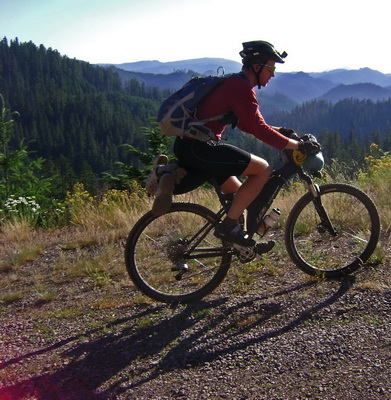
the lev, in “road” mode
The top came sooner than we expected. As we descended the world dropped out from below us. Massive logging areas gave us huge views of the Willamette River valley, and all the terrain we had covered in the last few days.
In 5 short hours from leaving the Umpqua Trail, we were back on singletrack again, hooting and hollering down the Middle Fork Trail. We found it twice as fun the second time, possibly due to descending rather than climbing it, but I think it had more to do with the rhythm of the trip. There’s always a learning curve and an adjustment period at the start of every trip. That was behind us; the trails were now our oyster.
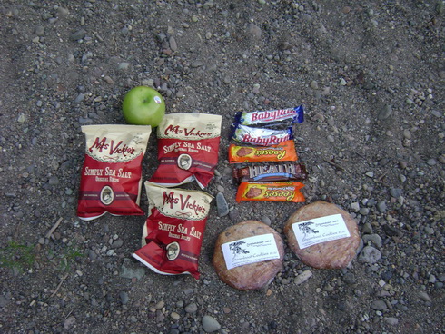
We ate our candy bar dinner just outside Sand Prairie campground. I’ve eaten worse out on the bike, that’s for sure.
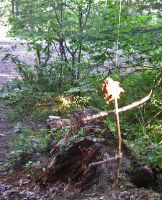
Around our campsite hung Blair Witch style little dudes. Probably someone wanting to “reserve” this site by scaring people away. With 200 miles in our legs and the sound of the rushing river, there could have been twenty specters dancing around our camp — we wouldn’t have noticed.
Day 6 – 53 miles.
Part three, coming up — we take a town day in Oakridge, then it’s on to the Mackenzie River!


It’s too bad you got some faulty info. You missed the North Umpqua Store at Dry Creek, just a 2 mile round trip off the trail. Glad you had a good time.
First I’ve heard of the store! It’s funny, you’d think the locals would know the area… but the guys at Lemolo couldn’t think of a single store along the Umpqua. Same with the guides (who admittedly aren’t local, but claimed to know everything about the trail). No one could even give me a straight answer about a store in Glide.
Still, 100% my fault for not having researched the area more thoroughly.
What WIngnut pack is that in the Lev in Road Mode pic? I have been looking at those packs and that will give me good perspective to size. Happy with the pack?
Love the Lev set up. That is my goal for next year, to get my Lev set up with soft bags like that.
Great bloggin’ about the trip to Ore!
mtroy — it’s not a wingnut. It’s made by Osprey (model = Talon 22 IIRC) and is getting to be a popular pack for this kind of thing. I really like mine, though it’s a little bigger than what I need. Super comfy though.
Yup, rackless is the way to go for singletrack riding.