We started where we left off on the last GET exploration: the catwalk outside Glenwood, New Mexico.
This time we followed the recommended GET route, which starts above the catwalk, dropping in after the suspension bridge.

The Gold Dust Trail started with nicely cut trail and rideable grades.
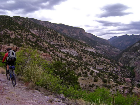
It then contoured, technical at times, into the Whitewater drainage, with great views of the cliffs and catwalks below.
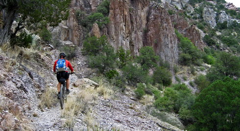
A difficult trail to jump into, fresh out of the car and on a loaded bike with recently adjusted suspension settings. But I was reveling in the challenge, and couldn’t have been happier about embarking on another exploratory ride.
The weather was enough to give one pause. Weeks of high pressure ended today. The day before we left Tucson saw a sudden shift in the forecast, towards very unsettled air and cooler temps.

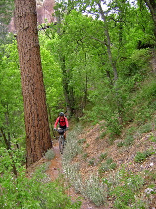
After a few hard switchbacks, we were deposited onto the Whitewater trail, a gateway to the Gila Wilderness. There was a great feel to starting our trip here, where many backpacks begin. Though it’s not wilderness, it sure feels like it.
I savored every bit of lush and rocky trail.
Soon enough the wilderness boundary approached and it was time to climb out of the canyon on the Powerhouse trail. Great name for a trail, if I’ve ever heard one.
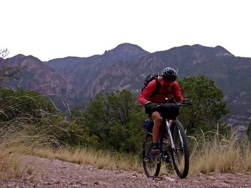
First a trail, then a quad track (though clearly signed as open to quads, someone has taken to placing boulders and tree limbs across the trail to dissuade them). Finally it turns to a steep 4×4 road.
I expected some hiking, but the upgraded contours on my GPS told me more about the trail ahead than I’m used to. The GPS was right, we rode most of the ~1500′ climb.
Soon we were catching air on forest road jumps, en route to “highway 78” and the nearly ghost town of Mogollon.

I think Mogollon awakens from its slumber on summer weekends, but it was quiet as a mouse this afternoon. From here the “highway” turns to dirt, and the forest service’s disinformation officer served us quite a tale about the dangers that were ahead. It’s only been open (due to snow) for a short time, and everyone she knew of had troubles getting through (flat tires for forest service trucks and state trooper cruisers). To top it off the road beyond Willow Creek had severe flood damage, and she doubted we could get through. It’s hard for some people to think outside their vehicular minds.
For now we had some climbing to do. 3000 feet, to be exact. Snow appeared above 9000′, and the temperatures dropped as rain threatened. I enjoyed the climb and was comfortable in my exertion heated skin. The cold air was refreshing given that my last two trips had been “hot” ones.
The singletrack descent from Sandy’s point looked tempting, and more singletrack awaited in Mineral Creek. Another day — we had very little daylight left and a precise goal for the day.
It took longer than expected to reach the actual descent to Willow Creek. After each short downhill we’d stop to pull more layers on. Finally I was wearing everything I brought and not very keen on the upcoming 1000′ descent.
The descent rolled on as small droplets formed in the air. There was an otherworldly quality to both the landscape and the air. Pine graveyards, a band of cerulean sky below darkening clouds. Raindrops evaporating on contact in the dusty, ashen ground. A plume of smoke trailing Lee’s tire. And most of all, the cold bite of the wind.
I’ll not soon forget that descent, and it was easy to lose myself in it. Though I was long past the point of losing feeling in extremities, I knew warmth was soon to come.
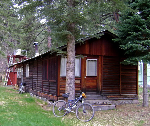
Lee had scored us a cabin for the night.
I think we were both holding our breaths as I searched for the key and Lee tried it in the door. Inside the woodstove turned 40 degrees into 70. As we pulled the bikes into the back room it started snowing.
We filtered creek water out of a pot, all from the comfort of the woodstove. It was quite the setup and we were quite fortunate to have the luxury of a roof overhead.
The day dawned with no snow accumulation, but subfreezing temps. We set about the north route, first following forest roads to meet the CDT southbound.
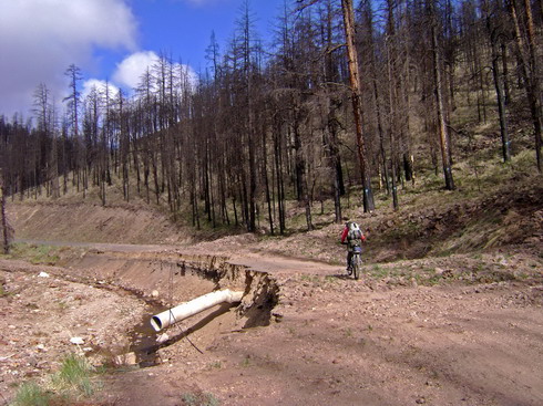
Indeed Gilita creek had flooded, taking most of the highly improved road with it. Ma nature has taken this canyon back for the time being, and not even the ATVs are getting through. On the bike it made for far more interesting and fun riding than your typical graded road.
A hawk sat on a tree screeching angrily at us as we passed. “We finally got this road shut down, what the hell are you doing here?!”
The sky began to clear, and sunlight was a welcome surprise.
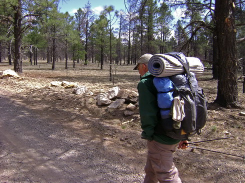
After a random encounter with a payphone in the middle of nowhere, we met CDT thru-hiker Buck. His website is bucktrack.com and he’s going for the whole enchilada, anticipating a finish date in October. (!) I know little of what it takes to be a successful thru-hiker, but Buck seemed to be as happy as any hiker I’ve ever met. Just pleased to be out there and without a complaint in the world.

Forest roads through Collins Park brought us onto the GDMBR route, though I could only vaguely remember having been there in 2004. So many maps and landscapes have entered into my mind since then. But the feeling was undoubtedly there. After meeting a southbound CDT section hiker from Germany, also as pleased as punch to be out there, we decided to take the more adventurous route, exploring “out of the way” bonus miles of CDT.
Our adventure on the CDT began at Ghost Lake–an appropriate name for both the lake and the accompanying trail. A CDT sign and two blazes were available to be followed, but there was no trail and soon we were making up our own route. Fun at first, but with steepening sideslope we reverted to hiking.
I enjoyed the route selection challenge (somewhat slower with two people), and each descent along the divide was full of grins. This is very friendly XC country, unlike anything in Arizona. We more or less followed the guidebook’s description of where the route goes, and also stayed close to the GPS line taken from the guidebook’s map. But we found very few blazes or markers, and the GPS waypoints were useless (it was obvious that they were not from a GPS, but simply coordinates plucked from a map, after-the-fact). The guidebook was from 2001 and rumors of new trailbuilding had given me some hope on improved conditions, but we found no 21st century trail all the way from Ghost Lake to Coyote Peak (and beyond). It was about the only thing the guidebook was right on — how much trail there was and wasn’t.
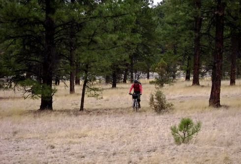
free ridin’ Lee
Information on this piece of CDT is so limited that there was only one way to find out for sure: see for ourselves. So I was quite happy to be “figuring” this piece of trail out. And none of it was distasteful at all, just slow. Mostly it was mental energy wasted following ghost trails and searching for tree blazes, wondering if some piece of sweet singletrack was just over the next ridge and being missed. We finally did find markers pointing back the way we had come, just off the 2-track to Divide Tank. They were about a half mile from the guidebook’s GPS waypoint for that junction, and there was no trail going that way.
Divide Tank, a reliable source according to the guidebook, had only a tiny bit of mud in it. As promised, though, faint 1998 singletrack led away from it, beginning the climb of O-Bar-O mountain. Initial hiking led to rideable switchbacks, punctuated by mandatory “heart calming” rests. 180 BPM is easy to reach at 8500′ and on a loaded bike.
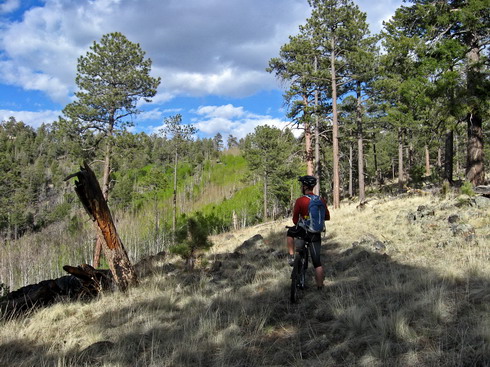
taking a heart calming break
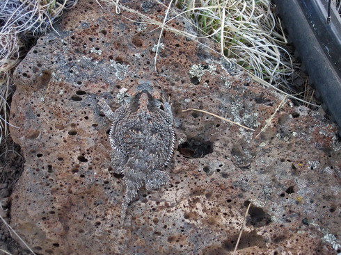
a well camouflaged toad
I was enjoying the climb, but Lee was mostly walking and slowly tiring. We were both happy to round the shoulder of an unnamed 9,245′ peak, at last descending towards Mesa Redondo Tank, which was holding water. Sharp rocks began to appear, forcing a sealant change for my front tire. The super juice / Stan’s combo spit itself out a small hole. Replacement pure Stan’s sealed things right away and we were back on the trail 10 minutes later.
Techy built trail contoured us around to a saddle above the tank. What followed was quite a shock – some of the best mountain biking I’ve seen in a while. Faintly built trail flirted with the drainage, and 15 mph was suddenly possible. Incredible flow and big grins resulted. Maybe we’d make it to Coyote Peak before nightfall after all.
North Tank held a confluence of cow trails. Intuition and the guidebook suggested attaining the eastern ridge, though no clear trail did so. Lee spotted a blaze leading up the western ridge, followed by another. “Yet another error in the guidebook,” or so I thought.
There was no third blaze. We descended and weaved through trees, committing ourselves to the western ridge. Brush blocked our path as we reluctantly resigned to switching sides. This was getting us nowhere.
Crossing turned out to be quite a chore. Down was easy enough, but the canyon wall was so steep that carrying a bike up it was difficult. Tricep burning pushes and shoulder shrugs brought us finally to the top as the sun set. I started a desperate descent, crashing through bushes and over piles of rocks, searching for clear ground.
“There’s a massive cairn over here!” I shouted. A cairn, but no trail. Time to dust off the free-riding shoes again.

This route reminded me of other sections of CDT, some 5000 feet higher. Specifically – tundra. We were following CDT stakes, and though it was clear of brush, there was no trail and the surface was full of bumps.
Invisible ones, in this case, but still just within the limits of rideability. Full focus was required, because hidden rocks would divert your line without warning, regardless of how even your weight distribution was. Crashing seemed like a bad idea, and it was on edge the entire time.
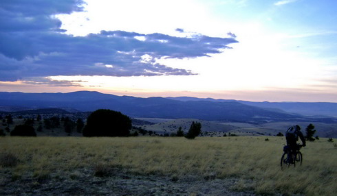
I wouldn’t say it was fun, in fact it grew towards the tedious side as the miles wore on. But there was a certain novelty to it and I couldn’t help but smile at the sheer nuttiness of it.
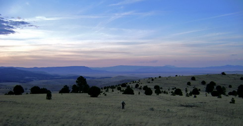
The views into the Plains of St. Augustine were impressive, too. At last, a two track along the powerline brought relief – now we could actually see the rocks and predict their effect on our desire for forward motion.
Lee’s wife, Joan, was waiting at Coyote Peak. She had just given up on us and was packing up to move camp up the road. We made it just minutes shy of turning the headlamps on. I was happy to see my big and warm sleeping bag in the car, leaving my featherweight one attached to my bike. I slept deeply, but there was a question in my mind. What now?
It had taken 8 hours to cover these first 20 miles of CDT, and the guidebook’s description combined with the twilight glimpse I got of the continuing “trail” east of Coyote Peak did not paint a pretty picture for the next 30. Lee was exhausted and was talking about taking three naps between breakfasts. The future was unknown.


Looks gorgeous!!! Very envious!
You have a rather unique gift.
You rode with a backpack (?!!)
Where do you carry your water?
Are you 7/7 or do you take down days?
Love it!
Walt
Backpack – yep! It’s a lot better than carrying everything on the bike for trail riding. Most of my water is in the pack (6L bladder) along with rain gear and other small items.
Lately all of our trips have been so short that down days aren’t necessary, though we do take some “easy” / short days for sure.
I went back and read the Safford-Morenci Trail account. It’s now clear to me why you wear your pack. This is bike mountaineering!
Walt