
V5.54 released – US Land Ownership Blend
Friday, November 16th, 2018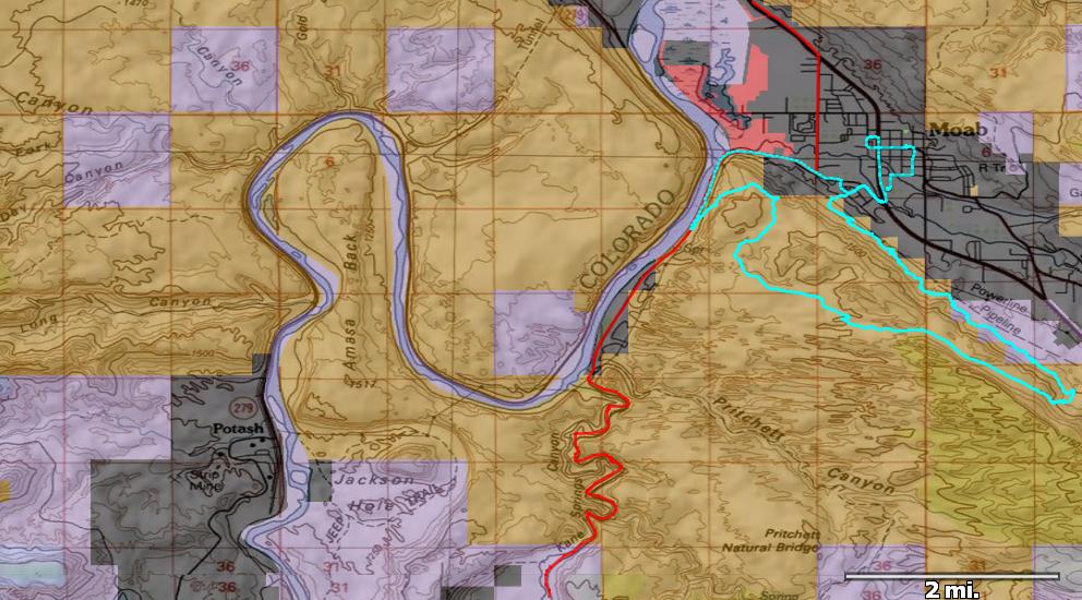
public land ownership in the Moab, UT area
We’ve got a new release ready — version 5.54. Pretty excited to have a new “Land Ownership” layer in the software. This information can be key to planning adventures — especially new routes. Or for hunting access. The colors on the above map are the standard ones for BLM, USFS, NPS, state, local and private land.
You can download these tiles directly in TopoFusion (using the map type dropdown in the upper right) or go to the Map Menu and select “Blend Land Ownership.” This will add the ownership data to the current map type you are looking at — using the combo blend feature in TopoFusion to blend the two map types together. Super useful!
As one who camps and travels on public land I’m very happy to have this ability. Good to know when you are actually on public land.
There are a number of other updates, including some existing map types being restored or improved.
Update your TF and check out the new version (full list of changes below), or if you are new to TopoFusion, go ahead and try the demo. And as always, let us know what you think, especially if you have a suggestion for a new feature or different way the software should work.
Thanks!
Team TopoFusion
Scott Morris
Version compiled and distributed from a small Scamp Trailer in the woods

Head over to the Download Page to try TopoFusion out, free of charge.
Registered users refer to your registration email for the download link, or go here to request your code and the download URL.
Full list of changes
For a complete list of changes see the Revision History, or keep reading here for what has changed since the last public release:
5.54 – 11/15/2018
Restored Land Ownership, added from previous beta
Adjusted settings and consistency of \223Map->Blend Land Ownership\224 function.
Fixed access to deprecated MSRMaps using UseMSRMaps=1 in .INI file
Restored access to Canadian Topos
5.53 – 10/6/2018
Added Land Ownership map type, including Map->Blend Land Ownership, which sets
up a combo blend mode with the current map type and land ownership layer.
Fixed hidden sat tiles
5.52 – 9/1/2018
Fixed problem with some elevation tiles not downloading
5.51 – 8/5/2018
Fixed ‘no map’ tiles in US Topo
Improved Elevation server downloads
5.5 – 7/23/2018
Restored access to Elevation data and LANDSAT tiles
Removed Juicy Trails layer from map menu (server removed)
Updated hidden sat tiles
New 2018 Splash Screen