
Version 5.43 – Elevation download restored, USGS Imagery
April 17th, 2017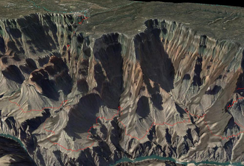
3D view of the Grand Canyon, South Rim
We’ve output a quick revision to the software, in response to some server changes. Elevation data is a key component of TopoFusion — for 3D views, shaded relief, adding to tracks, trail grade computation. The server requires the use of HTTPS now, which we added in the previous release. This release restores access to Elevation and the USGS imagery tiles.
So if you’ve been having issues downloading maps lately (getting “TopoFusion is having trouble…” messages), please update to the latest version. Also a reminder that you can get more reliable access to Mapquest based tiles (such as Open Aerial, Mapquest Street) by getting your own (free) map API key so you can download 15,000 tiles per month. We are still seeing outages on this every month on the default key. You can get a key here http://tinyurl.com/gvcuqg8 And the key is added in (Options->Preferences->Tiles->Mapquest API Key).
This version also adds some waypoint symbol exporting features for KMLs. Waypoint symbols that show up in TF now work when opened in google maps, google earth, etc.
Update your TF and check out the new version (full list of changes below), or if you are new to TopoFusion, go ahead and try the demo. And as always, let us know what you think, especially if you have a suggestion for a new feature or different way the software should work.
Thanks!
Team TopoFusion
Scott Morris
Version compiled and distributed from the South Rim of the Grand Canyon, a place where elevation data and 3D are essential, or at least more fun.

Head over to the Download Page to try TopoFusion out, free of charge.
Registered users refer to your registration email for the download link, or go here to request your code and the download URL.
Full list of changes
For a complete list of changes see the Revision History, or keep reading here for what has changed since the last public release:
5.43 – 4/17/17
Fixed elevation download (server now requires HTTPS)
Fixed waypoint symbols in KML files with spaces
5.42 – 3/27/17
Added waypoint icons (all 96 suported in TopoFusion’s GPX format) to KML
exports. Icons now import to google maps, for example.
Added quicker reporting of Open Aerial/Mapquest over quota download errors
Improved prompts for Open Aerial/Mapquest over quota error
5.41 – 3/10/17
USGS Imagery restored (now using HTTPS)
5.40 1/24/17
Public release of previous betas
New 2017 Splash Screens
5.39 1/15/2017
Added ability to read SSL-encrypted (secure) tiles
Restored access to the following tilesets: US Topo, Color, Open Topo Maps (which
now works worldwide), also ‘7’ key.
Changed ‘isMoving’ to include missing time stamps and negative times, for
better consitency in files that have bad time data (e.g. merged files)
PhotoFusion thumbnails now scale up with Export View exports, using the
Scale fonts/etc option.
5.32 10/15/2016
Added prompts in ‘download disabled’ dialog about Mapquest tiles and API key
Switched Find->Search to separate API key, due to continued usage of tile key
5.31 9/12/2016
Added ability to add Mapquest API key (Options->Preferences->Tiles->Mapquest API
Key) , so users can have their own 15,000 tile allocation of tiles. Sign up
for a key at: http://tinyurl.com/gvcuqg8
Removed Topo/Aerial/Urban from KMZ export, due to server being down indefinitely
Fixed issue with Lat/Lon grid in datums other than WGS84
Changed PhotoFusion HTML export to use USTopo and Color tilesets instead of
deprecated Topo/Aerial
5.30 – 7/17/2016
Restored access to Mapquest’s Open Aerial and Street tilesets
5.26 – 7/2/2016
Fixed additional issues with waypoints coming up in right click when not near
Fixed zero length segments (tracks within a file) in new Tracks area of File
Properties