
TopoFusion Pro v4.05 released – Elevation maps
Friday, October 22nd, 2010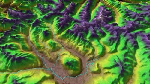
Version v4.05 of TopoFusion Pro was released today. This version introduces a new map type, “Elevation” which brings vivid colors, shaded by elevation. These can be great for large scale maps, and also as a powerful visualization tool to help understand an area. Elevation affects so much — vegetation, soil, temperature! The screen shot above is an elevation map in 3D mode, where purple and white represent areas above tree line, and brown/gold/green the lower elevations.
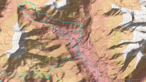
Here is another example, this time using colored sharp contours, and the “combo” feature to combine the elevation map with a myTopo map.
This version also fixes a number of small issues from the first v4 release this summer.

Head over to the Download Page to try TopoFusion out, free of charge.
Registered users refer to your registration email for the download link, or go here to request your code and the download URL.
Full list of changes
For a complete list of changes see the Revision History