TopoFusion.com

Archive for November, 2008

New Color Aerials in TopoFusion Pro. v3.60 out!

Wednesday, November 19th, 2008


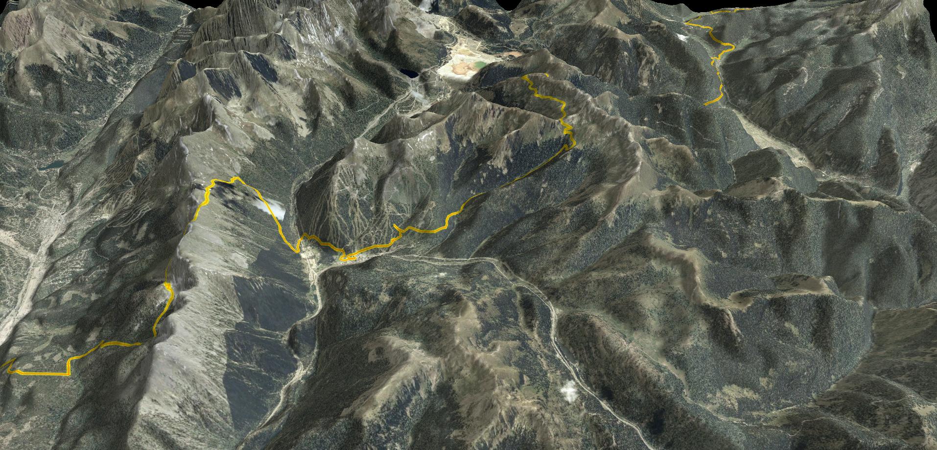
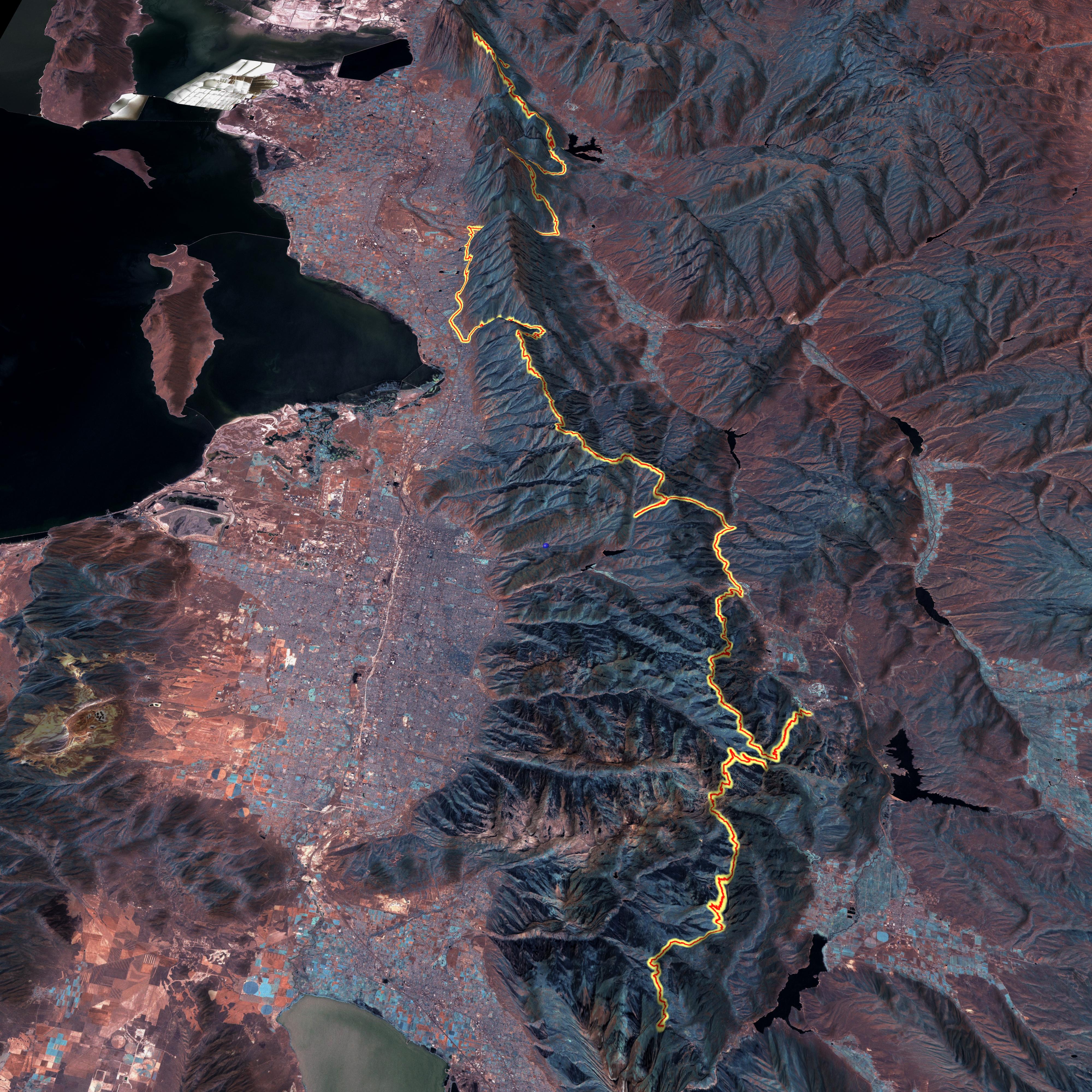
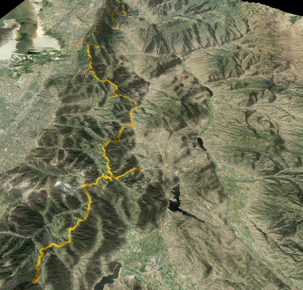
TopoFusion displaying new Color Aerials in Colorado

We’re excited about the release of version 3.60 of TopoFusion Pro. It features the new “Color” tileset that combines high resolution color aerial data from a number of servers into one “mega” tileset, covering most of the United States:


click to enlarge

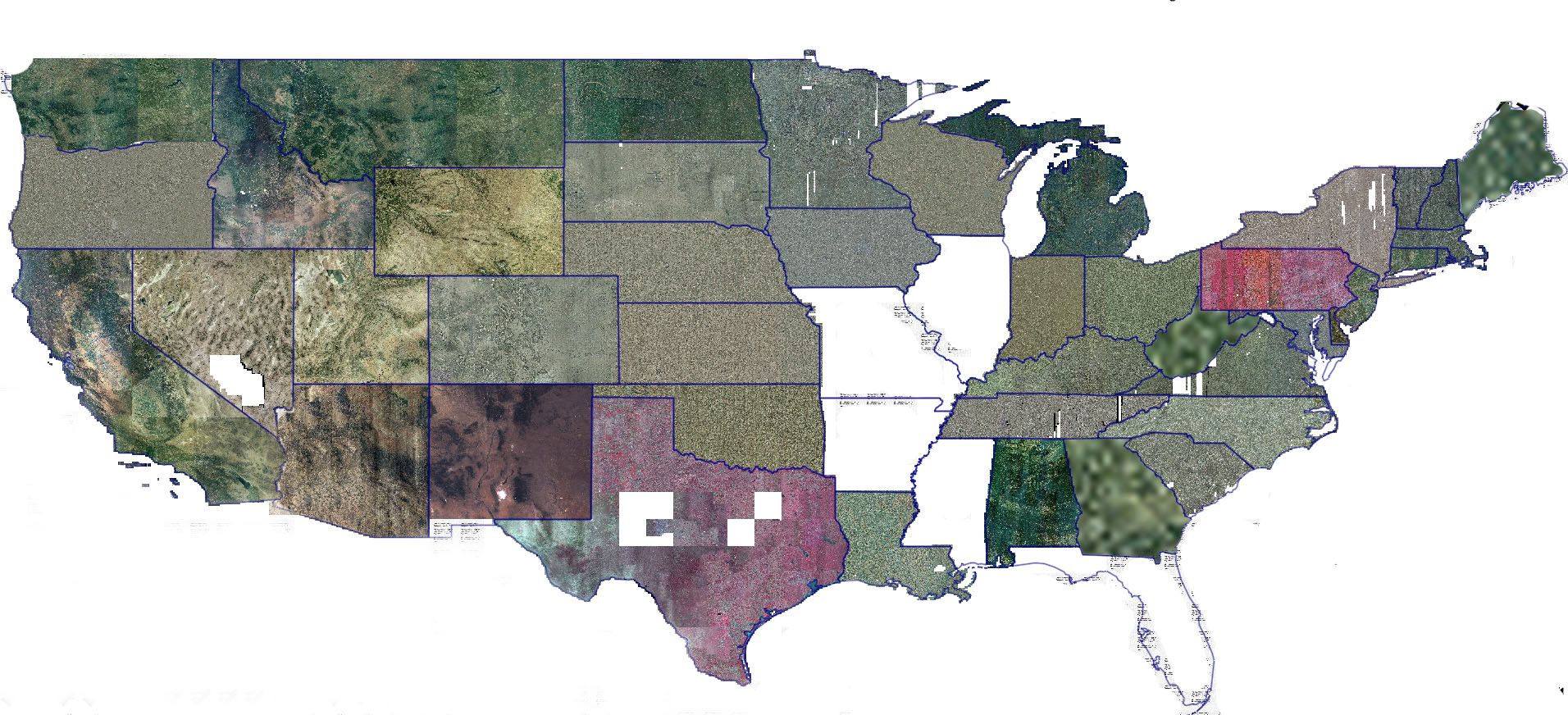
For list of states covered go to:

http://www.topofusion.com/color-coverage.php

Download

Click [ HERE ] to download TopoFusion Pro with the new Color Tileset.

Registered users refer to your registration email for the download link, or go here to request your code and the download URL.

One note: the server responsiveness and quality vary from state to state. For some reason Texas and Pennsylvania are not in true color — they are red (?). But otherwise this is some very high quality and a MAJOR improvement for TopoFusion, especially over the black and white DOQQ data from Terraserver which is often old and sometimes fuzzy / washed out.

Also new, WMS servers

Version 3.60 also introduces custom WMS server support. Any WMS server can be served and cached by TopoFusion, as long as it can output in the EPSG:4326 projection (most can). For more info see WMS servers in TopoFusion.

For a complete list of changes see the Revision History

TopoFusion 3D map in BIKE magazine

Saturday, November 8th, 2008

November’s issue of BIKE magazine features a story on a 160 mile singletrack epic in Utah’s Wasatch range. The author of the article contacted TopoFusion for a 3D plot of their route, published on page 75, and also online:

http://bikemag.com/gallery/across_the_wasatch_markewitz_utah_mountain_biking_photos/

They had tried to get an acceptable result from Google Earth, but the “patch work” effect (from stitching together data from various sources) made the result inacceptable. TopoFusion’s Landsat tileset was just the trick for mapping this 160 mile GPS track. It’s consistent and great for large scale maps. For publication their art department fiddled with the colors to make it a little less “mars” like (see the magazine). Original from TopoFusion looks like this:


(Warning – large file – 2.5 mb jpg)

In the soon-to-be-released next revision of TopoFusion we can do even better. We’ve got statewide color aerials at very high resolution (~1m or better) coming ‘atcha (for most of the United States). Here’s what the Wasatch Epic track looks like on the new color aerials:

Still very consistent. Also note that to get a high resolution 3D export in Google Earth you need the $400 Pro version. And even then it’s only 4800×4800. TopoFusion can export to 8192×8192 as long as you’ve got a video card that can support it.