Pro v3.51 out – Oregon/Colorado/705 direct support
Friday, October 3rd, 2008
We’re pleased to announce the release of version 3.51 of TopoFusion Pro.
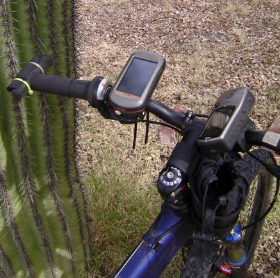
The latest revision adds direct support for the newest Garmin GPS units, like the Edge 705, Colorado, Oregon (shown above, mounted to handlebars) and Nuvi. These are the new “mass storage” device GPS units. TopoFusion has always supported them in that it loads and saves GPX and TCX files. But now you don’t need to do your own file management and be unsure if you got things into the correct directories — let TopoFusion handle it for you.
The new units are supported just like older USB and serial units are — direct transfer of tracks and waypoints. We’ve also added a few little tricks like auto-naming of tracks based on the filename. This prevents every track from being named “Tracklog” (the default if the track has no name field).
Also in this release is more Windows Vista friendly install and directory structure. Existing users won’t notice any change — settings and default directories will remain the same. New installs will now use “My Documents\My TopoFusion Files” by default, rather than storing everything in “Program Files.” This avoids the compatibility mode issues and the storing of files in the “Virtual Store.”
Download Link: Download TopoFusion
Full list of changes since v3.41:
3.51 – [10/03/08] (Full Release)
Separated transfer of waypoints and tracks for Garmin mass storage devices
(e.g. Edge 705, Colorado, NUVI, Oregon).
GPS transfer dialog now behaves the same for Garmin USB and Mass storage
Added track names (based on filename, and only if empty) to tracks upon upload
to mass storage devices. Now on Colorado/Oregon units uploaded tracks
will have names, rather than “Track log.”
Fixed crash unloading a newly downloaded file after using “Save all” command.
3.50 – [09/24/08] (Beta only)
Added direct upload support for Garmin mass storage devices
(e.g. Edge 705, Colorado, NUVI, Oregon series)
Updated Installer and default directories to be more Windows Vista friendly
Fixed double .INI file problems on Vista
For new installs only:
* Default tracks directory now “My documents\My TopoFusion Files”
* TopoFusion.ini and TopoFusion.log stored in “AppData\Local\TopoFusion”
Existing installs:
* Default tracks dir remains the same
* Current TopoFusion.ini file will be loaded, whether in
C:\Program Files\TopoFusion or in the “Virtual Store.”
* TopoFusion.log stored in “Appdata\Local\TopoFusion”
TopoFusion will now run without admin privileges on XP/Vista
(still need admin to install)
Installer now asks to run *after* closing
Fixed problems loading some NMEA .log files
3.42 – [09/10/08] (Beta only)
Added direct download support for Garmin mass storage devices
(e.g. Edge 705, Colorado, NUVI, Oregon series)
Changed default filename for downloaded tracks to YYYY-MM-DD
Downloaded “saved tracks” now default to their name if saved

