Few trails have as much mystery and mystique surrounding them. Few have as many yarns woven about them.
And few people have ever completed the trail, end to end. A Sammie yarn often begins thusly, “We tried to ride that trail once…”
The allure is too big — the promise of more than a vertical mile of descent, from the pine forests and cool air to the saguaros and hot desert. But trail conditions have always been poor, even before 2003’s Aspen fire toasted the ridge. Mountain bikers have been plucked from the ridge by helicopter, lost their bikes, abandoned the ridge to bushwhack towards civilization, and even those that made it, surely suffered for their decision to ride Samaniego.
But the experience of traversing Samaniego has no parallel, and indeed few trails stand out in my mind like it does. I’d put it out of my mind after the fire, but there was a rumor going around town that the forest service was rebuilding it.
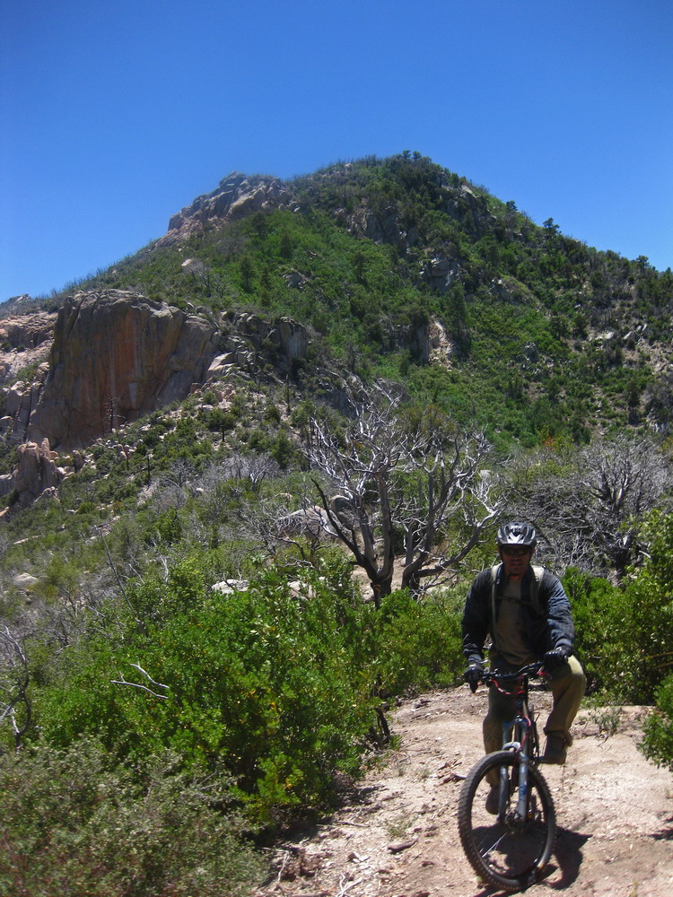
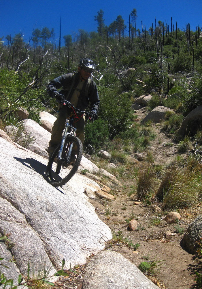
I spent the week alternately convincing myself that an AZT 300 ITT was a good / terrible idea. Friday I awoke still indecisive, but that ended when I told myself, “if you are not committed now, you’re not committed.” Two minutes later I sent Louis an email. Samaniego tomorrow? Within minutes his response came back. His wife shuttled us to the top of the mountain early the next morning, and we were off.
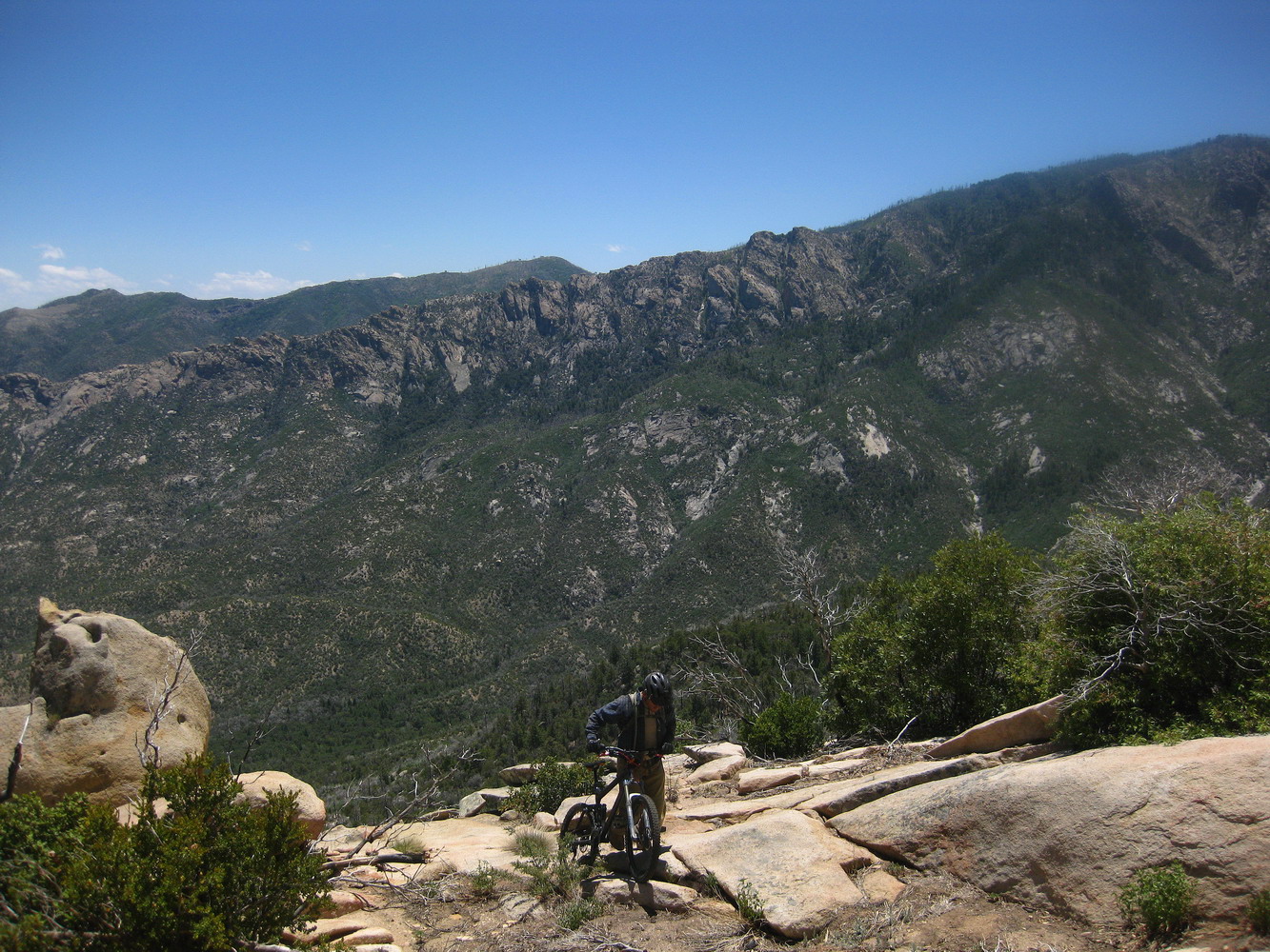
The wind sucked the warmth out of us as we coasted down Meadow and Lemmon trails. After all the flat/road/hot riding I have been doing lately, it was a treat to be cold and riding with numb hands through the forest. It always feels a little strange to start a ride out with a descent — like I haven’t earned it and can’t savor it as much. I knew that we would pay the piper soon enough, and in one way or another we would suffer far more than any 7000 foot climb (the amount we were shuttled) could punish us.
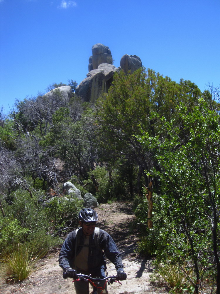
But as the route changes names from Sutherland to Samaniego to CDO shortcut, trail conditions were fabulous — as good as they ever get. On the ‘shortcut’ trail we encountered some major blowdowns, but they barely registered as ‘annoying’ on my radar, having endured far worse on Mt. Graham.
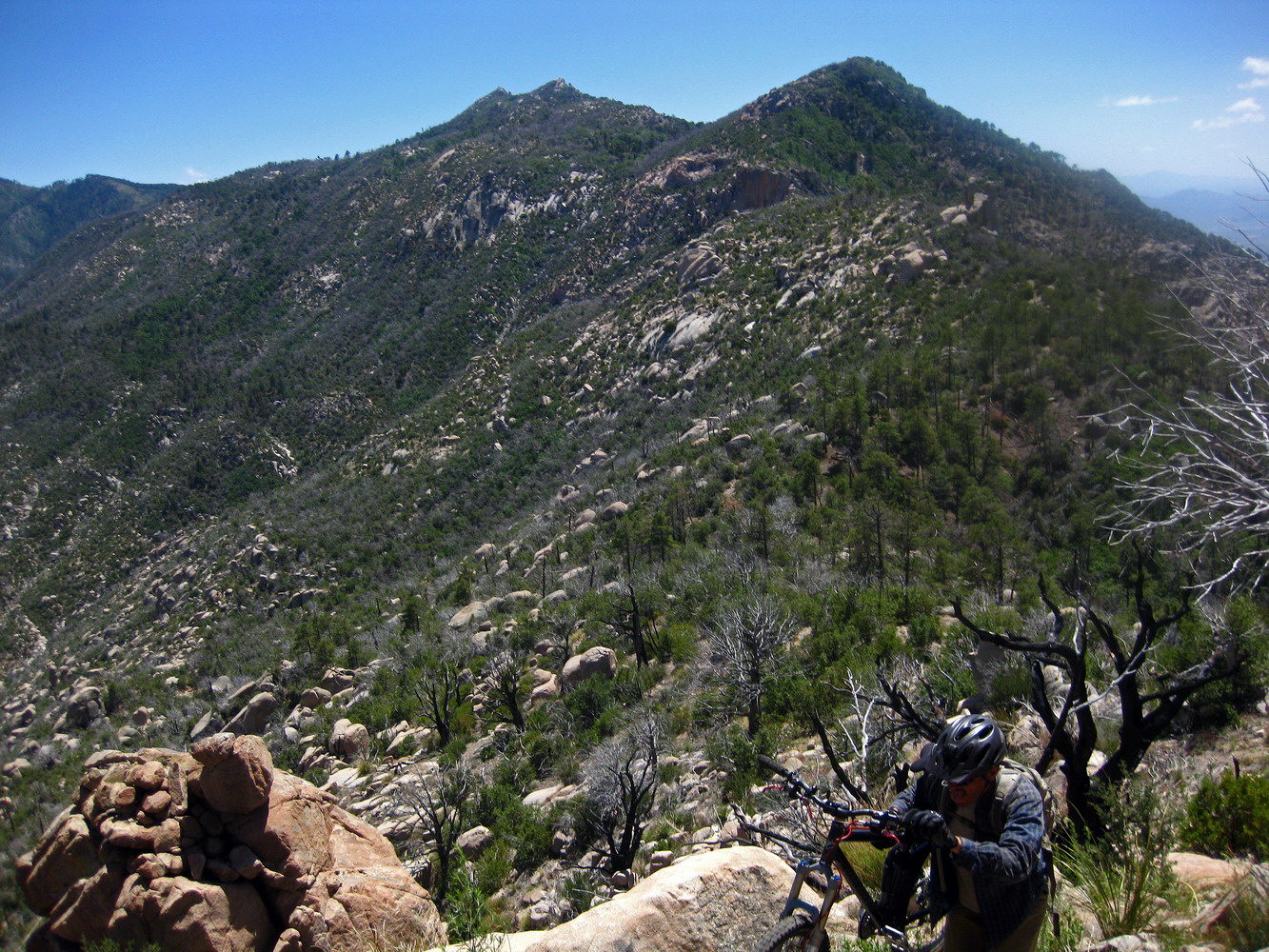
We climbed the vague trail back to regain the ridge, where it quickly became obvious what we were dealing with.
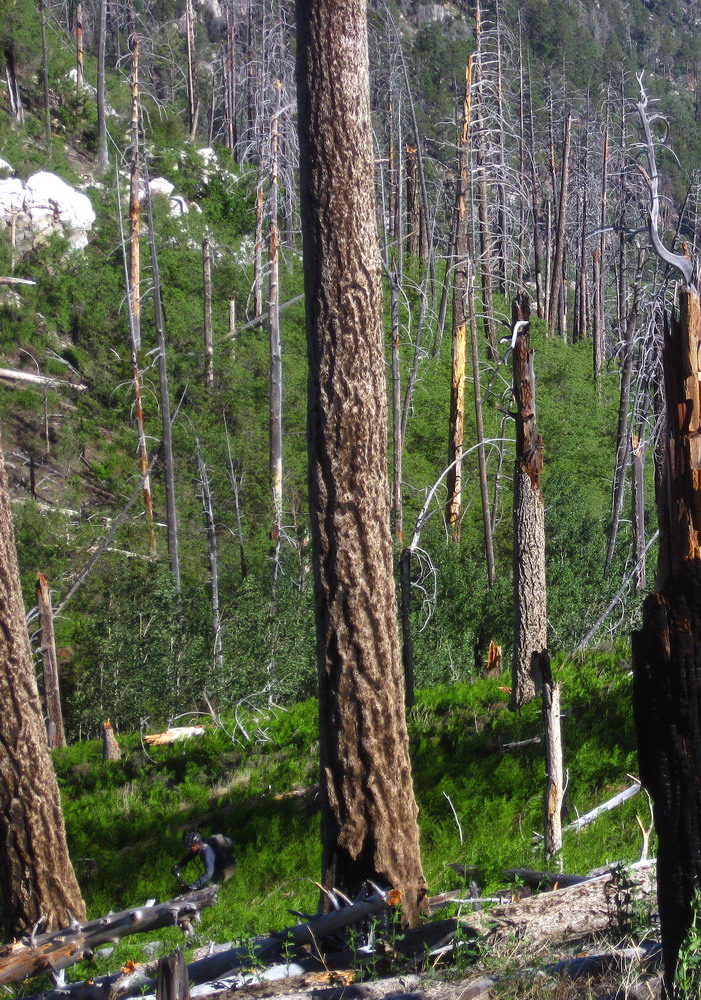
The simplest description is: abandoned trail.
I have never seen briars grow so high. The bushes that Louis is riding through in the above shot may not look like much, but they dig into your skin, and even break off. I’m still finding thorns embedded in my shins. It’s an interesting kind of burning pain in that at first they don’t seem to bother you, but once you’ve been scratched and poked 5,000 times, all you can think about is avoiding them, no matter the cost. Of course that was impossible.
Even Louis, master of enduring sharp plants, and equipped with canvas pants, was heard to exclaim, “yeow!” on many occasions.
There was rarely any tread to work with (i.e. ride), so we walked, a lot. We lost the trail many times, often consulting my 2002 GPS track. It would tell us ‘the line’ was to our right or to our left. And usually it was correct.
It took 3 hours to cover the next 3 miles.
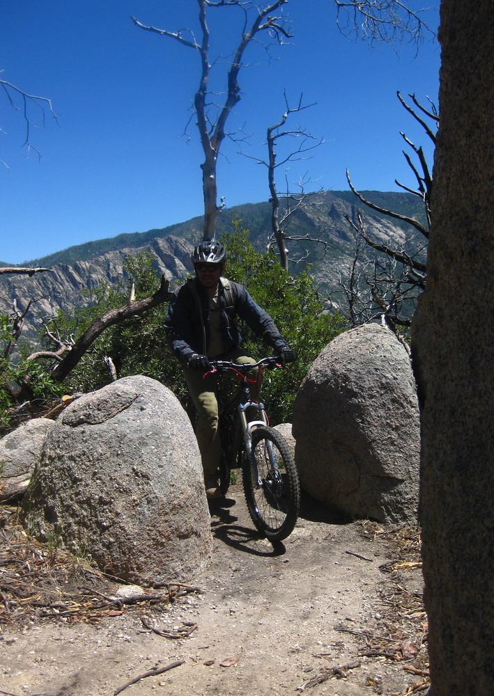
We did find occasional clear areas, some even untouched by the fires. It seemed only natural that we put the 30 pounds of awkwardness otherwise known as our bicycles, to good use.
We took a short break near Walnut spring. I made the comment that though we had been fighting for hours and it seemed like the only option was to continue, it was very possible that it was easier and faster to turn around now, and descend Canada del Oro instead. We had very little reason to believe work of any consequence had been done on the trail, and we were not even to the hard part of Samaniego yet.
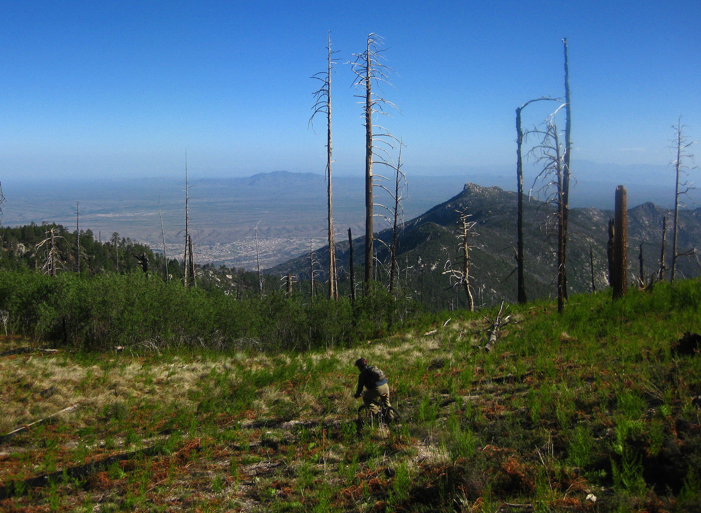
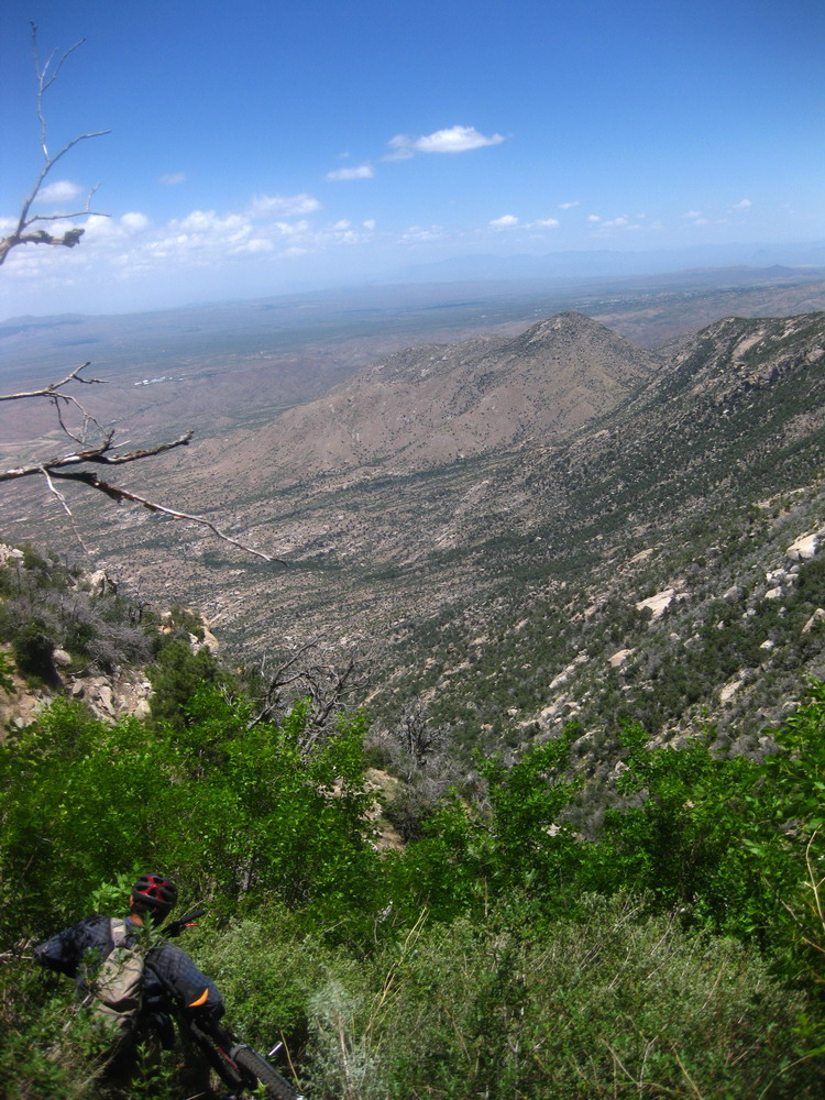
We were distracted by views and open (rideable) rock faces, delaying the inevitable dance with destiny: the catwalk.
The ridge cliffs out and the trail’s response is to ‘corkscrew’ off the north side, onto an insanely steep slope that is home to a pocket of decidedly non-Arizona vegetation.
From the top of the cliff we beheld a glorious sight. We could see freshly cut trail, an open corridor free of briars and downed trees. But it ended right at the exit of the catwalk. So close, yet so far. We could throw rocks onto the fresh trail, but getting there might be impossible.
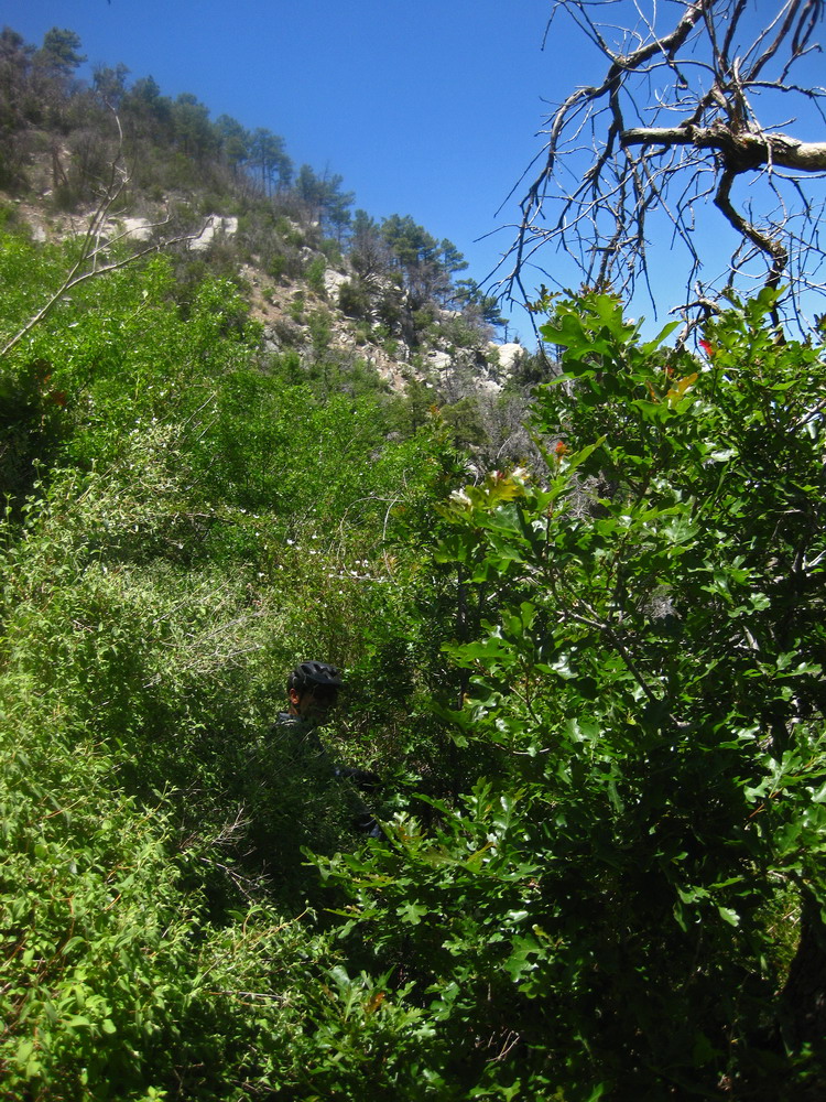
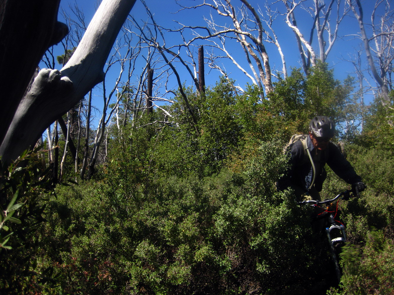
Look close, Louis is in there!
It’s more like a jungle than a desert or forest. At first we were descending and brief open pockets would give us faith that we were still on the old ‘route.’ We made it to where we thought the main switchback was, then started fighting back towards the ridge.
Rocks, whole trees and increasingly dense vegetation halted our progress. I used my bike to smash down a bush so I had a place to stand while Louis scouted low and scouted high. I was watching him dropping to the next ‘bench’. One moment I could see half of him. Then, nothing, as he fell into a hidden hole next to a rock. Scrambling back it seemed clear all avenues sucked equally. So I started punching ahead, on contour. First without bikes, we created a narrow corridor straight through, eventually running into truly impassable stuff.
We were within a few hundred yards of sweet, rideable singletrack, but still couldn’t get there. Fractional MPH figures don’t make much sense, so an average of about 10 feet per minute is a more reasonable (and yet ridiculous) statistic. It was good that we had that mental picture of rideable, open, ridgeline trail in our minds — a very nice motivator. If not for that my thoughts would have turned, as it has for others, to bailing on the ridge for civilization.
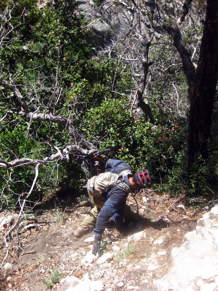
A small uphill chute, still clogged with vegetation and steep, seemed our only option. We fought back to the bikes. Louis sat on bushes while I handed him my bike, which he’d move past the bush. I would then hand him his, then pass myself, before we’d move onto the next section. I was happy to not be trying to get through here solo.
My ankle is still weak (this all turned out to be good therapy for it!), and Louis was kind enough to haul my bike up to me a number of times as we crawled up the chute. It was a lot of work, but near the top it started looking ‘trail like’ above.
the top of our chute. yep, we came from there
Sure enough, the chute led us to a piece of old trail, right where it disappeared into the brush. A short, but excruciating hike-a-bike along the “trail” brought back to the ridgeline. I could smell the trail work. Hunting around between a few between boulders, I felt like falling to kiss the ground when I found recently disturbed soil.
We both wanted to rest, but we wanted to pedal the new trail even more. At Mule Ears we scrambled up to the towers of rock, finally sitting down to grab some lunch and hopefully cool down. The wind quickly made us cold, not hot, so we retreated a bit to continue eating.
Pedaling away from Mule Ears it was hard not to be bubbling with excitement. I haven’t ridden here for years, and with any luck we’d be riding all the way to Charouleau Gap.
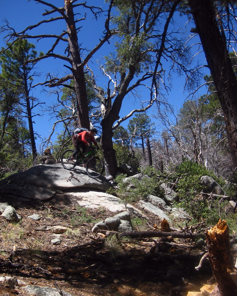
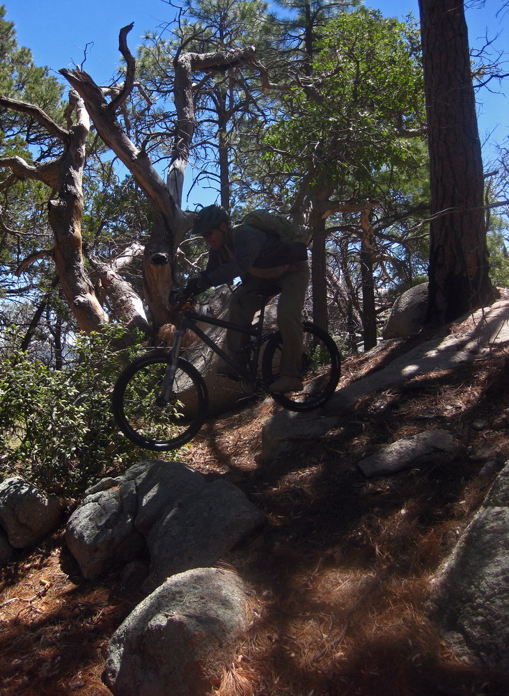
The crews had not rerouted or sanitized the trail — just opened it up. Excellent. The next climb held some hike-a-bike, but it was a delight to be pushing a bike through open country, enjoying the big views on both sides.
I was quickly reminded why this trail held such a place in my mind. After the catwalk it’s a complete blast.
Surprisingly flowy for a trail that sees so little traffic. Well, let’s be honest, it has received almost no traffic for the last eight or so years. We alternated leading for a while, then Louis disappeared when it started the big drop to the Gap. I was so happy to be riding my ‘big’ bike here, as the turns and rocks were pegging both the challenge and fun factors. It has been too long.
We continued descending the Gap, a ledgy 4×4 road that is one of my favorites. About halfway and over 1000′ down, I realized my camera wasn’t in its pouch. “Are you going to go for super stud man points and ride back up to find it?” I decided it was worth it, so Louis continued for home while I turned around to start climbing.
The climbing was awesome! There hadn’t been much in the way of ‘open’ climbing thus far, and my bike handling skills were coming back online after the killer descent of lower Samaniego and half of the Gap. I decided early on that whether or not I found the camera I wasn’t going to let it ruin what had been an excellent adventure and awesome day. So I just kept pedaling, and just below the top, on the last rocky switchback, I found the camera. The LCD was smashed but it still worked.
I was happy I found it mostly because it meant I could now rip the descent without scanning for lost cameras. And so I did exactly that, dropping 2000 feet on bermed corners, exposed slickrock and rocky jumbles. At CDO’s giant sandy crossing, I started following the exaggerated tracks Louis had left me, showing a route and connection that Chad and I had failed to find on a previous ride.
I lost his tracks by a condemned house, so I gave him a ring. As he was describing the upcoming turns he stopped and said, “hold on, I gotta puke.” I then heard some violent sounds. I put the phone away from my ear and started walking towards the wash. A couple minutes later I put the phone back to my ear and still heard some gnarly sounds. I wasn’t sure what the proper etiquette is (?!) when someone interrupts a phone conversation to be sick. A while later I listened in again and still heard bad stuff, so I hung up and kept riding.
I called back from the chutes to ask what the best route to his house was, and he was fine. He rode out to guide me through his neighborhood. Right when I walked in the door his wife pulled a pizza out of the oven. Sitting next to it was a freshly baked apple pie. Talk about perfect timing!
After enjoying some swamp cooled air, pizza, and pie / ice cream (thanks guys!), all while analyzing and reliving the ride, I started thinking about pedaling home. They offered me a ride, and were a little incredulous that I was saying I would ride home. But there was just enough daylight left, my belly was full of tasty food, and I could spend about half of the ride on trail, away from cars. It was a no brainer.
A no brainer and a great decision. I felt top, and very well in tune with my bicycle, the desert and the flow. I had a few moments of “can it really be this good?” as I ripped down the lower 50 year trail, stealing glances at Samaniego Ridge and the profile of our ride. The high lasted well through Oracle road and the river path, as I danced to the songs on my mp3 player and pretty much ignored the cars (thank you wide bike lane) and the headwind.
As I turned off the river path onto a short piece of trail the sun was setting and I started getting very sleepy. I was very glad I wasn’t out by Elephant Head, mind willing an all night ride, but body shutting down. I realized it had been a 12 hour ride, and felt like it was OK to be tired. I soft pedaled home, and spent the rest of the evening trying to focus enough to work on the Tour Divide Tracker.
If they rebuild the entire trail, including the catwalk, I foresee many ‘runs’ on this trail. Until then I think an out and back from the bottom to Mule Ears is worthy of an attempt. Paging Mr. Brown…

Digging the shadow shot that Louis seems to be dropping down some rocks (at first glance, it looks like his rear tire is off the ground). Interesting place to spend an exploratory trip on a mid-June day. That said, I only know a few fellas that would do this, you and Louis. Good on you for venturing out there.
Look forward to riding it tomorrow!