…in the White Mountains.
Paula’s got a new bike, and we’re planning a singletrack tour this summer. But she’s a runner, not a cyclist. So it would be a good idea to maybe do a long ride or two before embarking on a couple weeks of singletrack riding, right?
Well, before riding the 2,500 mile Divide in ’04, she did a single long ride. She’s like that (tough as nails), so it’s looking like the same story this time.
But where to put in a solid day’s effort in AZ, in June? Plans to attend the Kaibab Monstercross got derailed, then even a consolatory White Mountains trip looked in doubt and was delayed.
But we loaded up the car, hit the dentist on the way out of town (!), and were soon at 8000′, enjoying a quiet evening in the trees.
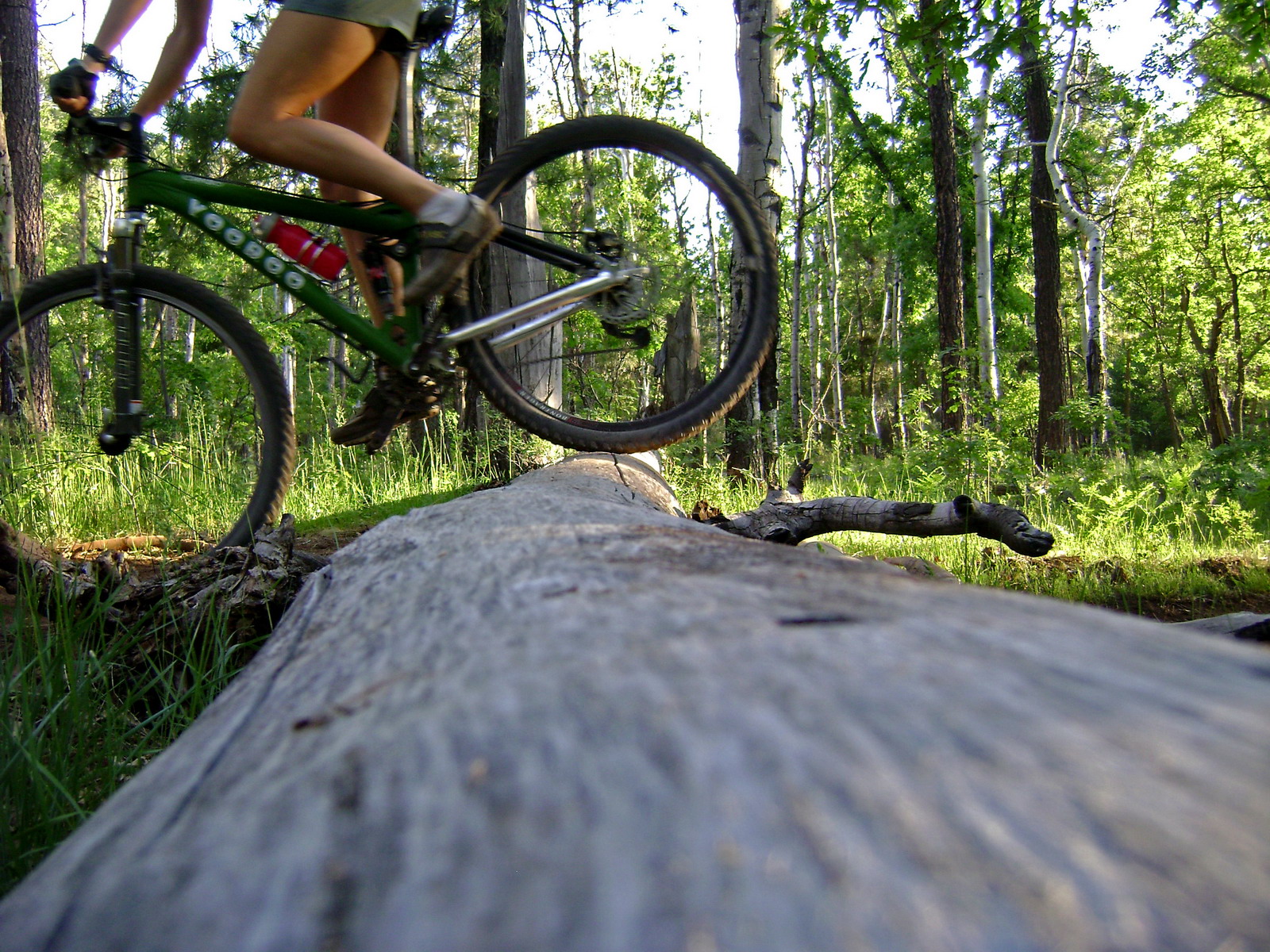
A short evening’s ride brought good trails, fun challenges and strange frustration at the gaping holes in my memory. Yet more evidence that my schematic trail memory has a life expectancy of about five years. After that it gets pretty vague.
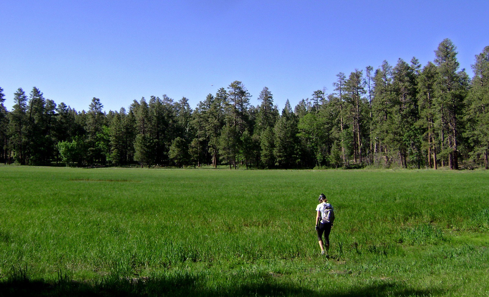
It’s been six years since we camped at this site, just before they closed all the forests in 2002. And it’s been six years too long, as far as I’m concerned. Almost off the map, very quiet, free, trails going in and out, meadows with elk wandering, and most important for this time of year: cool temps and shade!
My plan was to be the first to pre-ride the 2008 Tour of White Mountains ~60 mile loop. It’s a brand new course that I have been mapping and working with Todd on for the past month or so. It seemed the perfect ride to do with Paula (for tour prep). Plenty of singletrack, but nothing too gnarly, and a relatively quick way to get 60 all-dirt miles in.
So many rides start out in high hopes…
We made good time around the sweet Los Burros trail, and continued blasting downhill on the Country Club connector. It’s a confusing jumble of 2-tracks, ATV trails and occasional singletrack. GPS kept us on course, though we did make a few wrong turns.
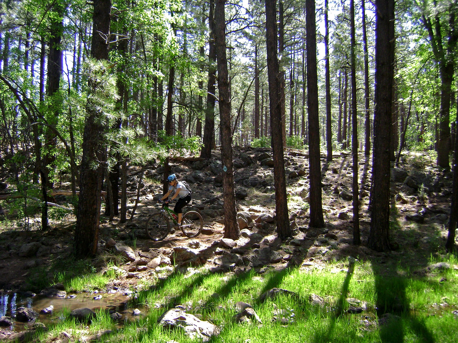
Following Thompson Creek things get technical, and I began to worry about the fun factor for Paula. I was loving it, but it was getting slower for Paula. I was just letting her do her thing while I rode ahead and waiting every once in a while.
Turns out she was slow because she was really trying to ride everything. And often succeeding! I did watch her descend some pretty technical stuff, and was really impressed.
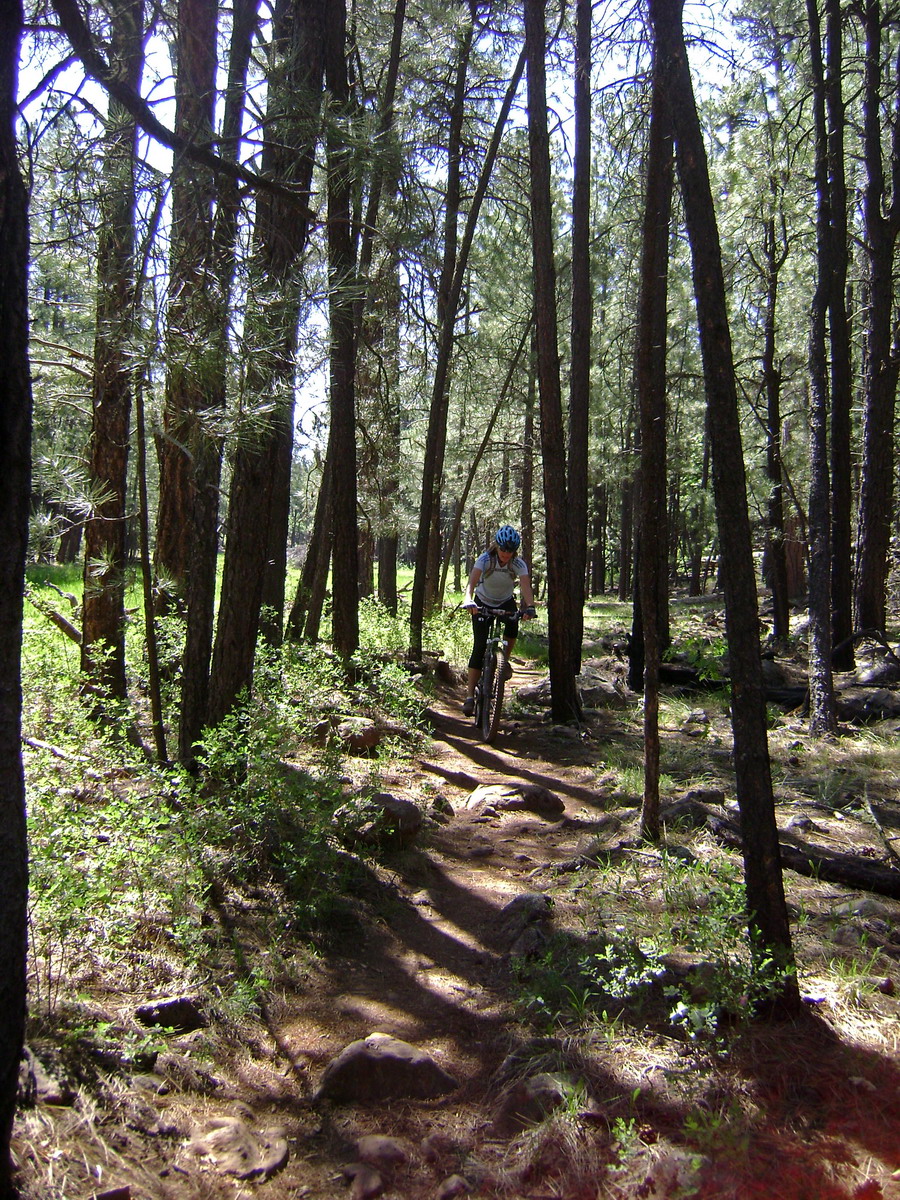
Speed was not high, though, and it only got slower as we began climbing up Blue Mountain. There are some challenges (I dabbed a few times and walked a bit), but we were moving along. It had been a long stretch of rocky / slow riding.
But we were finally at the descent. New territory for me: the Ice Cave Trail.
It started out OK, but things quickly deteriorated. Bad trail layout has led to nasty erosion. So there’s a deep rut that’s full of rocks. Kind of fun for a while, but it quickly grew tedious, and even I wasn’t having that much fun.
Paula got frustrated on a few sections because it was too hard to even get started again, but I was really impressed at how well she held together. I know some very experienced riders who would have been much more unhappy / frustrated.
Now it was time to find the Ice Cave Connector Trail. Coincidentally, we lost the trail in the same area we were supposed to branch off onto the connector trail. I searched around where my GPS line told me to be, but found no such trail.
So we backtracked into a boggy area and found the classic WMS blue diamonds, leading away from the GPS track. I was confused, but didn’t really care. We both had already agreed that the race shouldn’t use the Ice Cave trail period, so whether we were on the connector or not seemed irrelevant.
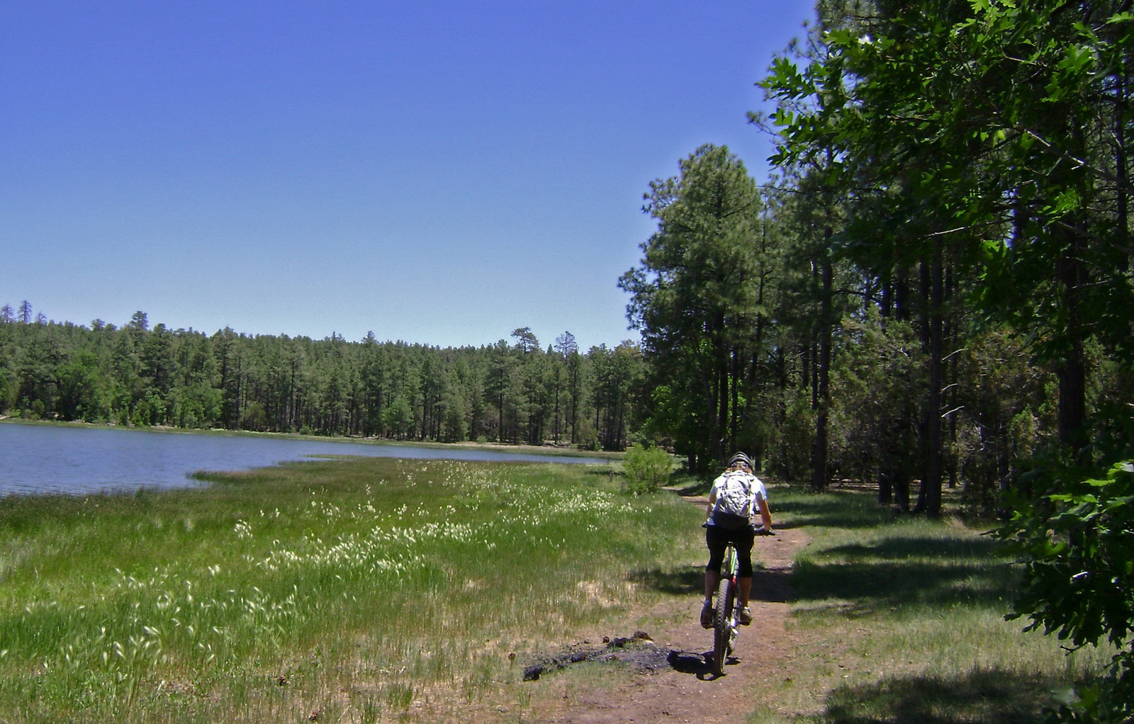
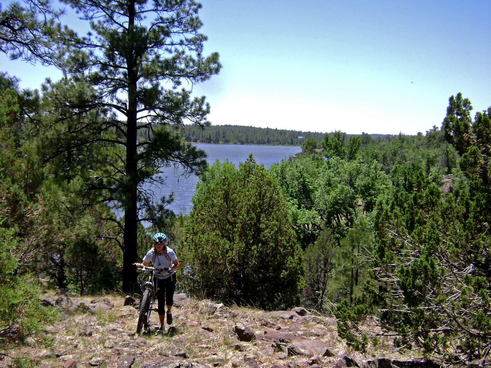
Finally we made it to a gorgeous lake, and I suggested a break. We’d been riding for four hours, with the last hour being pretty brutal. We ate apples, mango slices and chips while watching fishermen float around the lake.
A blue diamond indicated a trail heading east, back towards the connector. So I assumed the GPS line was simply off — it was based on my hand drawn trace over a scanned map, and that map was a little suspect to begin with.
The lakeside trail rolled along nicely for a quarter mile, then it followed a pattern I have seen many times before: gradual disappearance. People lose their enthusiasm for following the faint trail at a linear rate, and pretty soon all we had were a few broken branches to indicate where to go.
Worse, the cliff walls were steepening, and the only way forward was through the brush.
Bushwhacking shoes on standby.
Once we came around the cliff face the vegetation also let up, so I suggested we head straight up and search for the Connector trail, which I now was convinced that we had missed back by the bog.
hike-a-bike up from the lake
We hadn’t missed anything. There was no trail. Two fences, a sketchy creek crossing and some creative route finding brought us to Porter Mountain road. I rode back and forth on it to confirm what I already knew: there was no Ice Cave Connector trail.
(side note: turns out that trail is going to be constructed this summer, in time for the race. little did we know this at the time)
It was now midday and hot. The lost connector trail had cost us over an hour, so we decided to skip the Timber Mesa trails and start heading back. Porter Mountain took us over the FR 9722, back on course.
Again, I had a hand drawn track from a questionable source, and it sure wasn’t accurate. Once we were on the right “OHV trail” (really just a 4wd-ish road) things rolled smoothly, and I soon recognized the railroad grade the old race used to start on.
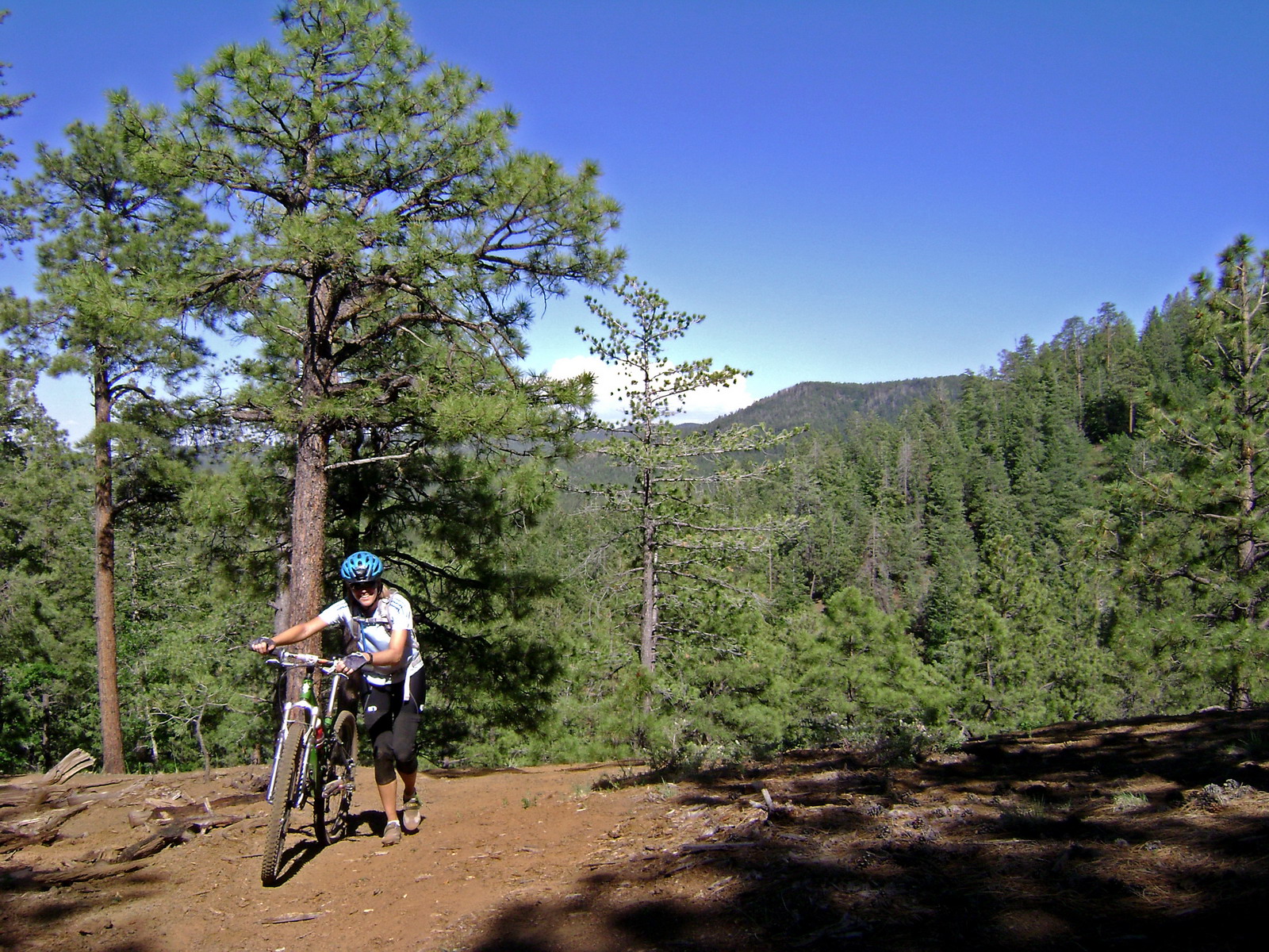
Time to hop back on singletrack near Pat Mullen mountain. But I’ll be darned if it wasn’t getting hot, and the midday sun had robbed us of most of the shade. We took a break at the trailhead to eat some food and allow shadows to creep longer.
It was a good place to stop. On singletrack the shadows don’t need to be long to keep things cool. Awesome trail and a fun descent.
I had studied the trail map at Pat Mullen and didn’t like what I saw: no indication of the road we were supposed to take. Again all I had was a hand drawn track from the same questionable source. Worst case we’d have to loop back on fun singletrack (what a shame) to the way we headed out.
But sure enough there was an ATV trail in almost the right place. It strayed several times from track, but it was quite fun to ride. We were good to go, soon blasting down an improved road with a tail wind.
The last twenty miles took as long as the previous five. So it goes in exploratory riding.
Now Lake Mountain was looming ahead of us. I gave Paula all the options (and encouragement) in the world to bail around it. It had already been a long day that hadn’t gone as planned. Lake Mountain is a few hundred feet of elevation by hike-a-bike.
But she had been riding strong, so I wasn’t too surprised when she said “let’s get ‘er done!”
The hiking was pretty straightforward over the first hump, but as we got into the real steeps we learned that riding in the trees has its drawbacks.
Sometimes they fall down.
All over the place.
And we were the first people of the season to attempt it. We had already pushed our bikes up too far to turn around. And even hopping over the first couple log piles was enough of a “point of no return”, so we kept going.
We ran out of water. Brought enough for ~8 hours of riding, but not 9 and a half.
I’ve been through plenty of log jams, with bike, in my day. But these were among the worst I’ve seen. The sideslope is so great that walking around is not an option. There’s nothing to do but fight through it. Being the first through is always hard since none of the branches are broken or minor trees cleared.
I put a lot of effort into clearing things should anyone else be unfortunate enough to attempt the trail.
It was a good thing there were two of us, because we had to hand bikes over a number of the piles that were taller than us.
It took 1.5 hours to go one mile, and when we got to the junction with the summit trail we chose to head up since it seemed more clear of trees.
Lake Mountain does have a lake, of sorts, at the top. Strange indentation that gets water from… where?
I knew there was a lookout tower at the very top, which means a driveable (free of trees!) road to get us down. Blissful coasting took us almost all the way back to camp (we bailed on riding the final piece of singletrack). Cold gatorades and chocolate milk awaited.
We still managed 50 miles, but several of those miles were “bonus” miles. Though my intention was to put together a rideable, moderate loop, this turned into anything but. It was a good revelation, though — my girlfriend rocks — and has a good future as an adventure rider. As I said earlier, I know many an experienced mountain biker who would have folded or at least been very whiny / unhappy. But as we were pulling into camp, dehydrated and exhausted she says, “I think I could ride another couple hours, easy.”
The next day Paula went for a ride and I rode a loop of Los Burros, picking up some of the trail and generally rocking my socks off. When I came back into camp, Jeff from Dallas was talking to Paula. He had just ridden the last half of Los Burros and commented that it had so much downhill that it “felt like cheating…”.
So I saddled back up and rode that loop again. And he was right.

“Again all I had was a hand drawn track from the same questionable source.”
dude, stop buying your maps at Walmart. Good write up. I’m excited to ride the new TOWM trails.
Sounds like fun!
We covered ~23 miles in 8.5 hours yesterday 🙂
Meh, the terrain was a little tough in some spots but I think we were mostly lollygagging.
Ed