
This weekend was the 1st Prescott Monster Cross, put on by the illustrious ionmuse.
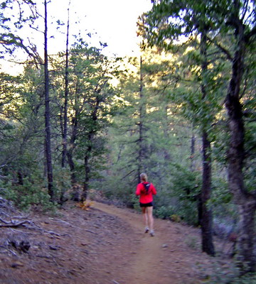
I’ve long been looking for an excuse to explore Prescott, and it was long overdue, if the above picture is any indication.
This was what I call a “choose your own adventure” race. You get minutes subtracted from your finish time for every checkpoint you successfully find. Go wherever you want for 10 hours – trails, roads, pavement – and come back at the end.
At 0700 Dave handed us (crappy) xerox copies of USGS quads, that almost fit together, almost made sense.
I wouldn’t have had it any other way.
I took a quick look at the overall distribution of the eight checkpoints, then saddled up to follow Paula up the mountain. My initial strategy was clear – I wanted to ride with Paula for as long as I could, so we were going for the closest checkpoints.
I actually beat Paula to the top of Spruce Mountain, but only because she went the wrong way, going to the other buildings instead of the fire lookout. We then spent the next 40 minutes scrambling around trying to find the book. One of the locals finally found it, but blew his cover when he realized he tore out [I]my[/I] page, instead of his team’s.
It was a little frustrating to top the 2000′ climb with a large lead, only to waste it trying to find the hidden cache. But it’s all part of the fun.
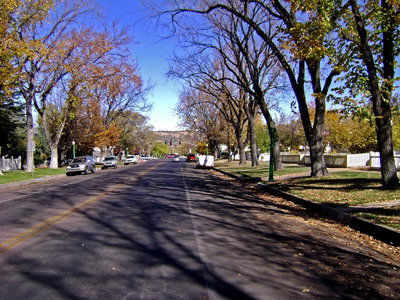
I think everyone ended up going through town and hitting up a bike shop. It was OK with me, because fall was in full effect, and navigating through town (and finding a bike shop) was a great additional challenge.
I pinch-flatted coming down off Spruce Mountain, and proceeded to blow the cap off my pump while airing back up. I had about 15 psi – enough to ride, but not ride well. With ~2000 to descend, I could either drop back to the car and call it a day, or limp into down to purchase a pump. I limped down the mountain after saying goodbye to Paula, guessing that she’d end up winning the race.
The bike shop was speedy and I was back to full pressure, ready to hunt down more checkpoints.
My GPS basemap was invaluable for finding the correct road out of town. I climbed pavement to a pass overlooking Granite Basin. The directions seemed clear enough but digging revealed no book. Chad rode up some twenty minutes later. I was getting frustrated, wishing the event was more about the riding and route-finding than digging around in the desert. Isn’t life tough when the worst you have to deal with is finding (for fun) a book some nut buried out in the desert? All under blue skies, a beautiful view, with a gut full of food, plenty of water, and strong legs. Yep, things were good.
I decided I’d rather ride the trail (#332) that was calling my name, loudly, while I scratched at the earth with the heel of my shoes. Heeding that call was a great choice – it was a wonderful descent.
A few consultations of the jumble of maps and directions led me to checkpoint #5, which was the first that was easy to find! Bolstered, I pedaled headlong down Iron Springs Road, towards the next checkpoint that was not shown on any of the maps. There was something fishy about this checkpoint, and I just had to figure it out.
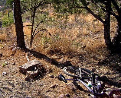
My jaw dropped to the handlebars as the descent unfolded before me. Down into the desert I went, knowing full well I’d be paying dearly for every foot of elevation lost.
An uber-washboarded road led to the powerlines, and at the first micro wash I found nothing. A piece of a clay pigeon hid nothing buried beneath it. Then a little further down I dug into a soft spot only to catch a glimpse of a familiar desert sight – a bug light can.
“Oh great, someone’s beer can.”
“Wait, there’s six, and they are all full. And here’s the book!”
I started laughing, and recalled Dave’s mention of leaving extra room in the pack to be competitive. I figured drinking the beers was going to play into it, but the directions were vague. I took one full can for a 15 minute bonus and drained the other (punctured one) for a 5 minute bonus. I could have taken them all (empty), but I didn’t want to spoil anyone else’s fun, should they have the misfortune of descending all the way down to this checkpoint.
Actually, the climb turned out really well. I stood on the pedals and got into a great rhythm. It was time to head for distant checkpoint 7.
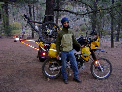
First I met Chad and the two Dave’s, resting in the shade. I debated about taking trail 37 over to Granite Basin, but I had such a road climbing rhythm going that I stuck to the (known) pavemiento. Here’s one of the Dave’s, with his cool bike rack:
I climbed to Granite Basin Overlook for the second time, thinking about giving checkpoint six another try. The Dave’s couldn’t find it either, so I figured it was a lost cause. On to more singletrack!
I turned onto trail as soon as I could, pulling out my maps to (try to) sort out some kind of route over to the checkpoint. This was pretty challenging, but I soon found my way to #347 and the rocking ride began.
On my way down I ran into the locals team who reported that after 45 minutes, the four of them could not find the checkpoint book. They were pretty frustrated, and I held out little hope I could find it. But I was having way too much fun to turn around and abandon.
I got there and followed the directions immediately to the cairn that held the book (Hamlet, I believe). Score!
(The locals team got me back on this one – after I saw them, they climbed up to checkpoint 6, back at Granite Basin Overlook and quickly found the buried book that both Chad and I had failed to find after more than a half hour).
It was 3 o’clock, though, so the race to get back to the start/finish by 5pm began. I had no idea what this ride would be like, but knew I could take all pavement. The hills were the only question.
Actually, there wasn’t really any question as to whether or not there would be hills.
It hurt. Good.
I did what any good endurance rider would do – put my head down and pedaled mindlessly into the wind.
I got to Trail 62 at 4:07pm, where I shuffled through my papers, trying to figure out how far up the trail the last cache was, and how well hidden. It said it was under a cairn, not buried, so I figured it was worth a shot. I wasn’t sure if I could get to the cache and have enough time to get back to the finish area by 5pm (the cutoff).
Making educated guesses like this one was one of the most challenging (and rewarding) aspects of the event. Having never ridden any of the trails, there was plenty of mystery and route-finding challenge out there for me.
I did find the last checkpoint, and rolled into the parking lot with seven minutes to spare, after suffering badly on the final climb.
Stories were swapped and much laughter ensued, throughout the night. Dave brought loads of pizza, nominating him for best race director in the universe, and the evening was whiled away by the fire. It was really great to meet everyone and further get to know those I had only met briefly in the past.
When the scores were tallied, Paula came out ahead of me! That girl is fast!!
The next day we spent a lazy morning getting up and chatting with Chad while he waited for his car to (literally) warm up in the sun, then Paula and I checked out trail 305. I almost gave this trail an award for excellence in flow, and feeling like it descends more than it climbs – a rare treat.
8 pm Monday update – I’m not nearly as tired as I was after last weekend’s Samaniego shuttle ride.
10pm Further update – three days, three flat rear tires. One during the race, one on #305, and one tonight on the recumbent, while taking a leisurely cruise through the neighborhood with Paula on foot.

How’d you get so many flats?! On 305 nonetheless.
Very glad you came up, and put up with my shenanigans and technical deficiencies. I shoulda headed back out Sunday morning, but the body protested (darn crashes).
We shall meet again.
[…] see Scott’s follow-up article Prescott Monster Redemption and Scott’s precursor to these two, Strategy in Prescott. With those blog posts as an introduction, I think that most would agree that Prescott Arizona is […]