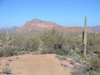
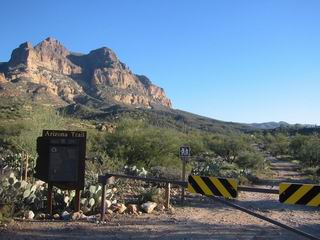
Lee and I continued our AZT exploration, starting where we finished last time:
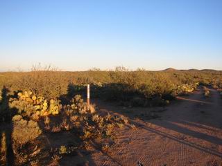
Start of the Boulders section, heading north of Freeman Road.
The ground and trail were frosty as we headed out. Immediately we passed a cache of water for thru-hikers. Empty gallon jugs were floating around, sort of in a mess. After the water cache we came to a wash crossing that featured a bridge:
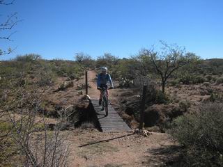
How cool is that? A bridge on the AZT out here in the desert. The funny thing was that the next wash crossing was even deeper than the bridged one, and it was completely unrideable. We walked across it.
This first section of trail was very faint; it seemed the desert was already beginning to reclaim it. We lost the trail several times and could not distinguish trail from natural openings in the vegetation. This trail needs some tires on it!
Soon we dumped onto an underground gasline road (the same one we followed for 8-9 miles on the Antelope Peak section) that rolled us up and down for a couple miles before turning left onto more singeltrack. Again it was faint and the ground was soft, but it made for enjoyable, easy riding.
We crossed roads (all well signed with carsonites), then began heading northwest down a giant sloping valley. It was as if the whole world was on a slight slant, and we were cruising down it. Off in the distance I saw a pile of boulders that I pointed out to Lee. A few minutes later I began wondering why this was called the Boulders section. It wasn’t long before I realized we must be passing near that pile (nice, genius). It didn’t seem too likley at the time, but we did eventually make our way there on the trail.
Before the boulders we reached a shiny new gate, freshly installed by Laddie Cox’s gate crew. It was designed to use gravity to make it self-closing, and it was working perfectly. It was just our luck that they installed it in time for our ride.
The boulders gave us something to look at, then later ride through. Pretty cool.
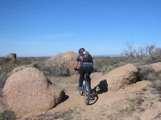
Boulders on the boulders section
Soon after trail construction disappeared, but the route was well marked with rooster tails, so we were able to keep riding, bush-whack style. After crossing Tecolote Ranch Road, the rooster tails ceased. But I had a waypoint from segment steward Anna Pfender (thanks Anna!) for where construction picked up again. It was about 0.7 miles as the crow flies, so we decided to bush-whack it rather than bail on the road.
I directed Lee a bit using the GPS while he found paths of least resistance through the veg. Sure enough, we found beautifully constructed trail right where the waypoint led us. This section took some incredible work, featuring a few well constructed switchbacks into and out of a wash, so we were happy to have ridden it.
More nice singletrack continued north of the Old Florence Highway, ending above the Ripsey Ranch. It is round about here that thru-bikers need to depart from the AZT for a while. The biggest problem is that the trail doesn’t exist, and the current route goes through the White Canyon Wilderness (though Larry Snead told me the plan is to now stay out of the wilderness).
We needed to start making some headway to our goal for the day, Superior, so we headed down to the giant cottonwood at the Ripsey Ranch site:
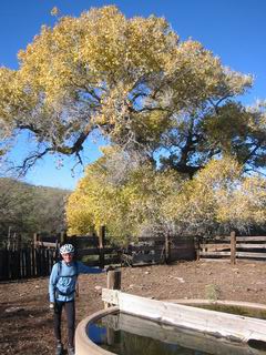
Ripsey Ranch (site)
There was a working windmill here, with gas pump backup, so this is a possible water source. It was definitely a nice spot. The Old Florence Highway left from the ranch down a sandy wash. We promptly missed the road turning out of the wash, but I saw that we were getting off it on my GPS, halting our error quickly.
We rolled quickly down the ‘highway’ which was really a rutted, narrow and rocky road. It wasn’t all that bad, actually, we just couldn’t really fly because of potentially deadly ruts and ravines. We were soon on the real highway: the grade Florence-Kelvin highway. Now we were flying, and again I spied piles of boulders in the distance. The highway brought us to them again, but they were clearly marked with private property signs. It’s “The Boulders at Skyrise” (or so the ranch style entrance indicated). At the junction we reached a decision point.
Option one was conservative: join Andrea Lankford’s AZT thru-route, taking Barkerville road to drop to Price and our Gila River crossing. We knew this one would work.
Option two was to turn north on Cochran road, trying a more direct route to the Gila. The problem was that we can’t drop all the way to Cochran since it is too far east on the river. But I had seen a route on the topo maps that brought us right where we want to be.
It was a gamble, but it was early in the day and we didn’t drive all the way up here to be conservative. We headed north on Cochran Road and my eyes began scanning furiously for private property signs. My eyes did find a state trust land sign — it was looking good.
We stopped a truck that turned out to be wildlife managers tracking coyotes. We talked to them about their tracking methods which was interesting, but they were clueless about dropping to the Gila. It was refreshing to meet someone out there who isn’t involved in ranching, if nothing else, just for a change.
Soon we reached my proposed turn off point from Cochran RD. There were no signs and it looked reasonable, so we rolled on into the unknown. It was ups and downs following a powerline rd, but an ATV-ish track branched off to the north just where my GPS track said it should.
We floated down this road/trail, carving some nice turns, crossing the occasional drainage, and staring at South Butte, towering above the Gila River:
We knew we had found something good in this route. We were happy that we went with the adventurous route. Next we found the perfect campsite:
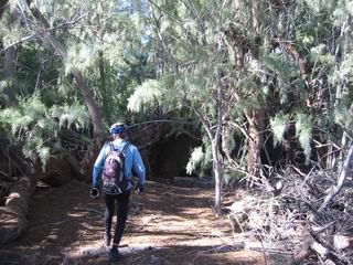
It was a strange collection of trees to find at 1900 feet and nowhere near the Gila River. The map indicates that there is a well there, which might explain the dense trees. We didn’t find any water, though.
We rolled around South Butte before the final drop to the Gila River. The river itself was impossible to see through the thick trees that surround it. We followed the river west, looking for a gap in the trees to attempt a crossing. When we knew we were close to where Box Canyon heads away from the river on the other side, we found a gap to drop in. The river was flowing, but was shallow enough to wade across. It was a cold and painful walk across, but the sun was shining bright on the other side, and it was actually getting a bit too warm. We couldn’t find a suitable gap on the other side, so we had to continue west down the river, riding through (sometimes) deep mud and thick growth. Eventually we found a gap, but I think it would have been faster to cross at the Ashurst-Hayden Dam, just slightly out of our way.
We hopped across the railroad tracks, then readied ourselves for Box Canyon. The mud flew from our bikes as we pedaled towards the orange and yellow cliffs to our north. We passed a few big rigs parked with trailers for ATVs or motorcycles. I was getting excited and hoping for a nice technical challenge. But I really didn’t know what to expect.
After a prelude of mellow climbing, the canyon walls closed in on us. Saguaro and cholla grew on high perches, straight out of the cliff walls. Though it was mid-day, we rode through frosty cold shadows, then out into the scorching sun–a pleasant contrast, actually. My head was constantly spinning and looking up. It was very, very cool.
The technical challenges were very few, unfortunately. Often a bike can ride around them by choosing a good line. So, of course, I chose some stupid lines instead. Some were fun, others threw me into mud pits or had me dabbing. The only ones that really required some skill had been rocked up by 4×4-ers. It was a bit disappointing, but still better than just a sandy 2wd road.
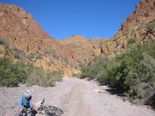
Box Canyon
As Lee predicted, we faced a steep granny gear climb out of the box. It felt really good, actually. All of box canyon was such a gradual climb that I was happy to feel the burn a bit. As we neared the top of the pass the wind blew and my knees ached a bit.
We dropped to a confusing intersection with Mineral Mountain Road, Telegraph Canyon Rd (FR 4) and a host of other lesser roads. GPS here saved us time in pulling out maps and thinking about it. We headed up FR 4 to climb and rejoin the AZ trail. A large group of older folks on ATVs came down soon after we started climbing.
FR 4 soon got serious. We were struggling to stay with it in our granny gears. We could see a road heading straight up the mountain in the distance. I dismissed it as a spurious spur to an abandoned mine (there were many we had already passed). We laughed about a similar situation we had met riding to Nacori Chico where we found ourselves on the road that “couldn’t be our route.” Just as in the Sierra Madre, it became clear that it was our road.
I gave it all I had to make it up one steep pitch, then realized I had two options: continue straight up on more extremely steep road, or take a right more contouring option. The choice was made for me since I didn’t have the strength to keep heading straight up. I wasn’t sure if I was heading to the top or to a mine, but I thought I’d check it out anyway.
It was quickly apparent what was going on: the road I had chosen featured a well planned switchback, but it was now impassable due to a missing 20 foot section. I was able to skirt around the hole in the road on foot, but it was a bit precarious and I would definitely not do it on a loaded bike. After the hole the road was growing with grass, but it was rideable and the switchback saved me some pushing. Lee was on the road straight up, pushing his bike. I hollered to him that I’d see him at the top.
At the top we attained a view of Picketpost mountain and found the singletrack Arizona Trail, begging us to dive off the side of the mountain into Alamo Canyon. It looked really good, but I was wondering how it would make its way off the steep slope.
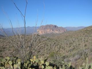
Picketpost mountain
Following the fall line was the answer. We got behind our seats and hung on for the plunge. There were a few contoured sections and a switchback or two, but there were some major fall line sections that had already begun to deeply erode. It was all rideable, thankfully, and the descent was quite fun.
The rest of the Alamo Canyon provided the technical challenge I had been looking for in Box Canyon. It was perhaps too challenging though, coming at the end of the day. I watched Lee choose some bold lines and cruise through some nasty sections. He seemed to be effected less by it than me, or he was pedaling harder to keep his momentum up. Occasionally there would be a relatively smooth trail skirting the wash, but it was always a very short break. Mostly it was large rocks, loose baby heads and slow going.
It was still early, so we continued on the trail from the Alamo Canyon Trailhead.
Alamo Canyon Trailhead
We rode under US 60, then onto more singletrack on the north side. It was a nice way to finish the day. At some point we lost it, but whatever we were following was leading us in the right direction and we eventually popped out onto US 60.
Big days seem to always end with a final push on busy pavement. You’re tired of sitting on the seat, but pavement provides the option for spinning, so you can’t help but pedal easy. The ride into Superior was not pleasant, but the promise of hot food is always enough. On the right, after the circular K, we found our motel, El Portal.
The owner came around the corner and sighed, “Sorry guys, I just rented our last room out.” “But I called yesterday to reserve one?!” “Oh, that’s right, you did.” Fortunately she realized it was getting late and we had nowhere else to go, so she started thinking of a plan. She decided to kick out a gal that had been staying for a while without paying rent. This sounded a bit dubious, but we rode off to find food and give her a few hours to sort it out.
Eduardo’s Pizzeria hit the spot. Comfy seats, quiet atmosphere, magazines to read and tasty food. The owner had a cheese crisp out for us quickly, then we almost finished a large Pizza between us. The local paper provided some hilarious reading of the religious kind. If all else fails, blame god and whine about how horrible your life is in the local paper. Also, pleadings to honor the ‘true’ meaning of Christmas. Do they know at all what they are talking about?
Our little motel room was ready for us by the time we got back. The owner had a few stories to tell. It seems she is usually empty, but the soon-to-reopen mine has meant she’s often booked. The full rooms are resulting in some ‘excitement’, as she put it. Last night a couple of buddies went out drinking late into the night. At some point one of the bud’s girl went from his room to the other bud. This resulted in pounding of fists, yelling, and eventually a broken door. The girl somehow ended up out by the street, sans towel.
Our night was more quiet. We watched Clint start his escape from Alcatraz (hmm, I was so tired TV sounded good), but before he escaped we walked back over to Eduardo’s for Apple Pie and Cheesecake. I miss life as a bike tourist.
Someone fired up their Diesel early in the morning which, of course, requires at least 20 minutes of idling. But we were getting up anyway. Lee had called home and found that his Dad’s B-day party was earlier than he thought, so we were going to try to make it back as early as possible. He tried asking some folks at the Circle K for a ride to Kelvin, or thereabouts, but was having no luck.
I was in the street, heading out, when the shop teacher at the local high school hollered at us. He’d take us to the top of the hill, at least. He was interesting to talk to, and his ride did save us a bit of time, maybe 45 minutes or so.
It was a strange morning. The wind was forceful, enough that even standing in it was unpleasant, but it was oddly warm. I think it was colder when we went to sleep than when we woke up. Regardless, we hopped on our bikes at the top of the pass for the blast down to Kelvin. What a road and what a drop — it was almost a scary descent. I stared off into the huge valley below me and tried to control my speeding bike through the strong winds. It would be quite a climb in the other direction.
We could see a cloud, or some kind of moisture trapped in the valley east of us. As we neared the valley the temperature suddenly dropped 15 degrees. Then, we rode straight into the cloud and visibility dropped. I turned on my blinky light.
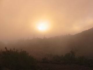
In the cloud
We reached the turnoff for the Florence-Kelvin highway, crossed the Gila on a car bridge (much easier this time), then began the push from 1500 feet to 3500. I started getting into a good climbing rhythm on the road, and began to have thoughts of the great divide, once again. I was in such a rhythm that I wanted to stay on the huge graded road rather than turn off on a powerline road that Lee suggested we take. I could see on my GPS that this road would take us right where we wanted to go, would be shorter and save us dropping a few hundred feet. It would also allow us to explore more of the AZ trail route (no trail yet) up by the power line.
The road was a nice ride. The only slight problem was that it was impassable by car in few places (washed away). No problem for bikes–it just required a dismount or two. Before we reached the hill above Ripsey Wash (and the giant cottonwood) the road became very faint. A major washout meant it was nearly non-existent on the other side. We almost turned around, but at the last moment we spied an AZ trail silver hanger and orange flagging. Once we crossed we could see some semblance of a road, so we continued following it.
We ended up abandoning the road after it appeared to climb a steep hill for seemingly no reason, so we began bush-whacking again before rejoining the road after it came around the hill. We should have just stuck to the road instead of fooling around trying to dodge prickly pear.
We were not far from where we had been before — the drop to the cottonwood tree. From here the route was known — the Boulders section. We still had a few challenges (no trail and rooster tail following), but we had tire marks to follow and a GPS track of our ride out. We put some weight on the pedals and made great time climbing back to the pickup on Freeman Road.
We cleaned up the water cache and left a gallon for ourselves before heading out. The B-day party was called off, but it was nice to be back early in the afternoon. We rolled into Casa Rivera in Oracle for giant burritos designed to fill our stomachs to maximum capacity.
Our route is set from the Mexican Border to Superior. The ride was nothing but a success. A few major challenges remain, though. Can we get from Superior to Roosevelt Lake on dirt? That is a ride for another day.
120 miles, 14,000 ft climbing

Leave a Reply