The Riddle of the Superstitions
The Superstition Mountains present a major challenge for mountain bikers on the Arizona Trail. The trail goes through Wilderness for roughly 20 miles. There are no continuous routes that are 1) open to mountain bikes 2) off major/dangerous highways. To the west we have Apache Junction and the Apache Trail. To the east busy Highway 60 and 188.
The following is a route that Lee Blackwell and I came up with after several trips, aerial recon and much studying of maps.
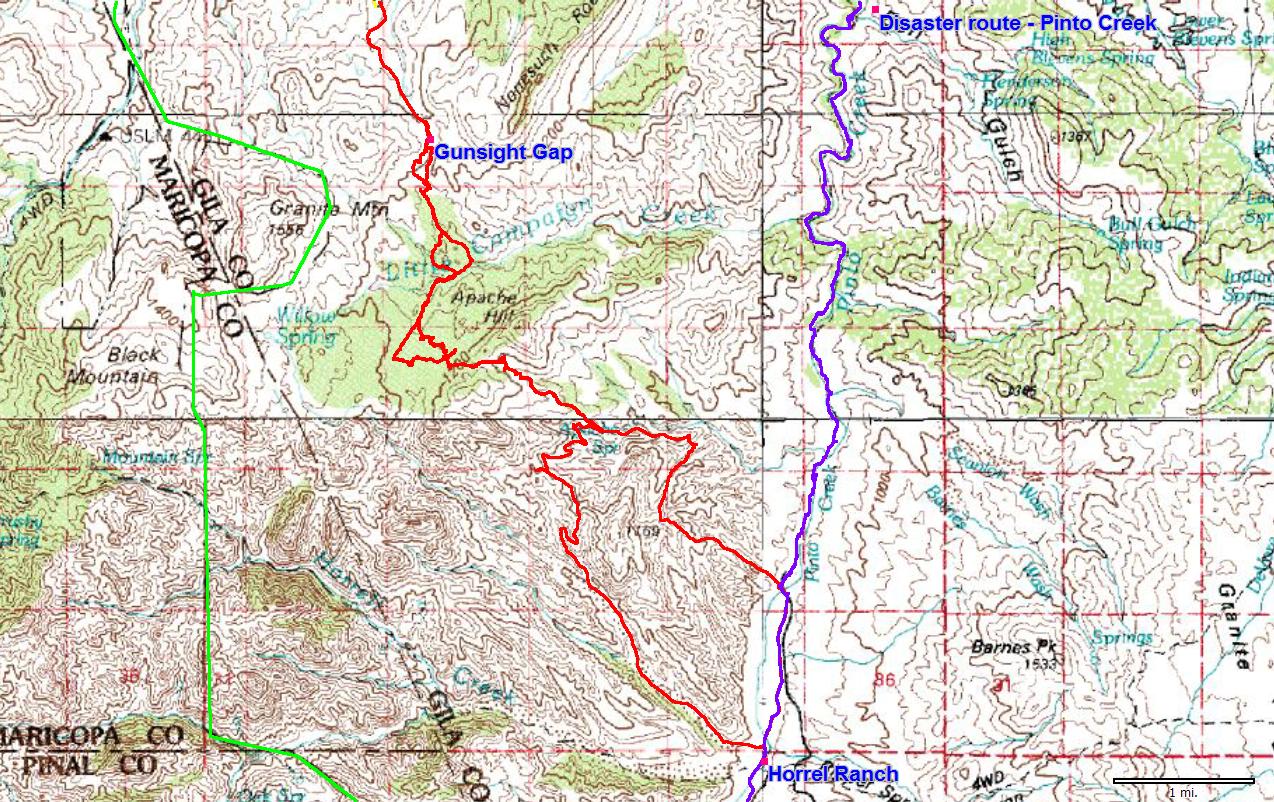
Start at the Arizona Trail off Hewitt Station road and follow the very nice trail until the second time it crosses FR 650. Turn right on 650 and begin climbing. Keep right on FR 342 as 650 turns left to climb to Montana Mountain. Another road will head left, it's a dead end. Continue on 342 until you top out. You are now looking down Haunted Canyon. It doesn't look like much, but continue on FR 342 for 500 feet to where a steep 4x4 road drops into the canyon. Once at the bottom turn your best trail finding senses on.
The trail follows the drainage down, but at times it is up on the hillside and is rarely rideable. As you proceed down the canyon the trail exists in places and is washed out in others. If you lose it just continue down the canyon until you see it again. After 5 very slow miles the trail reaches Tony Ranch (good camping). An inviting and well groomed singletrack exits the ranch down canyon, but when the canyon narrows it goes back to slow, hike a bike riding and tons of creek crossings.
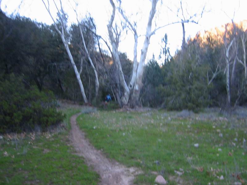
Singletrack in Haunted Canyon
2.5 miles after the ranch look for the trail heading out of the canyon on the north side. The trail goes around a narrow gorge. It's very important to find this trail. Parts of it are even rideable. It's closer to car access by Pinto Creek so it gets more use. Eventually it turns into a road, where you'll enjoy extended sections of riding (your first for a while).
After crossing Pinto creek and paralleling it, turn left on FR 237 to cross Pinto on a one lane bridge. Now you can really fly on a bike, but it's short lived. Cross Pinto again then ride by Horrel Ranch. Immediately after the ranch there is a sign for the Horrel Creek Trailhead - 3.5 miles. This is FR 305, but at the next right (just after crossing Pinto Creek yet again) turn right onto FR 312.
Climb on 312 until switchbacking and attaining a ridge. A lesser used road turns right/north from here. It in turn will junction with another unused road at a T. Turn left/west and climb until the road ends at a digging site. Though it is somewhat steep, it is rideable.
ATVs have ripped out a path for two more hills. Follow their path, then drop into the drainage and begin walking up. A very faint but walkable trail starts to appear on the west side of the wash. Follow it through a notch west of Apache Hill, the continue down on it until it disappears in a maze of Yuccas and clear ground. The goal now is to head to a unused dirt road. Just look for clear vegetation (as if..) paths as you make your way west. Very slow going.
The road is a nice change. Sandy, but possibly rideable. It dumps into Little Campaign creek which is totally washed out. Continue down it to the side drain indicated on the map, then walk up it. Follow the GPS data up a small ridge to gain a foothold on a shelf of rock above the drain. Although there are big rocks to manuever around and climb, it is much better than the thick vegetation down in the drainage.
Follow the shelf over to Gunsight Gap. Roosevelt Lake is in the distance. Head down the west side of the drain to join FR 47. Then it's FR 47 down to highway 188 along the lake.
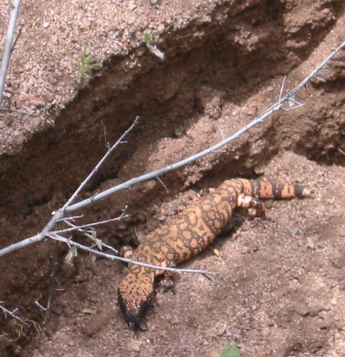
Gila monster near Gunsight Gap
Notes: Be aware that Pinto Creek might be flooded. This route crosses it several times. Check the USGS flow gage: here. We were able to ford it with no problems at 10 cubic feet per second. Anything above 15 could be serious trouble, though. Based on the statistics it doesn't seem like it should be much of a problem, but the area had heavy rain throughout winter 2005.
GPS Data:
SuperstitionAZTBypass.gpx [GPX Format]
Maps:
Overview Map [330k]
Detail Map [450k]